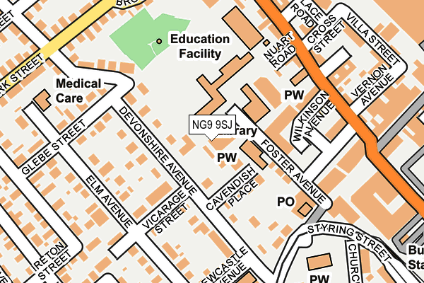
NG9 9SJ is located in the Beeston West electoral ward, within the local authority district of Broxtowe and the English Parliamentary constituency of Broxtowe. The Sub Integrated Care Board (ICB) Location is NHS Nottingham and Nottinghamshire ICB - 52R and the police force is Nottinghamshire. This postcode has been in use since February 2005.


GetTheData
Source: OS OpenMap – Local (Ordnance Survey)
Source: OS VectorMap District (Ordnance Survey)
Licence: Open Government Licence (requires attribution)
| Easting | 452614 |
| Northing | 336913 |
| Latitude | 52.927057 |
| Longitude | -1.218789 |
GetTheData
Source: Open Postcode Geo
Licence: Open Government Licence
| Country | England |
| Postcode District | NG9 |
➜ See where NG9 is on a map ➜ Where is Beeston? | |
GetTheData
Source: Land Registry Price Paid Data
Licence: Open Government Licence
Elevation or altitude of NG9 9SJ as distance above sea level:
| Metres | Feet | |
|---|---|---|
| Elevation | 40m | 131ft |
Elevation is measured from the approximate centre of the postcode, to the nearest point on an OS contour line from OS Terrain 50, which has contour spacing of ten vertical metres.
➜ How high above sea level am I? Find the elevation of your current position using your device's GPS.
GetTheData
Source: Open Postcode Elevation
Licence: Open Government Licence
| Ward | Beeston West |
| Constituency | Broxtowe |
GetTheData
Source: ONS Postcode Database
Licence: Open Government Licence
| Glebe Street (Devonshire Avenue) | Beeston | 131m |
| Newcastle Avenue (Devonshire Avenue) | Beeston | 147m |
| Wilkinson Avenue (Wollaton Road) | Beeston | 172m |
| Newcastle Avenue (Devonshire Avenue) | Beeston | 172m |
| Glebe Street | Beeston | 183m |
| Beeston Centre Tram Stop (Styring Street) | Beeston | 330m |
| Chilwell Road Tram Stop (Chilwell Road) | Beeston | 494m |
| Middle Street Tram Stop (Middle Street) | Beeston | 660m |
| High Road - Central College Tram Stop (High Road) | Chilwell | 710m |
| Cator Lane Tram Stop (N/A) | Chilwell | 985m |
| Beeston Station | 1km |
| Attenborough Station | 2.5km |
| Nottingham Station | 5.4km |
GetTheData
Source: NaPTAN
Licence: Open Government Licence
GetTheData
Source: ONS Postcode Database
Licence: Open Government Licence


➜ Get more ratings from the Food Standards Agency
GetTheData
Source: Food Standards Agency
Licence: FSA terms & conditions
| Last Collection | |||
|---|---|---|---|
| Location | Mon-Fri | Sat | Distance |
| Beeston Post Office | 17:30 | 12:30 | 167m |
| Beeston Post Office | 17:30 | 12:30 | 167m |
| Wollaton Road | 17:30 | 11:30 | 256m |
GetTheData
Source: Dracos
Licence: Creative Commons Attribution-ShareAlike
The below table lists the International Territorial Level (ITL) codes (formerly Nomenclature of Territorial Units for Statistics (NUTS) codes) and Local Administrative Units (LAU) codes for NG9 9SJ:
| ITL 1 Code | Name |
|---|---|
| TLF | East Midlands (England) |
| ITL 2 Code | Name |
| TLF1 | Derbyshire and Nottinghamshire |
| ITL 3 Code | Name |
| TLF16 | South Nottinghamshire |
| LAU 1 Code | Name |
| E07000172 | Broxtowe |
GetTheData
Source: ONS Postcode Directory
Licence: Open Government Licence
The below table lists the Census Output Area (OA), Lower Layer Super Output Area (LSOA), and Middle Layer Super Output Area (MSOA) for NG9 9SJ:
| Code | Name | |
|---|---|---|
| OA | E00143116 | |
| LSOA | E01028085 | Broxtowe 011D |
| MSOA | E02005860 | Broxtowe 011 |
GetTheData
Source: ONS Postcode Directory
Licence: Open Government Licence
| NG9 1AE | Foster Avenue | 79m |
| NG9 1BY | Cavendish Place | 83m |
| NG9 1BS | Devonshire Avenue | 99m |
| NG9 1BW | Vicarage Street | 109m |
| NG9 1AF | Glebe Street | 126m |
| NG9 2NL | Wilkinson Avenue | 146m |
| NG9 1BU | Elm Avenue | 147m |
| NG9 2NJ | Commercial Avenue | 178m |
| NG9 2NG | Wollaton Road | 183m |
| NG9 2RN | Wollaton Road | 184m |
GetTheData
Source: Open Postcode Geo; Land Registry Price Paid Data
Licence: Open Government Licence