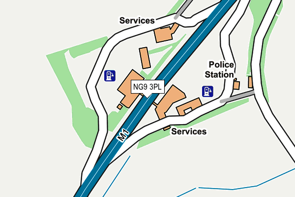
NG9 3PL is located in the Awsworth, Cossall & Trowell electoral ward, within the local authority district of Broxtowe and the English Parliamentary constituency of Broxtowe. The Sub Integrated Care Board (ICB) Location is NHS Nottingham and Nottinghamshire ICB - 52R and the police force is Nottinghamshire. This postcode has been in use since January 1980.


GetTheData
Source: OS OpenMap – Local (Ordnance Survey)
Source: OS VectorMap District (Ordnance Survey)
Licence: Open Government Licence (requires attribution)
| Easting | 449264 |
| Northing | 340715 |
| Latitude | 52.961567 |
| Longitude | -1.268038 |
GetTheData
Source: Open Postcode Geo
Licence: Open Government Licence
| Country | England |
| Postcode District | NG9 |
➜ See where NG9 is on a map | |
GetTheData
Source: Land Registry Price Paid Data
Licence: Open Government Licence
Elevation or altitude of NG9 3PL as distance above sea level:
| Metres | Feet | |
|---|---|---|
| Elevation | 80m | 262ft |
Elevation is measured from the approximate centre of the postcode, to the nearest point on an OS contour line from OS Terrain 50, which has contour spacing of ten vertical metres.
➜ How high above sea level am I? Find the elevation of your current position using your device's GPS.
GetTheData
Source: Open Postcode Elevation
Licence: Open Government Licence
| Ward | Awsworth, Cossall & Trowell |
| Constituency | Broxtowe |
GetTheData
Source: ONS Postcode Database
Licence: Open Government Licence
| Waterloo Lane (Nottingham Road) | Trowell Moor | 652m |
| Waterloo Lane (Nottingham Road) | Trowell Moor | 673m |
| Motorway Bridge (Nottingham Road) | Trowell | 791m |
| Motorway Bridge (Nottingham Road) | Trowell | 799m |
| Nottingham Road | Trowell | 991m |
| Ilkeston Station | 2.7km |
| Beeston Station | 6.1km |
| Bulwell Station | 6.4km |
GetTheData
Source: NaPTAN
Licence: Open Government Licence
GetTheData
Source: ONS Postcode Database
Licence: Open Government Licence


➜ Get more ratings from the Food Standards Agency
GetTheData
Source: Food Standards Agency
Licence: FSA terms & conditions
| Last Collection | |||
|---|---|---|---|
| Location | Mon-Fri | Sat | Distance |
| Trowell Moor | 17:30 | 11:30 | 639m |
| Nottingham Road | 17:30 | 11:30 | 946m |
| Ilkeston Road | 17:30 | 11:30 | 1,373m |
GetTheData
Source: Dracos
Licence: Creative Commons Attribution-ShareAlike
The below table lists the International Territorial Level (ITL) codes (formerly Nomenclature of Territorial Units for Statistics (NUTS) codes) and Local Administrative Units (LAU) codes for NG9 3PL:
| ITL 1 Code | Name |
|---|---|
| TLF | East Midlands (England) |
| ITL 2 Code | Name |
| TLF1 | Derbyshire and Nottinghamshire |
| ITL 3 Code | Name |
| TLF16 | South Nottinghamshire |
| LAU 1 Code | Name |
| E07000172 | Broxtowe |
GetTheData
Source: ONS Postcode Directory
Licence: Open Government Licence
The below table lists the Census Output Area (OA), Lower Layer Super Output Area (LSOA), and Middle Layer Super Output Area (MSOA) for NG9 3PL:
| Code | Name | |
|---|---|---|
| OA | E00143386 | |
| LSOA | E01033412 | Broxtowe 016F |
| MSOA | E02006906 | Broxtowe 016 |
GetTheData
Source: ONS Postcode Directory
Licence: Open Government Licence
| NG9 3QQ | Waterloo Lane | 554m |
| NG9 3PN | Nottingham Road | 657m |
| NG9 3PP | Nottingham Road | 792m |
| NG9 3PJ | Nottingham Road | 806m |
| NG9 3PG | Cossall Road | 858m |
| NG9 3PH | Ellesmere Drive | 891m |
| NG9 3PF | Nottingham Road | 1039m |
| NG9 3PE | Hill Rise | 1155m |
| NG9 3PD | Smithfield Avenue | 1165m |
| NG9 3PQ | Trowell Moor | 1169m |
GetTheData
Source: Open Postcode Geo; Land Registry Price Paid Data
Licence: Open Government Licence