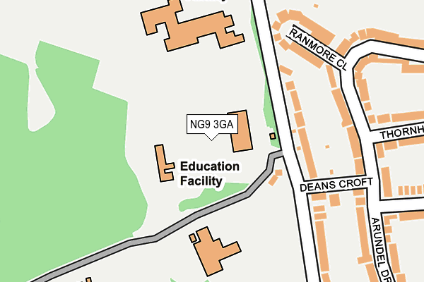
NG9 3GA is located in the Bramcote electoral ward, within the local authority district of Broxtowe and the English Parliamentary constituency of Broxtowe. The Sub Integrated Care Board (ICB) Location is NHS Nottingham and Nottinghamshire ICB - 52R and the police force is Nottinghamshire. This postcode has been in use since January 1980.


GetTheData
Source: OS OpenMap – Local (Ordnance Survey)
Source: OS VectorMap District (Ordnance Survey)
Licence: Open Government Licence (requires attribution)
| Easting | 450704 |
| Northing | 338541 |
| Latitude | 52.941893 |
| Longitude | -1.246940 |
GetTheData
Source: Open Postcode Geo
Licence: Open Government Licence
| Country | England |
| Postcode District | NG9 |
➜ See where NG9 is on a map ➜ Where is Beeston? | |
GetTheData
Source: Land Registry Price Paid Data
Licence: Open Government Licence
Elevation or altitude of NG9 3GA as distance above sea level:
| Metres | Feet | |
|---|---|---|
| Elevation | 80m | 262ft |
Elevation is measured from the approximate centre of the postcode, to the nearest point on an OS contour line from OS Terrain 50, which has contour spacing of ten vertical metres.
➜ How high above sea level am I? Find the elevation of your current position using your device's GPS.
GetTheData
Source: Open Postcode Elevation
Licence: Open Government Licence
| Ward | Bramcote |
| Constituency | Broxtowe |
GetTheData
Source: ONS Postcode Database
Licence: Open Government Licence
| Leisure Centre (Derby Road) | Beeston | 504m |
| Eyam Close (Eastcote Avenue) | Bramcote Hills | 505m |
| Sandringham Drive (Thoresby Road) | Bramcote Hills | 506m |
| Sandringham Drive (Thoresby Road) | Bramcote Hills | 518m |
| Leisure Centre (Derby Road) | Beeston | 529m |
| Beeston Station | 3.5km |
| Attenborough Station | 4.1km |
| Ilkeston Station | 5.3km |
GetTheData
Source: NaPTAN
Licence: Open Government Licence
GetTheData
Source: ONS Postcode Database
Licence: Open Government Licence


➜ Get more ratings from the Food Standards Agency
GetTheData
Source: Food Standards Agency
Licence: FSA terms & conditions
| Last Collection | |||
|---|---|---|---|
| Location | Mon-Fri | Sat | Distance |
| Bramcote Hills Post Office | 16:45 | 11:30 | 362m |
| Moor Lane | 17:15 | 11:30 | 463m |
| Chesham Drive | 17:30 | 11:30 | 465m |
GetTheData
Source: Dracos
Licence: Creative Commons Attribution-ShareAlike
The below table lists the International Territorial Level (ITL) codes (formerly Nomenclature of Territorial Units for Statistics (NUTS) codes) and Local Administrative Units (LAU) codes for NG9 3GA:
| ITL 1 Code | Name |
|---|---|
| TLF | East Midlands (England) |
| ITL 2 Code | Name |
| TLF1 | Derbyshire and Nottinghamshire |
| ITL 3 Code | Name |
| TLF16 | South Nottinghamshire |
| LAU 1 Code | Name |
| E07000172 | Broxtowe |
GetTheData
Source: ONS Postcode Directory
Licence: Open Government Licence
The below table lists the Census Output Area (OA), Lower Layer Super Output Area (LSOA), and Middle Layer Super Output Area (MSOA) for NG9 3GA:
| Code | Name | |
|---|---|---|
| OA | E00143136 | |
| LSOA | E01028089 | Broxtowe 007C |
| MSOA | E02005856 | Broxtowe 007 |
GetTheData
Source: ONS Postcode Directory
Licence: Open Government Licence
| NG9 3FR | Ranmore Close | 148m |
| NG9 3FQ | Arundel Drive | 153m |
| NG9 3FL | Deans Croft | 158m |
| NG9 3FH | Moor Lane | 183m |
| NG9 3FN | Arundel Drive | 250m |
| NG9 3FS | Thornhill Close | 263m |
| NG9 3FP | Seven Oaks Crescent | 280m |
| NG9 3GE | Moor Lane | 297m |
| NG9 3FT | Balmoral Drive | 308m |
| NG9 3FW | Seven Oaks Crescent | 388m |
GetTheData
Source: Open Postcode Geo; Land Registry Price Paid Data
Licence: Open Government Licence