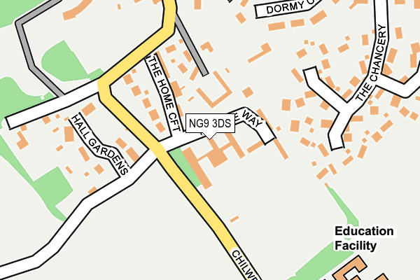
NG9 3DS is located in the Bramcote electoral ward, within the local authority district of Broxtowe and the English Parliamentary constituency of Broxtowe. The Sub Integrated Care Board (ICB) Location is NHS Nottingham and Nottinghamshire ICB - 52R and the police force is Nottinghamshire. This postcode has been in use since January 1980.


GetTheData
Source: OS OpenMap – Local (Ordnance Survey)
Source: OS VectorMap District (Ordnance Survey)
Licence: Open Government Licence (requires attribution)
| Easting | 450968 |
| Northing | 337183 |
| Latitude | 52.929661 |
| Longitude | -1.243225 |
GetTheData
Source: Open Postcode Geo
Licence: Open Government Licence
| Country | England |
| Postcode District | NG9 |
➜ See where NG9 is on a map ➜ Where is Beeston? | |
GetTheData
Source: Land Registry Price Paid Data
Licence: Open Government Licence
Elevation or altitude of NG9 3DS as distance above sea level:
| Metres | Feet | |
|---|---|---|
| Elevation | 70m | 230ft |
Elevation is measured from the approximate centre of the postcode, to the nearest point on an OS contour line from OS Terrain 50, which has contour spacing of ten vertical metres.
➜ How high above sea level am I? Find the elevation of your current position using your device's GPS.
GetTheData
Source: Open Postcode Elevation
Licence: Open Government Licence
| Ward | Bramcote |
| Constituency | Broxtowe |
GetTheData
Source: ONS Postcode Database
Licence: Open Government Licence
| Chilwell Lane | Bramcote Village | 55m |
| Chilwell Lane | Bramcote Village | 69m |
| Alderman White School (Chilwell Lane) | Bramcote Village | 213m |
| Alderman White School (Chilwell Lane) | Bramcote Village | 248m |
| Moss Drive (Town Street) | Bramcote Village | 327m |
| Bramcote Lane Tram Stop (Sandby Court) | Chilwell | 1,015m |
| Eskdale Drive Tram Stop (Eskdale Drive) | Chilwell | 1,036m |
| Cator Lane Tram Stop (N/A) | Chilwell | 1,113m |
| Inham Road Tram Stop (Eskdale Drive) | Chilwell | 1,250m |
| High Road - Central College Tram Stop (High Road) | Chilwell | 1,633m |
| Beeston Station | 2.6km |
| Attenborough Station | 2.7km |
| Long Eaton Station | 5.8km |
GetTheData
Source: NaPTAN
Licence: Open Government Licence
GetTheData
Source: ONS Postcode Database
Licence: Open Government Licence


➜ Get more ratings from the Food Standards Agency
GetTheData
Source: Food Standards Agency
Licence: FSA terms & conditions
| Last Collection | |||
|---|---|---|---|
| Location | Mon-Fri | Sat | Distance |
| Town Street | 17:30 | 12:15 | 341m |
| Claremont Avenue | 17:30 | 12:15 | 375m |
| Chilwell Lane | 17:30 | 12:00 | 462m |
GetTheData
Source: Dracos
Licence: Creative Commons Attribution-ShareAlike
The below table lists the International Territorial Level (ITL) codes (formerly Nomenclature of Territorial Units for Statistics (NUTS) codes) and Local Administrative Units (LAU) codes for NG9 3DS:
| ITL 1 Code | Name |
|---|---|
| TLF | East Midlands (England) |
| ITL 2 Code | Name |
| TLF1 | Derbyshire and Nottinghamshire |
| ITL 3 Code | Name |
| TLF16 | South Nottinghamshire |
| LAU 1 Code | Name |
| E07000172 | Broxtowe |
GetTheData
Source: ONS Postcode Directory
Licence: Open Government Licence
The below table lists the Census Output Area (OA), Lower Layer Super Output Area (LSOA), and Middle Layer Super Output Area (MSOA) for NG9 3DS:
| Code | Name | |
|---|---|---|
| OA | E00143129 | |
| LSOA | E01028087 | Broxtowe 007A |
| MSOA | E02005856 | Broxtowe 007 |
GetTheData
Source: ONS Postcode Directory
Licence: Open Government Licence
| NG9 3DX | Peache Way | 57m |
| NG9 3DR | Manor Court | 112m |
| NG9 3DQ | The Home Croft | 127m |
| NG9 3HN | The View | 154m |
| NG9 3LR | Hall Gardens | 189m |
| NG9 3AJ | The Chancery | 209m |
| NG9 3DE | Dormy Close | 225m |
| NG9 3DP | Town Street | 280m |
| NG9 3DF | Fern Close | 280m |
| NG9 3NF | Moss Drive | 292m |
GetTheData
Source: Open Postcode Geo; Land Registry Price Paid Data
Licence: Open Government Licence