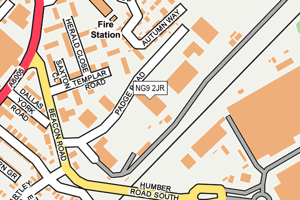
NG9 2JR is located in the Beeston Central electoral ward, within the local authority district of Broxtowe and the English Parliamentary constituency of Broxtowe. The Sub Integrated Care Board (ICB) Location is NHS Nottingham and Nottinghamshire ICB - 52R and the police force is Nottinghamshire. This postcode has been in use since April 1985.


GetTheData
Source: OS OpenMap – Local (Ordnance Survey)
Source: OS VectorMap District (Ordnance Survey)
Licence: Open Government Licence (requires attribution)
| Easting | 453940 |
| Northing | 336930 |
| Latitude | 52.927098 |
| Longitude | -1.199059 |
GetTheData
Source: Open Postcode Geo
Licence: Open Government Licence
| Country | England |
| Postcode District | NG9 |
➜ See where NG9 is on a map ➜ Where is Beeston? | |
GetTheData
Source: Land Registry Price Paid Data
Licence: Open Government Licence
Elevation or altitude of NG9 2JR as distance above sea level:
| Metres | Feet | |
|---|---|---|
| Elevation | 30m | 98ft |
Elevation is measured from the approximate centre of the postcode, to the nearest point on an OS contour line from OS Terrain 50, which has contour spacing of ten vertical metres.
➜ How high above sea level am I? Find the elevation of your current position using your device's GPS.
GetTheData
Source: Open Postcode Elevation
Licence: Open Government Licence
| Ward | Beeston Central |
| Constituency | Broxtowe |
GetTheData
Source: ONS Postcode Database
Licence: Open Government Licence
| Padge Road (Beacon Road) | Beeston | 191m |
| Padge Road (Beacon Road) | Beeston | 203m |
| Hassocks Lane (Queens Road East) | Beeston | 265m |
| Lilac Grove | Beeston Rylands | 278m |
| Lilac Grove | Beeston Rylands | 288m |
| University Boulevard Tram Stop (University Boulevard) | Nottingham University Main Campus | 606m |
| Middle Street Tram Stop (Middle Street) | Beeston | 678m |
| Beeston Centre Tram Stop (Styring Street) | Beeston | 1,075m |
| University Of Nottingham Tram Stop (University Boulevard) | Nottingham University Main Campus | 1,341m |
| Chilwell Road Tram Stop (Chilwell Road) | Beeston | 1,503m |
| Beeston Station | 0.9km |
| Attenborough Station | 3.2km |
| Nottingham Station | 4.2km |
GetTheData
Source: NaPTAN
Licence: Open Government Licence
GetTheData
Source: ONS Postcode Database
Licence: Open Government Licence


➜ Get more ratings from the Food Standards Agency
GetTheData
Source: Food Standards Agency
Licence: FSA terms & conditions
| Last Collection | |||
|---|---|---|---|
| Location | Mon-Fri | Sat | Distance |
| Nottingham Mailcentre | 19:30 | 14:00 | 164m |
| Mailcentre | 165m | ||
| Salisbury Street | 17:30 | 11:30 | 387m |
GetTheData
Source: Dracos
Licence: Creative Commons Attribution-ShareAlike
The below table lists the International Territorial Level (ITL) codes (formerly Nomenclature of Territorial Units for Statistics (NUTS) codes) and Local Administrative Units (LAU) codes for NG9 2JR:
| ITL 1 Code | Name |
|---|---|
| TLF | East Midlands (England) |
| ITL 2 Code | Name |
| TLF1 | Derbyshire and Nottinghamshire |
| ITL 3 Code | Name |
| TLF16 | South Nottinghamshire |
| LAU 1 Code | Name |
| E07000172 | Broxtowe |
GetTheData
Source: ONS Postcode Directory
Licence: Open Government Licence
The below table lists the Census Output Area (OA), Lower Layer Super Output Area (LSOA), and Middle Layer Super Output Area (MSOA) for NG9 2JR:
| Code | Name | |
|---|---|---|
| OA | E00143052 | |
| LSOA | E01028074 | Broxtowe 011B |
| MSOA | E02005860 | Broxtowe 011 |
GetTheData
Source: ONS Postcode Directory
Licence: Open Government Licence
| NG9 2DX | Templar Road | 126m |
| NG9 2DW | Herald Close | 187m |
| NG9 2DU | Saxton Close | 201m |
| NG9 2EY | Beacon Road | 220m |
| NG9 2EZ | Dallas York Road | 235m |
| NG9 2DT | Lambeth Court | 243m |
| NG9 2GX | Summer Crescent | 281m |
| NG9 2EX | Humber Road | 286m |
| NG9 2FD | Queens Road East | 313m |
| NG9 2FG | Hawthorne Grove | 319m |
GetTheData
Source: Open Postcode Geo; Land Registry Price Paid Data
Licence: Open Government Licence