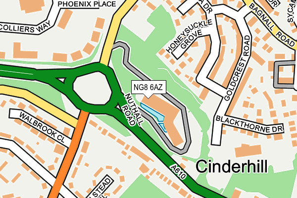
NG8 6AZ is located in the Basford electoral ward, within the unitary authority of Nottingham and the English Parliamentary constituency of Nottingham North. The Sub Integrated Care Board (ICB) Location is NHS Nottingham and Nottinghamshire ICB - 52R and the police force is Nottinghamshire. This postcode has been in use since January 1992.


GetTheData
Source: OS OpenMap – Local (Ordnance Survey)
Source: OS VectorMap District (Ordnance Survey)
Licence: Open Government Licence (requires attribution)
| Easting | 453741 |
| Northing | 343502 |
| Latitude | 52.986189 |
| Longitude | -1.200932 |
GetTheData
Source: Open Postcode Geo
Licence: Open Government Licence
| Country | England |
| Postcode District | NG8 |
➜ See where NG8 is on a map ➜ Where is Nottingham? | |
GetTheData
Source: Land Registry Price Paid Data
Licence: Open Government Licence
Elevation or altitude of NG8 6AZ as distance above sea level:
| Metres | Feet | |
|---|---|---|
| Elevation | 50m | 164ft |
Elevation is measured from the approximate centre of the postcode, to the nearest point on an OS contour line from OS Terrain 50, which has contour spacing of ten vertical metres.
➜ How high above sea level am I? Find the elevation of your current position using your device's GPS.
GetTheData
Source: Open Postcode Elevation
Licence: Open Government Licence
| Ward | Basford |
| Constituency | Nottingham North |
GetTheData
Source: ONS Postcode Database
Licence: Open Government Licence
| Cinderhill Island (Nuthall Road) | Cinderhill | 61m |
| Cinderhill Island (Nuthall Road) | Cinderhill | 84m |
| Walbrook Close (Bells Lane) | Cinderhill | 220m |
| Phoenix Park Interchange (Cinderhill Road) | Cinderhill | 226m |
| Walbrook Close (Bells Lane) | Cinderhill | 227m |
| Cinderhill Tram Stop (Cinderhill Road) | Cinderhill | 313m |
| Phoenix Park Tram Stop (Millennium Way East) | Phoenix Park | 516m |
| Highbury Vale Tram Stop (Highbury Vale) | Highbury Vale | 833m |
| David Lane Tram Stop (Vernon Road) | Basford | 1,269m |
| Bulwell Station | 1.5km |
| Nottingham Station | 5.7km |
GetTheData
Source: NaPTAN
Licence: Open Government Licence
GetTheData
Source: ONS Postcode Database
Licence: Open Government Licence


➜ Get more ratings from the Food Standards Agency
GetTheData
Source: Food Standards Agency
Licence: FSA terms & conditions
| Last Collection | |||
|---|---|---|---|
| Location | Mon-Fri | Sat | Distance |
| Tilbury Rise | 17:00 | 11:30 | 255m |
| Neston Drive | 17:30 | 11:30 | 345m |
| Pheonix Park | 18:30 | 469m | |
GetTheData
Source: Dracos
Licence: Creative Commons Attribution-ShareAlike
| Risk of NG8 6AZ flooding from rivers and sea | Medium |
| ➜ NG8 6AZ flood map | |
GetTheData
Source: Open Flood Risk by Postcode
Licence: Open Government Licence
The below table lists the International Territorial Level (ITL) codes (formerly Nomenclature of Territorial Units for Statistics (NUTS) codes) and Local Administrative Units (LAU) codes for NG8 6AZ:
| ITL 1 Code | Name |
|---|---|
| TLF | East Midlands (England) |
| ITL 2 Code | Name |
| TLF1 | Derbyshire and Nottinghamshire |
| ITL 3 Code | Name |
| TLF14 | Nottingham |
| LAU 1 Code | Name |
| E06000018 | Nottingham |
GetTheData
Source: ONS Postcode Directory
Licence: Open Government Licence
The below table lists the Census Output Area (OA), Lower Layer Super Output Area (LSOA), and Middle Layer Super Output Area (MSOA) for NG8 6AZ:
| Code | Name | |
|---|---|---|
| OA | E00069767 | |
| LSOA | E01013831 | Nottingham 009C |
| MSOA | E02002876 | Nottingham 009 |
GetTheData
Source: ONS Postcode Directory
Licence: Open Government Licence
| NG8 6AN | Broxtowe Rise | 133m |
| NG6 8PW | Honeysuckle Grove | 134m |
| NG8 6AF | Nuthall Road | 165m |
| NG6 8PT | Goldcrest Road | 177m |
| NG8 6ES | Bells Lane | 201m |
| NG8 6ER | Halstead Close | 203m |
| NG8 6AU | Nuthall Road | 208m |
| NG6 8PU | Japonica Drive | 214m |
| NG6 8PZ | Blackthorn Drive | 216m |
| NG8 6ET | Bells Lane | 232m |
GetTheData
Source: Open Postcode Geo; Land Registry Price Paid Data
Licence: Open Government Licence