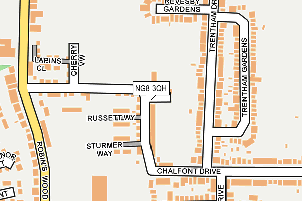
NG8 3QH is located in the Leen Valley electoral ward, within the unitary authority of Nottingham and the English Parliamentary constituency of Nottingham South. The Sub Integrated Care Board (ICB) Location is NHS Nottingham and Nottinghamshire ICB - 52R and the police force is Nottinghamshire. This postcode has been in use since July 2017.


GetTheData
Source: OS OpenMap – Local (Ordnance Survey)
Source: OS VectorMap District (Ordnance Survey)
Licence: Open Government Licence (requires attribution)
| Easting | 454063 |
| Northing | 341128 |
| Latitude | 52.964819 |
| Longitude | -1.196532 |
GetTheData
Source: Open Postcode Geo
Licence: Open Government Licence
| Country | England |
| Postcode District | NG8 |
➜ See where NG8 is on a map ➜ Where is Nottingham? | |
GetTheData
Source: Land Registry Price Paid Data
Licence: Open Government Licence
| Ward | Leen Valley |
| Constituency | Nottingham South |
GetTheData
Source: ONS Postcode Database
Licence: Open Government Licence
4, CRISPIN WAY, NOTTINGHAM, NG8 3QH 2018 27 JUL £245,000 |
3, CRISPIN WAY, NOTTINGHAM, NG8 3QH 2018 5 APR £275,000 |
1, CRISPIN WAY, NOTTINGHAM, NG8 3QH 2018 16 FEB £275,000 |
2, CRISPIN WAY, NOTTINGHAM, NG8 3QH 2017 30 JUN £239,995 |
GetTheData
Source: HM Land Registry Price Paid Data
Licence: Contains HM Land Registry data © Crown copyright and database right 2025. This data is licensed under the Open Government Licence v3.0.
| Trentham Drive H&r (Trentham Drive) | Aspley | 252m |
| Prestwood Drive Hr (Prestwood Drive) | Aspley | 255m |
| Robins Wood Rd Hr (Robins Wood Road) | Beechdale | 268m |
| Chalfont Drive (Western Boulevard) | Beechdale | 384m |
| Manning School (Robins Wood Road) | Aspley | 401m |
| Wilkinson Street Tram Stop (Wilkinson Street) | Basford | 1,476m |
| Bulwell Station | 3.9km |
| Nottingham Station | 3.9km |
| Beeston Station | 5km |
GetTheData
Source: NaPTAN
Licence: Open Government Licence
| Percentage of properties with Next Generation Access | 100.0% |
| Percentage of properties with Superfast Broadband | 100.0% |
| Percentage of properties with Ultrafast Broadband | 100.0% |
| Percentage of properties with Full Fibre Broadband | 0.0% |
Superfast Broadband is between 30Mbps and 300Mbps
Ultrafast Broadband is > 300Mbps
| Percentage of properties unable to receive 2Mbps | 0.0% |
| Percentage of properties unable to receive 5Mbps | 0.0% |
| Percentage of properties unable to receive 10Mbps | 0.0% |
| Percentage of properties unable to receive 30Mbps | 0.0% |
GetTheData
Source: Ofcom
Licence: Ofcom Terms of Use (requires attribution)
GetTheData
Source: ONS Postcode Database
Licence: Open Government Licence


➜ Get more ratings from the Food Standards Agency
GetTheData
Source: Food Standards Agency
Licence: FSA terms & conditions
| Last Collection | |||
|---|---|---|---|
| Location | Mon-Fri | Sat | Distance |
| Chalfont Drive | 17:30 | 11:00 | 390m |
| Enthorpe Street | 17:30 | 11:00 | 458m |
| Charlbury Road | 17:30 | 11:00 | 622m |
GetTheData
Source: Dracos
Licence: Creative Commons Attribution-ShareAlike
The below table lists the International Territorial Level (ITL) codes (formerly Nomenclature of Territorial Units for Statistics (NUTS) codes) and Local Administrative Units (LAU) codes for NG8 3QH:
| ITL 1 Code | Name |
|---|---|
| TLF | East Midlands (England) |
| ITL 2 Code | Name |
| TLF1 | Derbyshire and Nottinghamshire |
| ITL 3 Code | Name |
| TLF14 | Nottingham |
| LAU 1 Code | Name |
| E06000018 | Nottingham |
GetTheData
Source: ONS Postcode Directory
Licence: Open Government Licence
The below table lists the Census Output Area (OA), Lower Layer Super Output Area (LSOA), and Middle Layer Super Output Area (MSOA) for NG8 3QH:
| Code | Name | |
|---|---|---|
| OA | E00070297 | |
| LSOA | E01013932 | Nottingham 019C |
| MSOA | E02002886 | Nottingham 019 |
GetTheData
Source: ONS Postcode Directory
Licence: Open Government Licence
| NG8 3LU | Trentham Drive | 87m |
| NG8 3LW | Trentham Drive | 126m |
| NG8 3LT | Chalfont Drive | 158m |
| NG8 3NG | Trentham Gardens | 158m |
| NG8 3LX | Revesby Gardens | 185m |
| NG8 3LS | Chalfont Drive | 194m |
| NG8 3NF | Trentham Gardens | 194m |
| NG8 3NJ | Walesby Crescent | 248m |
| NG8 3LY | Prestwood Drive | 265m |
| NG8 3LD | Robins Wood Road | 274m |
GetTheData
Source: Open Postcode Geo; Land Registry Price Paid Data
Licence: Open Government Licence