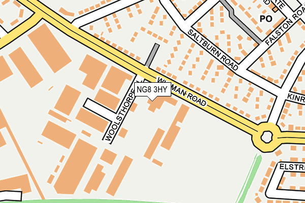
NG8 3HY is located in the Bilborough electoral ward, within the unitary authority of Nottingham and the English Parliamentary constituency of Nottingham North. The Sub Integrated Care Board (ICB) Location is NHS Nottingham and Nottinghamshire ICB - 52R and the police force is Nottinghamshire. This postcode has been in use since January 1980.


GetTheData
Source: OS OpenMap – Local (Ordnance Survey)
Source: OS VectorMap District (Ordnance Survey)
Licence: Open Government Licence (requires attribution)
| Easting | 453073 |
| Northing | 340835 |
| Latitude | 52.962284 |
| Longitude | -1.211318 |
GetTheData
Source: Open Postcode Geo
Licence: Open Government Licence
| Country | England |
| Postcode District | NG8 |
➜ See where NG8 is on a map ➜ Where is Nottingham? | |
GetTheData
Source: Land Registry Price Paid Data
Licence: Open Government Licence
Elevation or altitude of NG8 3HY as distance above sea level:
| Metres | Feet | |
|---|---|---|
| Elevation | 50m | 164ft |
Elevation is measured from the approximate centre of the postcode, to the nearest point on an OS contour line from OS Terrain 50, which has contour spacing of ten vertical metres.
➜ How high above sea level am I? Find the elevation of your current position using your device's GPS.
GetTheData
Source: Open Postcode Elevation
Licence: Open Government Licence
| Ward | Bilborough |
| Constituency | Nottingham North |
GetTheData
Source: ONS Postcode Database
Licence: Open Government Licence
| Greetwell Close (Wigman Road) | Bilborough | 61m |
| Greetwell Close (Wigman Road) | Bilborough | 103m |
| Saltburn Road H&r (Saltburn Road) | Beechdale | 144m |
| Glaisdale Drive (Wigman Road) | Bilborough | 185m |
| Wigman Road (Fremount Drive) | Beechdale | 206m |
| Bulwell Station | 4.3km |
| Beeston Station | 4.6km |
| Nottingham Station | 4.7km |
GetTheData
Source: NaPTAN
Licence: Open Government Licence
GetTheData
Source: ONS Postcode Database
Licence: Open Government Licence


➜ Get more ratings from the Food Standards Agency
GetTheData
Source: Food Standards Agency
Licence: FSA terms & conditions
| Last Collection | |||
|---|---|---|---|
| Location | Mon-Fri | Sat | Distance |
| Fremount Drive | 17:00 | 11:00 | 190m |
| Ambergate Road Post Office | 17:00 | 11:00 | 313m |
| Charlbury Road | 17:30 | 11:00 | 483m |
GetTheData
Source: Dracos
Licence: Creative Commons Attribution-ShareAlike
The below table lists the International Territorial Level (ITL) codes (formerly Nomenclature of Territorial Units for Statistics (NUTS) codes) and Local Administrative Units (LAU) codes for NG8 3HY:
| ITL 1 Code | Name |
|---|---|
| TLF | East Midlands (England) |
| ITL 2 Code | Name |
| TLF1 | Derbyshire and Nottinghamshire |
| ITL 3 Code | Name |
| TLF14 | Nottingham |
| LAU 1 Code | Name |
| E06000018 | Nottingham |
GetTheData
Source: ONS Postcode Directory
Licence: Open Government Licence
The below table lists the Census Output Area (OA), Lower Layer Super Output Area (LSOA), and Middle Layer Super Output Area (MSOA) for NG8 3HY:
| Code | Name | |
|---|---|---|
| OA | E00069912 | |
| LSOA | E01013861 | Nottingham 020B |
| MSOA | E02002887 | Nottingham 020 |
GetTheData
Source: ONS Postcode Directory
Licence: Open Government Licence
| NG8 3HW | Wigman Road | 66m |
| NG8 3FY | Saltburn Road | 127m |
| NG8 3FZ | Saltburn Road | 179m |
| NG8 3GT | Fremount Drive | 183m |
| NG8 3HS | Bathurst Drive | 228m |
| NG8 3GG | Ranmere Road | 240m |
| NG8 3GA | Tetney Walk | 254m |
| NG8 3GB | Falston Road | 261m |
| NG8 3GH | Fremount Drive | 274m |
| NG8 3GD | Ambergate Road | 303m |
GetTheData
Source: Open Postcode Geo; Land Registry Price Paid Data
Licence: Open Government Licence