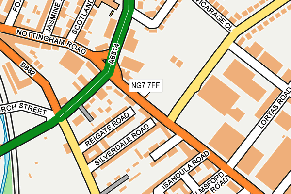
NG7 7FF is located in the Berridge electoral ward, within the unitary authority of Nottingham and the English Parliamentary constituency of Nottingham East. The Sub Integrated Care Board (ICB) Location is NHS Nottingham and Nottinghamshire ICB - 52R and the police force is Nottinghamshire. This postcode has been in use since January 1980.


GetTheData
Source: OS OpenMap – Local (Ordnance Survey)
Source: OS VectorMap District (Ordnance Survey)
Licence: Open Government Licence (requires attribution)
| Easting | 455646 |
| Northing | 342840 |
| Latitude | 52.980045 |
| Longitude | -1.172672 |
GetTheData
Source: Open Postcode Geo
Licence: Open Government Licence
| Country | England |
| Postcode District | NG7 |
➜ See where NG7 is on a map ➜ Where is Nottingham? | |
GetTheData
Source: Land Registry Price Paid Data
Licence: Open Government Licence
Elevation or altitude of NG7 7FF as distance above sea level:
| Metres | Feet | |
|---|---|---|
| Elevation | 40m | 131ft |
Elevation is measured from the approximate centre of the postcode, to the nearest point on an OS contour line from OS Terrain 50, which has contour spacing of ten vertical metres.
➜ How high above sea level am I? Find the elevation of your current position using your device's GPS.
GetTheData
Source: Open Postcode Elevation
Licence: Open Government Licence
| Ward | Berridge |
| Constituency | Nottingham East |
GetTheData
Source: ONS Postcode Database
Licence: Open Government Licence
| Perry Road (Nottingham Road) | Basford | 33m |
| Perry Road (Nottingham Road) | Basford | 35m |
| Nottingham Road (Perry Road) | Basford | 112m |
| Futurist (Valley Road) | Basford | 115m |
| Westbury Road (Perry Road) | Basford | 189m |
| Basford Tram Stop (Vernon Road) | Basford | 436m |
| David Lane Tram Stop (Vernon Road) | Basford | 835m |
| Shipstone Street Tram Stop (Shipstone Street) | Radford | 945m |
| Wilkinson Street Tram Stop (Wilkinson Street) | Basford | 966m |
| Beaconsfield Street Tram Stop (Noel Street) | Forest Fields | 1,097m |
| Bulwell Station | 2.7km |
| Nottingham Station | 4.1km |
GetTheData
Source: NaPTAN
Licence: Open Government Licence
GetTheData
Source: ONS Postcode Database
Licence: Open Government Licence


➜ Get more ratings from the Food Standards Agency
GetTheData
Source: Food Standards Agency
Licence: FSA terms & conditions
| Last Collection | |||
|---|---|---|---|
| Location | Mon-Fri | Sat | Distance |
| Valley Road | 17:30 | 10:30 | 67m |
| Nottingham Road | 17:30 | 12:00 | 316m |
| Radford Road | 17:30 | 12:30 | 377m |
GetTheData
Source: Dracos
Licence: Creative Commons Attribution-ShareAlike
The below table lists the International Territorial Level (ITL) codes (formerly Nomenclature of Territorial Units for Statistics (NUTS) codes) and Local Administrative Units (LAU) codes for NG7 7FF:
| ITL 1 Code | Name |
|---|---|
| TLF | East Midlands (England) |
| ITL 2 Code | Name |
| TLF1 | Derbyshire and Nottinghamshire |
| ITL 3 Code | Name |
| TLF14 | Nottingham |
| LAU 1 Code | Name |
| E06000018 | Nottingham |
GetTheData
Source: ONS Postcode Directory
Licence: Open Government Licence
The below table lists the Census Output Area (OA), Lower Layer Super Output Area (LSOA), and Middle Layer Super Output Area (MSOA) for NG7 7FF:
| Code | Name | |
|---|---|---|
| OA | E00069840 | |
| LSOA | E01013839 | Nottingham 012C |
| MSOA | E02002879 | Nottingham 012 |
GetTheData
Source: ONS Postcode Directory
Licence: Open Government Licence
| NG7 7FD | Nottingham Road | 50m |
| NG5 1JE | Valley Road | 76m |
| NG5 1JH | Fairfax Close | 86m |
| NG7 7FB | Reigate Road | 92m |
| NG7 7EU | Nottingham Road | 102m |
| NG5 1JG | Valley Road | 109m |
| NG7 7EZ | Silverdale Road | 121m |
| NG7 7EW | Chatsworth Avenue | 132m |
| NG5 1GR | Scotland Road | 151m |
| NG7 7EX | Radford Road | 169m |
GetTheData
Source: Open Postcode Geo; Land Registry Price Paid Data
Licence: Open Government Licence