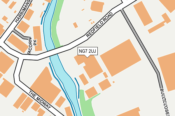
NG7 2UJ lies on Redfield Road in Lenton Lane Industrial Estate, Nottingham. NG7 2UJ is located in the Lenton & Wollaton East electoral ward, within the unitary authority of Nottingham and the English Parliamentary constituency of Nottingham South. The Sub Integrated Care Board (ICB) Location is NHS Nottingham and Nottinghamshire ICB - 52R and the police force is Nottinghamshire. This postcode has been in use since March 1983.


GetTheData
Source: OS OpenMap – Local (Ordnance Survey)
Source: OS VectorMap District (Ordnance Survey)
Licence: Open Government Licence (requires attribution)
| Easting | 455414 |
| Northing | 337602 |
| Latitude | 52.932989 |
| Longitude | -1.177022 |
GetTheData
Source: Open Postcode Geo
Licence: Open Government Licence
| Street | Redfield Road |
| Locality | Lenton Lane Industrial Estate |
| Town/City | Nottingham |
| Country | England |
| Postcode District | NG7 |
➜ See where NG7 is on a map ➜ Where is Nottingham? | |
GetTheData
Source: Land Registry Price Paid Data
Licence: Open Government Licence
Elevation or altitude of NG7 2UJ as distance above sea level:
| Metres | Feet | |
|---|---|---|
| Elevation | 30m | 98ft |
Elevation is measured from the approximate centre of the postcode, to the nearest point on an OS contour line from OS Terrain 50, which has contour spacing of ten vertical metres.
➜ How high above sea level am I? Find the elevation of your current position using your device's GPS.
GetTheData
Source: Open Postcode Elevation
Licence: Open Government Licence
| Ward | Lenton & Wollaton East |
| Constituency | Nottingham South |
GetTheData
Source: ONS Postcode Database
Licence: Open Government Licence
| Showcase Cinema (Clifton Boulevard) | Lenton Lane Industrial Estate | 335m |
| Showcase Cinema (Clifton Boulevard) | Lenton Lane Industrial Estate | 381m |
| Finch Close (Lenton Lane) | Lenton Lane Industrial Estate | 398m |
| Finch Close (Lenton Lane) | Lenton Lane Industrial Estate | 400m |
| Beechdale Motors (Lenton Lane) | Lenton Lane Industrial Estate | 434m |
| University Of Nottingham Tram Stop (University Boulevard) | Nottingham University Main Campus | 896m |
| Queens Medical Centre Tram Stop (South Road) | Queens Medical Centre | 1,155m |
| Gregory Street Tram Stop (Lenton Lane) | Lenton | 1,213m |
| Ng2 Tram Stop (Enterprise Way) | Lenton Lane Industrial Estate | 1,266m |
| Wilford Village Tram Stop (Main Road) | Wilford | 1,467m |
| Beeston Station | 2.5km |
| Nottingham Station | 2.6km |
| Attenborough Station | 4.7km |
GetTheData
Source: NaPTAN
Licence: Open Government Licence
GetTheData
Source: ONS Postcode Database
Licence: Open Government Licence


➜ Get more ratings from the Food Standards Agency
GetTheData
Source: Food Standards Agency
Licence: FSA terms & conditions
| Last Collection | |||
|---|---|---|---|
| Location | Mon-Fri | Sat | Distance |
| Redfield Road | 17:30 | 12:30 | 345m |
| Harrimans Lane | 19:15 | 381m | |
| Lenton Lane | 17:30 | 11:00 | 399m |
GetTheData
Source: Dracos
Licence: Creative Commons Attribution-ShareAlike
| Risk of NG7 2UJ flooding from rivers and sea | Low |
| ➜ NG7 2UJ flood map | |
GetTheData
Source: Open Flood Risk by Postcode
Licence: Open Government Licence
The below table lists the International Territorial Level (ITL) codes (formerly Nomenclature of Territorial Units for Statistics (NUTS) codes) and Local Administrative Units (LAU) codes for NG7 2UJ:
| ITL 1 Code | Name |
|---|---|
| TLF | East Midlands (England) |
| ITL 2 Code | Name |
| TLF1 | Derbyshire and Nottinghamshire |
| ITL 3 Code | Name |
| TLF14 | Nottingham |
| LAU 1 Code | Name |
| E06000018 | Nottingham |
GetTheData
Source: ONS Postcode Directory
Licence: Open Government Licence
The below table lists the Census Output Area (OA), Lower Layer Super Output Area (LSOA), and Middle Layer Super Output Area (MSOA) for NG7 2UJ:
| Code | Name | |
|---|---|---|
| OA | E00070259 | |
| LSOA | E01013928 | Nottingham 031G |
| MSOA | E02002898 | Nottingham 031 |
GetTheData
Source: ONS Postcode Directory
Licence: Open Government Licence
| NG7 2SD | Harrimans Lane | 394m |
| NG7 2SB | Gibbons Street | 413m |
| NG7 2UR | Alcester Street | 456m |
| NG7 2RP | Barrique Road | 577m |
| NG7 2RW | Tonnelier Road | 611m |
| NG7 2LA | Claude Street | 625m |
| NG7 2JY | Montpelier Road | 654m |
| NG7 2JX | Montpelier Road | 656m |
| NG7 2LB | Claude Street | 660m |
| NG7 2LF | Dunkirk Road | 672m |
GetTheData
Source: Open Postcode Geo; Land Registry Price Paid Data
Licence: Open Government Licence