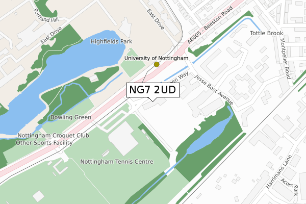
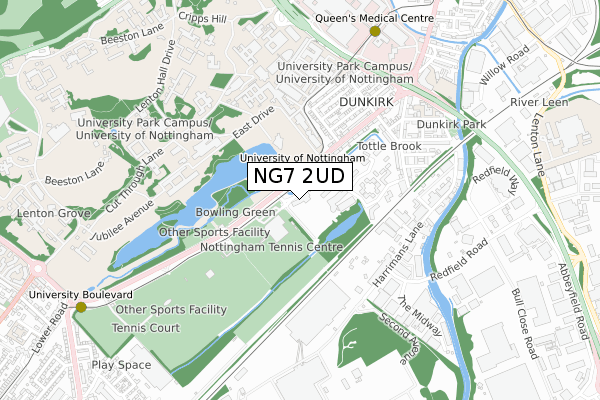
NG7 2UD is located in the Lenton & Wollaton East electoral ward, within the unitary authority of Nottingham and the English Parliamentary constituency of Nottingham South. The Sub Integrated Care Board (ICB) Location is NHS Nottingham and Nottinghamshire ICB - 52R and the police force is Nottinghamshire. This postcode has been in use since April 2020.


GetTheData
Source: OS Open Zoomstack (Ordnance Survey)
Licence: Open Government Licence (requires attribution)
Attribution: Contains OS data © Crown copyright and database right 2024
Source: Open Postcode Geo
Licence: Open Government Licence (requires attribution)
Attribution: Contains OS data © Crown copyright and database right 2024; Contains Royal Mail data © Royal Mail copyright and database right 2024; Source: Office for National Statistics licensed under the Open Government Licence v.3.0
| Easting | 454638 |
| Northing | 337946 |
| Latitude | 52.936160 |
| Longitude | -1.188507 |
GetTheData
Source: Open Postcode Geo
Licence: Open Government Licence
| Country | England |
| Postcode District | NG7 |
➜ See where NG7 is on a map ➜ Where is Nottingham? | |
GetTheData
Source: Land Registry Price Paid Data
Licence: Open Government Licence
| Ward | Lenton & Wollaton East |
| Constituency | Nottingham South |
GetTheData
Source: ONS Postcode Database
Licence: Open Government Licence
| South Entrance (University Boulevard) | Nottingham University Main Campus | 144m |
| South Entrance (University Boulevard) | Nottingham University Main Campus | 241m |
| Tennis Centre (University Boulevard) | Nottingham University Main Campus | 290m |
| Arts Centre (Nottingham University) | Nottingham University Main Campus | 321m |
| Arts Centre (Nottingham University) | Nottingham University Main Campus | 322m |
| University Of Nottingham Tram Stop (University Boulevard) | Nottingham University Main Campus | 122m |
| Queens Medical Centre Tram Stop (South Road) | Queens Medical Centre | 781m |
| University Boulevard Tram Stop (University Boulevard) | Nottingham University Main Campus | 1,017m |
| Gregory Street Tram Stop (Lenton Lane) | Lenton | 1,155m |
| Middle Street Tram Stop (Middle Street) | Beeston | 1,661m |
| Beeston Station | 2.1km |
| Nottingham Station | 3.1km |
| Attenborough Station | 4.4km |
GetTheData
Source: NaPTAN
Licence: Open Government Licence
GetTheData
Source: ONS Postcode Database
Licence: Open Government Licence

➜ Get more ratings from the Food Standards Agency
GetTheData
Source: Food Standards Agency
Licence: FSA terms & conditions
| Last Collection | |||
|---|---|---|---|
| Location | Mon-Fri | Sat | Distance |
| Highfields Science Park | 19:15 | 12:30 | 205m |
| Highfields Science Park | 19:15 | 206m | |
| Harrimans Lane | 19:15 | 478m | |
GetTheData
Source: Dracos
Licence: Creative Commons Attribution-ShareAlike
The below table lists the International Territorial Level (ITL) codes (formerly Nomenclature of Territorial Units for Statistics (NUTS) codes) and Local Administrative Units (LAU) codes for NG7 2UD:
| ITL 1 Code | Name |
|---|---|
| TLF | East Midlands (England) |
| ITL 2 Code | Name |
| TLF1 | Derbyshire and Nottinghamshire |
| ITL 3 Code | Name |
| TLF14 | Nottingham |
| LAU 1 Code | Name |
| E06000018 | Nottingham |
GetTheData
Source: ONS Postcode Directory
Licence: Open Government Licence
The below table lists the Census Output Area (OA), Lower Layer Super Output Area (LSOA), and Middle Layer Super Output Area (MSOA) for NG7 2UD:
| Code | Name | |
|---|---|---|
| OA | E00070257 | |
| LSOA | E01033410 | Nottingham 031I |
| MSOA | E02002898 | Nottingham 031 |
GetTheData
Source: ONS Postcode Directory
Licence: Open Government Licence
| NG7 2RU | Jesse Boot Avenue | 125m |
| NG7 2JN | Greenfield Street | 324m |
| NG7 2JQ | Beeston Road | 343m |
| NG7 2JP | Beeston Road | 377m |
| NG7 2JL | City Road | 420m |
| NG7 2UR | Alcester Street | 423m |
| NG7 2JX | Montpelier Road | 445m |
| NG7 2JT | Lace Street | 452m |
| NG7 2JF | Ednaston Road | 476m |
| NG7 2SD | Harrimans Lane | 476m |
GetTheData
Source: Open Postcode Geo; Land Registry Price Paid Data
Licence: Open Government Licence