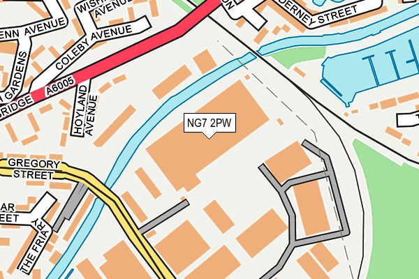
NG7 2PW is located in the Lenton & Wollaton East electoral ward, within the unitary authority of Nottingham and the English Parliamentary constituency of Nottingham South. The Sub Integrated Care Board (ICB) Location is NHS Nottingham and Nottinghamshire ICB - 52R and the police force is Nottinghamshire. This postcode has been in use since July 2012.


GetTheData
Source: OS OpenMap – Local (Ordnance Survey)
Source: OS VectorMap District (Ordnance Survey)
Licence: Open Government Licence (requires attribution)
| Easting | 455653 |
| Northing | 338858 |
| Latitude | 52.944233 |
| Longitude | -1.173254 |
GetTheData
Source: Open Postcode Geo
Licence: Open Government Licence
| Country | England |
| Postcode District | NG7 |
➜ See where NG7 is on a map ➜ Where is Nottingham? | |
GetTheData
Source: Land Registry Price Paid Data
Licence: Open Government Licence
Elevation or altitude of NG7 2PW as distance above sea level:
| Metres | Feet | |
|---|---|---|
| Elevation | 30m | 98ft |
Elevation is measured from the approximate centre of the postcode, to the nearest point on an OS contour line from OS Terrain 50, which has contour spacing of ten vertical metres.
➜ How high above sea level am I? Find the elevation of your current position using your device's GPS.
GetTheData
Source: Open Postcode Elevation
Licence: Open Government Licence
| Ward | Lenton & Wollaton East |
| Constituency | Nottingham South |
GetTheData
Source: ONS Postcode Database
Licence: Open Government Licence
| Abbey Bridge | Lenton | 220m |
| Willow Road (Lenton Lane) | Lenton Lane Industrial Estate | 223m |
| Abbey Bridge | Lenton | 233m |
| Willow Road (Lenton Lane) | Lenton Lane Industrial Estate | 235m |
| Red Cow (Lenton Lane) | Dunkirk | 260m |
| Gregory Street Tram Stop (Lenton Lane) | Lenton | 258m |
| Ng2 Tram Stop (Enterprise Way) | Lenton Lane Industrial Estate | 602m |
| Queens Medical Centre Tram Stop (South Road) | Queens Medical Centre | 728m |
| Meadows Way West Tram Stop (Meadows Way) | Meadows | 1,117m |
| University Of Nottingham Tram Stop (University Boulevard) | Nottingham University Main Campus | 1,278m |
| Nottingham Station | 1.8km |
| Beeston Station | 3.5km |
| Attenborough Station | 5.8km |
GetTheData
Source: NaPTAN
Licence: Open Government Licence
GetTheData
Source: ONS Postcode Database
Licence: Open Government Licence


➜ Get more ratings from the Food Standards Agency
GetTheData
Source: Food Standards Agency
Licence: FSA terms & conditions
| Last Collection | |||
|---|---|---|---|
| Location | Mon-Fri | Sat | Distance |
| Grove Road | 17:00 | 11:00 | 328m |
| New Lenton Post Office | 17:00 | 11:30 | 404m |
| Old Lenton | 17:30 | 11:00 | 453m |
GetTheData
Source: Dracos
Licence: Creative Commons Attribution-ShareAlike
| Risk of NG7 2PW flooding from rivers and sea | Low |
| ➜ NG7 2PW flood map | |
GetTheData
Source: Open Flood Risk by Postcode
Licence: Open Government Licence
The below table lists the International Territorial Level (ITL) codes (formerly Nomenclature of Territorial Units for Statistics (NUTS) codes) and Local Administrative Units (LAU) codes for NG7 2PW:
| ITL 1 Code | Name |
|---|---|
| TLF | East Midlands (England) |
| ITL 2 Code | Name |
| TLF1 | Derbyshire and Nottinghamshire |
| ITL 3 Code | Name |
| TLF14 | Nottingham |
| LAU 1 Code | Name |
| E06000018 | Nottingham |
GetTheData
Source: ONS Postcode Directory
Licence: Open Government Licence
The below table lists the Census Output Area (OA), Lower Layer Super Output Area (LSOA), and Middle Layer Super Output Area (MSOA) for NG7 2PW:
| Code | Name | |
|---|---|---|
| OA | E00070248 | |
| LSOA | E01013926 | Nottingham 031E |
| MSOA | E02002898 | Nottingham 031 |
GetTheData
Source: ONS Postcode Directory
Licence: Open Government Licence
| NG7 2RR | Poplars Court | 108m |
| NG7 1HF | Petersham Mews | 167m |
| NG7 2NJ | Hoyland Avenue | 209m |
| NG7 2NF | Coleby Avenue | 215m |
| NG7 1HE | Grove Road | 217m |
| NG7 2PF | Claytons Drive | 218m |
| NG7 1HL | Hungerton Street | 223m |
| NG7 1HJ | Grove Road | 243m |
| NG7 2NH | Abbey Bridge | 245m |
| NG7 1HQ | Broadholme Street | 249m |
GetTheData
Source: Open Postcode Geo; Land Registry Price Paid Data
Licence: Open Government Licence