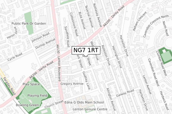
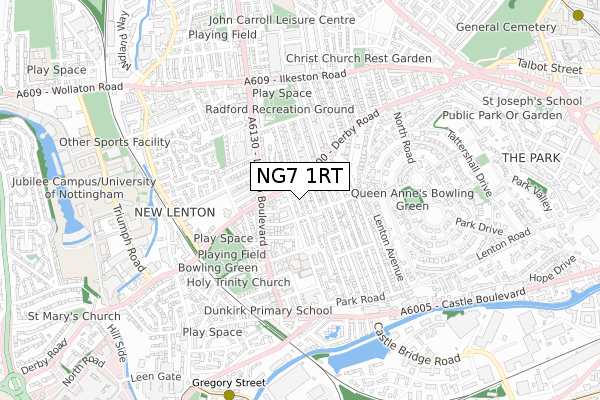
NG7 1RT is located in the Lenton & Wollaton East electoral ward, within the unitary authority of Nottingham and the English Parliamentary constituency of Nottingham South. The Sub Integrated Care Board (ICB) Location is NHS Nottingham and Nottinghamshire ICB - 52R and the police force is Nottinghamshire. This postcode has been in use since October 2017.


GetTheData
Source: OS Open Zoomstack (Ordnance Survey)
Licence: Open Government Licence (requires attribution)
Attribution: Contains OS data © Crown copyright and database right 2025
Source: Open Postcode Geo
Licence: Open Government Licence (requires attribution)
Attribution: Contains OS data © Crown copyright and database right 2025; Contains Royal Mail data © Royal Mail copyright and database right 2025; Source: Office for National Statistics licensed under the Open Government Licence v.3.0
| Easting | 455695 |
| Northing | 339629 |
| Latitude | 52.951179 |
| Longitude | -1.172494 |
GetTheData
Source: Open Postcode Geo
Licence: Open Government Licence
| Country | England |
| Postcode District | NG7 |
➜ See where NG7 is on a map ➜ Where is Nottingham? | |
GetTheData
Source: Land Registry Price Paid Data
Licence: Open Government Licence
| Ward | Lenton & Wollaton East |
| Constituency | Nottingham South |
GetTheData
Source: ONS Postcode Database
Licence: Open Government Licence
| Savoy Cinema (Derby Road) | Lenton | 66m |
| Savoy Cinema (Derby Road) | Lenton | 89m |
| Willoughby Avenue (Lenton Boulevard) | Lenton | 167m |
| Willoughby Avenue (Lenton Boulevard) | Lenton | 191m |
| Lenton Boulevard (Derby Road) | Lenton | 215m |
| Gregory Street Tram Stop (Lenton Lane) | Lenton | 866m |
| Ng2 Tram Stop (Enterprise Way) | Lenton Lane Industrial Estate | 1,146m |
| Queens Medical Centre Tram Stop (South Road) | Queens Medical Centre | 1,220m |
| Meadows Way West Tram Stop (Meadows Way) | Meadows | 1,370m |
| Ntu Tram Stop (Goldsmith Street) | Nottingham Trent University In City Centre | 1,380m |
| Nottingham Station | 1.8km |
| Beeston Station | 4.1km |
GetTheData
Source: NaPTAN
Licence: Open Government Licence
| Percentage of properties with Next Generation Access | 100.0% |
| Percentage of properties with Superfast Broadband | 100.0% |
| Percentage of properties with Ultrafast Broadband | 100.0% |
| Percentage of properties with Full Fibre Broadband | 0.0% |
Superfast Broadband is between 30Mbps and 300Mbps
Ultrafast Broadband is > 300Mbps
| Median download speed | 80.0Mbps |
| Average download speed | 93.7Mbps |
| Maximum download speed | 350.00Mbps |
| Median upload speed | 10.0Mbps |
| Average upload speed | 12.7Mbps |
| Maximum upload speed | 20.00Mbps |
| Percentage of properties unable to receive 2Mbps | 0.0% |
| Percentage of properties unable to receive 5Mbps | 0.0% |
| Percentage of properties unable to receive 10Mbps | 0.0% |
| Percentage of properties unable to receive 30Mbps | 0.0% |
GetTheData
Source: Ofcom
Licence: Ofcom Terms of Use (requires attribution)
GetTheData
Source: ONS Postcode Database
Licence: Open Government Licence


➜ Get more ratings from the Food Standards Agency
GetTheData
Source: Food Standards Agency
Licence: FSA terms & conditions
| Last Collection | |||
|---|---|---|---|
| Location | Mon-Fri | Sat | Distance |
| Arthur Avenue | 17:30 | 12:30 | 157m |
| Church Street/Digby Avenue | 17:30 | 11:00 | 204m |
| Derby Grove | 17:30 | 12:30 | 302m |
GetTheData
Source: Dracos
Licence: Creative Commons Attribution-ShareAlike
The below table lists the International Territorial Level (ITL) codes (formerly Nomenclature of Territorial Units for Statistics (NUTS) codes) and Local Administrative Units (LAU) codes for NG7 1RT:
| ITL 1 Code | Name |
|---|---|
| TLF | East Midlands (England) |
| ITL 2 Code | Name |
| TLF1 | Derbyshire and Nottinghamshire |
| ITL 3 Code | Name |
| TLF14 | Nottingham |
| LAU 1 Code | Name |
| E06000018 | Nottingham |
GetTheData
Source: ONS Postcode Directory
Licence: Open Government Licence
The below table lists the Census Output Area (OA), Lower Layer Super Output Area (LSOA), and Middle Layer Super Output Area (MSOA) for NG7 1RT:
| Code | Name | |
|---|---|---|
| OA | E00173475 | |
| LSOA | E01013924 | Nottingham 031C |
| MSOA | E02002898 | Nottingham 031 |
GetTheData
Source: ONS Postcode Directory
Licence: Open Government Licence
| NG7 1QL | Welby Avenue | 48m |
| NG7 1RR | Park Street | 86m |
| NG7 1JT | Rolleston Drive | 101m |
| NG7 1QJ | Derby Road | 107m |
| NG7 1QN | Derby Road | 110m |
| NG7 1JP | Harrowby Road | 110m |
| NG7 1PZ | Derby Road | 121m |
| NG7 1QF | Derby Road | 123m |
| NG7 1JS | Rolleston Drive | 132m |
| NG7 2EL | Arthur Avenue | 134m |
GetTheData
Source: Open Postcode Geo; Land Registry Price Paid Data
Licence: Open Government Licence