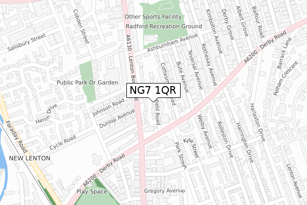
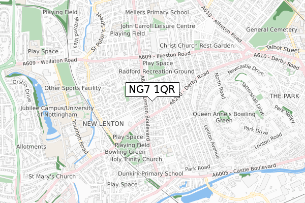
NG7 1QR is located in the Radford electoral ward, within the unitary authority of Nottingham and the English Parliamentary constituency of Nottingham South. The Sub Integrated Care Board (ICB) Location is NHS Nottingham and Nottinghamshire ICB - 52R and the police force is Nottinghamshire. This postcode has been in use since June 2019.


GetTheData
Source: OS Open Zoomstack (Ordnance Survey)
Licence: Open Government Licence (requires attribution)
Attribution: Contains OS data © Crown copyright and database right 2025
Source: Open Postcode Geo
Licence: Open Government Licence (requires attribution)
Attribution: Contains OS data © Crown copyright and database right 2025; Contains Royal Mail data © Royal Mail copyright and database right 2025; Source: Office for National Statistics licensed under the Open Government Licence v.3.0
| Easting | 455589 |
| Northing | 339795 |
| Latitude | 52.952682 |
| Longitude | -1.174043 |
GetTheData
Source: Open Postcode Geo
Licence: Open Government Licence
| Country | England |
| Postcode District | NG7 |
➜ See where NG7 is on a map ➜ Where is Nottingham? | |
GetTheData
Source: Land Registry Price Paid Data
Licence: Open Government Licence
| Ward | Radford |
| Constituency | Nottingham South |
GetTheData
Source: ONS Postcode Database
Licence: Open Government Licence
6, SANDFIELD ROAD, LENTON, NOTTINGHAM, NG7 1QR 2023 28 FEB £320,000 |
5, SANDFIELD ROAD, LENTON, NOTTINGHAM, NG7 1QR 2022 16 DEC £370,000 |
20, SANDFIELD ROAD, LENTON, NOTTINGHAM, NG7 1QR 2022 12 APR £350,000 |
31, SANDFIELD ROAD, NOTTINGHAM, NG7 1QR 2020 14 DEC £264,995 |
33, SANDFIELD ROAD, NOTTINGHAM, NG7 1QR 2020 27 NOV £264,995 |
35, SANDFIELD ROAD, NOTTINGHAM, NG7 1QR 2020 23 NOV £230,995 |
29, SANDFIELD ROAD, NOTTINGHAM, NG7 1QR 2020 28 AUG £230,995 |
23, SANDFIELD ROAD, NOTTINGHAM, NG7 1QR 2020 31 JUL £237,995 |
21, SANDFIELD ROAD, NOTTINGHAM, NG7 1QR 2020 31 JUL £237,995 |
20, SANDFIELD ROAD, LENTON, NOTTINGHAM, NG7 1QR 2019 20 DEC £324,995 |
GetTheData
Source: HM Land Registry Price Paid Data
Licence: Contains HM Land Registry data © Crown copyright and database right 2025. This data is licensed under the Open Government Licence v3.0.
| Lenton Boulevard H&r (Lenton Boulevard) | Lenton | 107m |
| Savoy Cinema (Derby Road) | Lenton | 111m |
| Savoy Cinema (Derby Road) | Lenton | 134m |
| Harrington Drive (Derby Road) | Lenton | 224m |
| Lenton Boulevard (Derby Road) | Lenton | 237m |
| Gregory Street Tram Stop (Lenton Lane) | Lenton | 998m |
| Queens Medical Centre Tram Stop (South Road) | Queens Medical Centre | 1,301m |
| Ng2 Tram Stop (Enterprise Way) | Lenton Lane Industrial Estate | 1,342m |
| High School Tram Stop (Waverley Street) | Arboretum | 1,377m |
| Ntu Tram Stop (Goldsmith Street) | Nottingham Trent University In City Centre | 1,384m |
| Nottingham Station | 2km |
| Beeston Station | 4.2km |
GetTheData
Source: NaPTAN
Licence: Open Government Licence
| Percentage of properties with Next Generation Access | 100.0% |
| Percentage of properties with Superfast Broadband | 100.0% |
| Percentage of properties with Ultrafast Broadband | 0.0% |
| Percentage of properties with Full Fibre Broadband | 0.0% |
Superfast Broadband is between 30Mbps and 300Mbps
Ultrafast Broadband is > 300Mbps
| Percentage of properties unable to receive 2Mbps | 0.0% |
| Percentage of properties unable to receive 5Mbps | 0.0% |
| Percentage of properties unable to receive 10Mbps | 0.0% |
| Percentage of properties unable to receive 30Mbps | 0.0% |
GetTheData
Source: Ofcom
Licence: Ofcom Terms of Use (requires attribution)
GetTheData
Source: ONS Postcode Database
Licence: Open Government Licence


➜ Get more ratings from the Food Standards Agency
GetTheData
Source: Food Standards Agency
Licence: FSA terms & conditions
| Last Collection | |||
|---|---|---|---|
| Location | Mon-Fri | Sat | Distance |
| Arthur Avenue | 17:30 | 12:30 | 223m |
| Johnson Road/Cycle Road | 17:30 | 11:00 | 239m |
| Derby Grove | 17:30 | 12:30 | 281m |
GetTheData
Source: Dracos
Licence: Creative Commons Attribution-ShareAlike
The below table lists the International Territorial Level (ITL) codes (formerly Nomenclature of Territorial Units for Statistics (NUTS) codes) and Local Administrative Units (LAU) codes for NG7 1QR:
| ITL 1 Code | Name |
|---|---|
| TLF | East Midlands (England) |
| ITL 2 Code | Name |
| TLF1 | Derbyshire and Nottinghamshire |
| ITL 3 Code | Name |
| TLF14 | Nottingham |
| LAU 1 Code | Name |
| E06000018 | Nottingham |
GetTheData
Source: ONS Postcode Directory
Licence: Open Government Licence
The below table lists the Census Output Area (OA), Lower Layer Super Output Area (LSOA), and Middle Layer Super Output Area (MSOA) for NG7 1QR:
| Code | Name | |
|---|---|---|
| OA | E00070410 | |
| LSOA | E01013953 | Nottingham 026F |
| MSOA | E02002893 | Nottingham 026 |
GetTheData
Source: ONS Postcode Directory
Licence: Open Government Licence
| NG7 1QE | Cottesmore Road | 32m |
| NG7 1QB | Bute Avenue | 91m |
| NG7 2BT | Lenton Boulevard | 108m |
| NG7 1PZ | Derby Road | 110m |
| NG7 1QF | Derby Road | 114m |
| NG7 1QA | Bute Avenue | 118m |
| NG7 1QD | Ashburnham Avenue | 123m |
| NG7 1PY | Teversal Avenue | 138m |
| NG7 1PX | Teversal Avenue | 161m |
| NG7 1QJ | Derby Road | 165m |
GetTheData
Source: Open Postcode Geo; Land Registry Price Paid Data
Licence: Open Government Licence