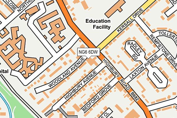
NG6 6DW is located in the Bulwell Forest electoral ward, within the unitary authority of Nottingham and the English Parliamentary constituency of Nottingham North. The Sub Integrated Care Board (ICB) Location is NHS Nottingham and Nottinghamshire ICB - 52R and the police force is Nottinghamshire. This postcode has been in use since March 2017.


GetTheData
Source: OS OpenMap – Local (Ordnance Survey)
Source: OS VectorMap District (Ordnance Survey)
Licence: Open Government Licence (requires attribution)
| Easting | 454572 |
| Northing | 344202 |
| Latitude | 52.992397 |
| Longitude | -1.188437 |
GetTheData
Source: Open Postcode Geo
Licence: Open Government Licence
| Country | England |
| Postcode District | NG6 |
➜ See where NG6 is on a map ➜ Where is Nottingham? | |
GetTheData
Source: Land Registry Price Paid Data
Licence: Open Government Licence
| Ward | Bulwell Forest |
| Constituency | Nottingham North |
GetTheData
Source: ONS Postcode Database
Licence: Open Government Licence
| Highbury Hospital (Highbury Road) | Highbury Vale | 61m |
| Bedford Grove (Highbury Road) | Highbury Vale | 73m |
| Bedford Grove (Highbury Road) | Highbury Vale | 100m |
| Highbury Hospital (Highbury Road) | Highbury Vale | 134m |
| Piccadilly (Highbury Road) | Highbury Vale | 258m |
| Highbury Vale Tram Stop (Highbury Vale) | Highbury Vale | 316m |
| Cinderhill Tram Stop (Cinderhill Road) | Cinderhill | 907m |
| Bulwell Tram Stop (Station Road) | Bulwell | 929m |
| David Lane Tram Stop (Vernon Road) | Basford | 935m |
| Phoenix Park Tram Stop (Millennium Way East) | Phoenix Park | 1,305m |
| Bulwell Station | 1km |
GetTheData
Source: NaPTAN
Licence: Open Government Licence
GetTheData
Source: ONS Postcode Database
Licence: Open Government Licence


➜ Get more ratings from the Food Standards Agency
GetTheData
Source: Food Standards Agency
Licence: FSA terms & conditions
| Last Collection | |||
|---|---|---|---|
| Location | Mon-Fri | Sat | Distance |
| Highbury Avenue | 17:00 | 11:30 | 49m |
| Kersall Drive | 17:00 | 09:30 | 353m |
| Highbury Vale | 17:00 | 12:00 | 386m |
GetTheData
Source: Dracos
Licence: Creative Commons Attribution-ShareAlike
The below table lists the International Territorial Level (ITL) codes (formerly Nomenclature of Territorial Units for Statistics (NUTS) codes) and Local Administrative Units (LAU) codes for NG6 6DW:
| ITL 1 Code | Name |
|---|---|
| TLF | East Midlands (England) |
| ITL 2 Code | Name |
| TLF1 | Derbyshire and Nottinghamshire |
| ITL 3 Code | Name |
| TLF14 | Nottingham |
| LAU 1 Code | Name |
| E06000018 | Nottingham |
GetTheData
Source: ONS Postcode Directory
Licence: Open Government Licence
The below table lists the Census Output Area (OA), Lower Layer Super Output Area (LSOA), and Middle Layer Super Output Area (MSOA) for NG6 6DW:
| Code | Name | |
|---|---|---|
| OA | E00070081 | |
| LSOA | E01013891 | Nottingham 004E |
| MSOA | E02002871 | Nottingham 004 |
GetTheData
Source: ONS Postcode Directory
Licence: Open Government Licence
| NG6 9DU | Highbury Road | 89m |
| NG6 9BY | Woodland Avenue | 115m |
| NG6 9DE | Bedford Grove | 124m |
| NG6 9DH | Radley Square | 132m |
| NG6 9DB | Highbury Avenue | 146m |
| NG6 9DD | Highbury Road | 161m |
| NG6 9EU | Kersall Drive | 188m |
| NG6 9DQ | Highbury Road | 201m |
| NG6 0DP | Gabrielle Close | 205m |
| NG6 9EW | Rempstone Drive | 205m |
GetTheData
Source: Open Postcode Geo; Land Registry Price Paid Data
Licence: Open Government Licence