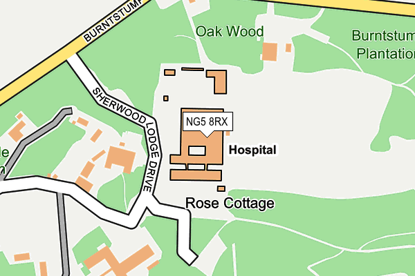
NG5 8RX is located in the Calverton electoral ward, within the local authority district of Gedling and the English Parliamentary constituency of Sherwood. The Sub Integrated Care Board (ICB) Location is NHS Nottingham and Nottinghamshire ICB - 52R and the police force is Nottinghamshire. This postcode has been in use since March 1983.


GetTheData
Source: OS OpenMap – Local (Ordnance Survey)
Source: OS VectorMap District (Ordnance Survey)
Licence: Open Government Licence (requires attribution)
| Easting | 457553 |
| Northing | 350658 |
| Latitude | 53.050094 |
| Longitude | -1.142886 |
GetTheData
Source: Open Postcode Geo
Licence: Open Government Licence
| Country | England |
| Postcode District | NG5 |
➜ See where NG5 is on a map | |
GetTheData
Source: Land Registry Price Paid Data
Licence: Open Government Licence
Elevation or altitude of NG5 8RX as distance above sea level:
| Metres | Feet | |
|---|---|---|
| Elevation | 90m | 295ft |
Elevation is measured from the approximate centre of the postcode, to the nearest point on an OS contour line from OS Terrain 50, which has contour spacing of ten vertical metres.
➜ How high above sea level am I? Find the elevation of your current position using your device's GPS.
GetTheData
Source: Open Postcode Elevation
Licence: Open Government Licence
| Ward | Calverton |
| Constituency | Sherwood |
GetTheData
Source: ONS Postcode Database
Licence: Open Government Licence
| Burntstump Hill (Mansfield Road) | Papplewick | 418m |
| Burntstump Hill (Mansfield Road) | Papplewick | 469m |
| South Lodge (Mansfield Road) | Papplewick | 534m |
| South Lodge (Mansfield Road) | Papplewick | 544m |
| Forest Farm (Mansfield Road) | Papplewick | 1,093m |
| Hucknall Station | 3.8km |
GetTheData
Source: NaPTAN
Licence: Open Government Licence
GetTheData
Source: ONS Postcode Database
Licence: Open Government Licence


➜ Get more ratings from the Food Standards Agency
GetTheData
Source: Food Standards Agency
Licence: FSA terms & conditions
| Last Collection | |||
|---|---|---|---|
| Location | Mon-Fri | Sat | Distance |
| Seven Mile House | 17:00 | 10:00 | 433m |
| Mansfield Road | 16:00 | 11:00 | 1,554m |
| Killarney Park | 17:00 | 11:00 | 2,361m |
GetTheData
Source: Dracos
Licence: Creative Commons Attribution-ShareAlike
The below table lists the International Territorial Level (ITL) codes (formerly Nomenclature of Territorial Units for Statistics (NUTS) codes) and Local Administrative Units (LAU) codes for NG5 8RX:
| ITL 1 Code | Name |
|---|---|
| TLF | East Midlands (England) |
| ITL 2 Code | Name |
| TLF1 | Derbyshire and Nottinghamshire |
| ITL 3 Code | Name |
| TLF16 | South Nottinghamshire |
| LAU 1 Code | Name |
| E07000173 | Gedling |
GetTheData
Source: ONS Postcode Directory
Licence: Open Government Licence
The below table lists the Census Output Area (OA), Lower Layer Super Output Area (LSOA), and Middle Layer Super Output Area (MSOA) for NG5 8RX:
| Code | Name | |
|---|---|---|
| OA | E00143634 | |
| LSOA | E01028189 | Gedling 001A |
| MSOA | E02005865 | Gedling 001 |
GetTheData
Source: ONS Postcode Directory
Licence: Open Government Licence
| NG5 8PN | Mansfield Road | 500m |
| NG15 8FH | Mansfield Road | 688m |
| NG5 8PQ | Burntstump Hill | 692m |
| NG15 8FJ | Mansfield Road | 1078m |
| NG15 8FG | Forest Lane | 1399m |
| NG15 8FL | Mansfield Road | 1544m |
| NG15 9AJ | Forestry Houses | 1689m |
| NG6 8UJ | Goosedale Lane | 1861m |
| NG5 8PH | Mansfield Road | 1866m |
| NG5 8PS | Oxton Road | 2038m |
GetTheData
Source: Open Postcode Geo; Land Registry Price Paid Data
Licence: Open Government Licence