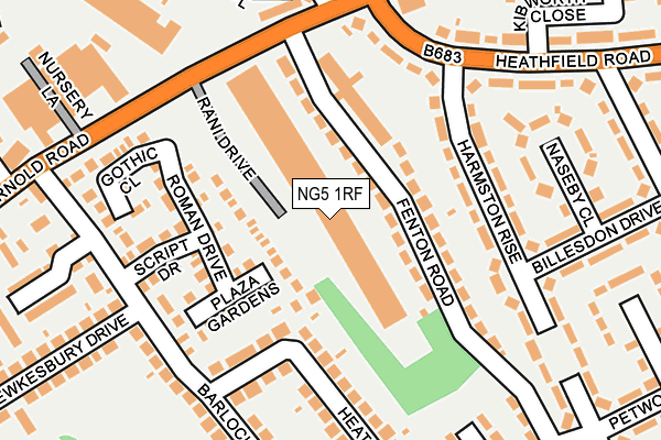
NG5 1RF is located in the Basford electoral ward, within the unitary authority of Nottingham and the English Parliamentary constituency of Nottingham North. The Sub Integrated Care Board (ICB) Location is NHS Nottingham and Nottinghamshire ICB - 52R and the police force is Nottinghamshire. This postcode has been in use since July 2007.


GetTheData
Source: OS OpenMap – Local (Ordnance Survey)
Source: OS VectorMap District (Ordnance Survey)
Licence: Open Government Licence (requires attribution)
| Easting | 455614 |
| Northing | 343743 |
| Latitude | 52.988145 |
| Longitude | -1.172997 |
GetTheData
Source: Open Postcode Geo
Licence: Open Government Licence
| Country | England |
| Postcode District | NG5 |
➜ See where NG5 is on a map ➜ Where is Nottingham? | |
GetTheData
Source: Land Registry Price Paid Data
Licence: Open Government Licence
Elevation or altitude of NG5 1RF as distance above sea level:
| Metres | Feet | |
|---|---|---|
| Elevation | 50m | 164ft |
Elevation is measured from the approximate centre of the postcode, to the nearest point on an OS contour line from OS Terrain 50, which has contour spacing of ten vertical metres.
➜ How high above sea level am I? Find the elevation of your current position using your device's GPS.
GetTheData
Source: Open Postcode Elevation
Licence: Open Government Licence
| Ward | Basford |
| Constituency | Nottingham North |
GetTheData
Source: ONS Postcode Database
Licence: Open Government Licence
| Fenton Road Top (Fenton Road) | Basford | 99m |
| Fenton Road Top (Fenton Road) | Basford | 131m |
| Heathfield Road H&r (Heathfield Road) | Basford | 170m |
| Fenton Road (Arnold Road) | Basford | 173m |
| Barlock Road (Arnold Road) | Basford | 214m |
| David Lane Tram Stop (Vernon Road) | Basford | 715m |
| Basford Tram Stop (Vernon Road) | Basford | 812m |
| Highbury Vale Tram Stop (Highbury Vale) | Highbury Vale | 1,153m |
| Bulwell Station | 2km |
| Nottingham Station | 4.9km |
GetTheData
Source: NaPTAN
Licence: Open Government Licence
GetTheData
Source: ONS Postcode Database
Licence: Open Government Licence


➜ Get more ratings from the Food Standards Agency
GetTheData
Source: Food Standards Agency
Licence: FSA terms & conditions
| Last Collection | |||
|---|---|---|---|
| Location | Mon-Fri | Sat | Distance |
| Barlock Road | 17:30 | 12:00 | 265m |
| Vernon Avenue | 17:30 | 12:00 | 293m |
| Ventnor Rise | 17:00 | 12:00 | 321m |
GetTheData
Source: Dracos
Licence: Creative Commons Attribution-ShareAlike
The below table lists the International Territorial Level (ITL) codes (formerly Nomenclature of Territorial Units for Statistics (NUTS) codes) and Local Administrative Units (LAU) codes for NG5 1RF:
| ITL 1 Code | Name |
|---|---|
| TLF | East Midlands (England) |
| ITL 2 Code | Name |
| TLF1 | Derbyshire and Nottinghamshire |
| ITL 3 Code | Name |
| TLF14 | Nottingham |
| LAU 1 Code | Name |
| E06000018 | Nottingham |
GetTheData
Source: ONS Postcode Directory
Licence: Open Government Licence
The below table lists the Census Output Area (OA), Lower Layer Super Output Area (LSOA), and Middle Layer Super Output Area (MSOA) for NG5 1RF:
| Code | Name | |
|---|---|---|
| OA | E00069761 | |
| LSOA | E01013827 | Nottingham 008A |
| MSOA | E02002875 | Nottingham 008 |
GetTheData
Source: ONS Postcode Directory
Licence: Open Government Licence
| NG5 1LY | Fenton Road | 60m |
| NG6 0NY | Plaza Gardens | 112m |
| NG6 0NX | Roman Drive | 122m |
| NG5 1NQ | Harmston Rise | 123m |
| NG6 0FL | Runton Drive | 138m |
| NG6 0NZ | Script Drive | 173m |
| NG6 0NU | Gothic Close | 192m |
| NG6 0EJ | Mallard Close | 198m |
| NG5 1NR | Harmston Rise | 233m |
| NG5 1NJ | Arnold Road | 235m |
GetTheData
Source: Open Postcode Geo; Land Registry Price Paid Data
Licence: Open Government Licence