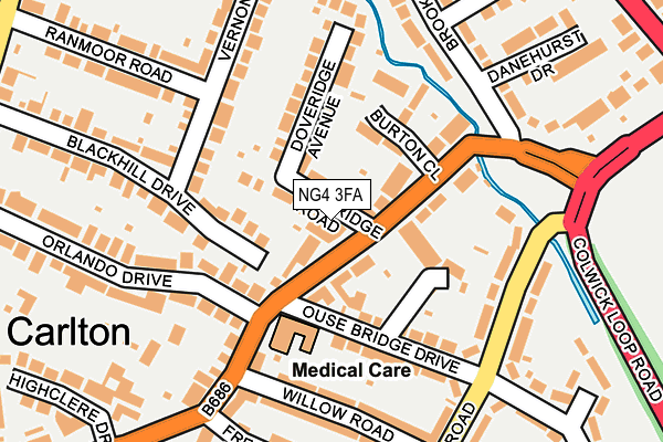
NG4 3FA is located in the Gedling electoral ward, within the local authority district of Gedling and the English Parliamentary constituency of Gedling. The Sub Integrated Care Board (ICB) Location is NHS Nottingham and Nottinghamshire ICB - 52R and the police force is Nottinghamshire. This postcode has been in use since May 2017.


GetTheData
Source: OS OpenMap – Local (Ordnance Survey)
Source: OS VectorMap District (Ordnance Survey)
Licence: Open Government Licence (requires attribution)
| Easting | 462067 |
| Northing | 341881 |
| Latitude | 52.970722 |
| Longitude | -1.077236 |
GetTheData
Source: Open Postcode Geo
Licence: Open Government Licence
| Country | England |
| Postcode District | NG4 |
➜ See where NG4 is on a map ➜ Where is Carlton? | |
GetTheData
Source: Land Registry Price Paid Data
Licence: Open Government Licence
| Ward | Gedling |
| Constituency | Gedling |
GetTheData
Source: ONS Postcode Database
Licence: Open Government Licence
| Ousebridge Drive (Burton Road) | Carlton | 64m |
| Ousebridge Drive (Burton Road) | Carlton | 78m |
| Burton Close (Burton Road) | Carlton | 96m |
| Burton Close (Burton Road) | Carlton | 107m |
| Manor Crescent (Burton Road) | Carlton | 240m |
| Carlton Station | 0.6km |
| Netherfield Station | 1km |
| Burton Joyce Station | 2.8km |
GetTheData
Source: NaPTAN
Licence: Open Government Licence
| Percentage of properties with Next Generation Access | 100.0% |
| Percentage of properties with Superfast Broadband | 100.0% |
| Percentage of properties with Ultrafast Broadband | 100.0% |
| Percentage of properties with Full Fibre Broadband | 0.0% |
Superfast Broadband is between 30Mbps and 300Mbps
Ultrafast Broadband is > 300Mbps
| Median download speed | 75.0Mbps |
| Average download speed | 75.0Mbps |
| Maximum download speed | 100.00Mbps |
Ofcom does not currently provide upload speed data for NG4 3FA. This is because there are less than four broadband connections in this postcode.
| Percentage of properties unable to receive 2Mbps | 0.0% |
| Percentage of properties unable to receive 5Mbps | 0.0% |
| Percentage of properties unable to receive 10Mbps | 0.0% |
| Percentage of properties unable to receive 30Mbps | 0.0% |
GetTheData
Source: Ofcom
Licence: Ofcom Terms of Use (requires attribution)
GetTheData
Source: ONS Postcode Database
Licence: Open Government Licence


➜ Get more ratings from the Food Standards Agency
GetTheData
Source: Food Standards Agency
Licence: FSA terms & conditions
| Last Collection | |||
|---|---|---|---|
| Location | Mon-Fri | Sat | Distance |
| Burton Road Post Office | 17:00 | 11:00 | 79m |
| Conway Road | 17:30 | 11:30 | 242m |
| Westdale Lane | 17:30 | 12:30 | 349m |
GetTheData
Source: Dracos
Licence: Creative Commons Attribution-ShareAlike
The below table lists the International Territorial Level (ITL) codes (formerly Nomenclature of Territorial Units for Statistics (NUTS) codes) and Local Administrative Units (LAU) codes for NG4 3FA:
| ITL 1 Code | Name |
|---|---|
| TLF | East Midlands (England) |
| ITL 2 Code | Name |
| TLF1 | Derbyshire and Nottinghamshire |
| ITL 3 Code | Name |
| TLF16 | South Nottinghamshire |
| LAU 1 Code | Name |
| E07000173 | Gedling |
GetTheData
Source: ONS Postcode Directory
Licence: Open Government Licence
The below table lists the Census Output Area (OA), Lower Layer Super Output Area (LSOA), and Middle Layer Super Output Area (MSOA) for NG4 3FA:
| Code | Name | |
|---|---|---|
| OA | E00143539 | |
| LSOA | E01028171 | Gedling 012D |
| MSOA | E02005876 | Gedling 012 |
GetTheData
Source: ONS Postcode Directory
Licence: Open Government Licence
| NG4 3GL | Doveridge Road | 21m |
| NG4 3GN | Burton Road | 41m |
| NG4 3GQ | Doveridge Road | 45m |
| NG4 3GP | Burton Road | 52m |
| NG4 3FQ | Blackhill Drive | 61m |
| NG4 3GS | Burton Road | 69m |
| NG4 3FR | Blackhill Drive | 70m |
| NG4 3FS | Blackhill Drive | 75m |
| NG4 3GT | Burton Close | 114m |
| NG4 3BL | Ousebridge Crescent | 119m |
GetTheData
Source: Open Postcode Geo; Land Registry Price Paid Data
Licence: Open Government Licence