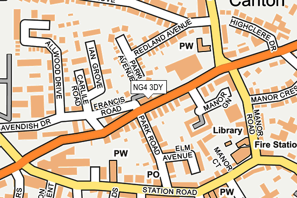
NG4 3DY is located in the Cavendish electoral ward, within the local authority district of Gedling and the English Parliamentary constituency of Gedling. The Sub Integrated Care Board (ICB) Location is NHS Nottingham and Nottinghamshire ICB - 52R and the police force is Nottinghamshire. This postcode has been in use since June 2017.


GetTheData
Source: OS OpenMap – Local (Ordnance Survey)
Source: OS VectorMap District (Ordnance Survey)
Licence: Open Government Licence (requires attribution)
| Easting | 461616 |
| Northing | 341577 |
| Latitude | 52.968042 |
| Longitude | -1.084009 |
GetTheData
Source: Open Postcode Geo
Licence: Open Government Licence
| Country | England |
| Postcode District | NG4 |
➜ See where NG4 is on a map ➜ Where is Carlton? | |
GetTheData
Source: Land Registry Price Paid Data
Licence: Open Government Licence
| Ward | Cavendish |
| Constituency | Gedling |
GetTheData
Source: ONS Postcode Database
Licence: Open Government Licence
| Manor Green Walk (Burton Road) | Carlton | 59m |
| Manor Green Walk (Burton Road) | Carlton | 102m |
| Redland Grove (Gedling Road) | Carlton | 192m |
| Redland Grove (Gedling Road) | Carlton | 193m |
| Manor Road | Carlton | 204m |
| Carlton Station | 0.5km |
| Netherfield Station | 0.8km |
| Burton Joyce Station | 3.4km |
GetTheData
Source: NaPTAN
Licence: Open Government Licence
| Percentage of properties with Next Generation Access | 100.0% |
| Percentage of properties with Superfast Broadband | 100.0% |
| Percentage of properties with Ultrafast Broadband | 100.0% |
| Percentage of properties with Full Fibre Broadband | 0.0% |
Superfast Broadband is between 30Mbps and 300Mbps
Ultrafast Broadband is > 300Mbps
| Median download speed | 100.0Mbps |
| Average download speed | 78.5Mbps |
| Maximum download speed | 100.00Mbps |
Ofcom does not currently provide upload speed data for NG4 3DY. This is because there are less than four broadband connections in this postcode.
| Percentage of properties unable to receive 2Mbps | 0.0% |
| Percentage of properties unable to receive 5Mbps | 0.0% |
| Percentage of properties unable to receive 10Mbps | 0.0% |
| Percentage of properties unable to receive 30Mbps | 0.0% |
GetTheData
Source: Ofcom
Licence: Ofcom Terms of Use (requires attribution)
GetTheData
Source: ONS Postcode Database
Licence: Open Government Licence


➜ Get more ratings from the Food Standards Agency
GetTheData
Source: Food Standards Agency
Licence: FSA terms & conditions
| Last Collection | |||
|---|---|---|---|
| Location | Mon-Fri | Sat | Distance |
| Carlton Post Office | 17:00 | 12:00 | 180m |
| Gedling Road | 17:00 | 11:15 | 207m |
| Burton Road Post Office | 17:00 | 11:00 | 472m |
GetTheData
Source: Dracos
Licence: Creative Commons Attribution-ShareAlike
The below table lists the International Territorial Level (ITL) codes (formerly Nomenclature of Territorial Units for Statistics (NUTS) codes) and Local Administrative Units (LAU) codes for NG4 3DY:
| ITL 1 Code | Name |
|---|---|
| TLF | East Midlands (England) |
| ITL 2 Code | Name |
| TLF1 | Derbyshire and Nottinghamshire |
| ITL 3 Code | Name |
| TLF16 | South Nottinghamshire |
| LAU 1 Code | Name |
| E07000173 | Gedling |
GetTheData
Source: ONS Postcode Directory
Licence: Open Government Licence
The below table lists the Census Output Area (OA), Lower Layer Super Output Area (LSOA), and Middle Layer Super Output Area (MSOA) for NG4 3DY:
| Code | Name | |
|---|---|---|
| OA | E00143739 | |
| LSOA | E01028210 | Gedling 014G |
| MSOA | E02005878 | Gedling 014 |
GetTheData
Source: ONS Postcode Directory
Licence: Open Government Licence
| NG4 3DH | Burton Road | 45m |
| NG4 3DQ | Burton Road | 55m |
| NG4 3DS | Francis Road | 69m |
| NG4 3DF | Burton Road | 76m |
| NG4 3DP | Park Avenue | 97m |
| NG4 3BW | Manor Green Walk | 103m |
| NG4 3DE | Park Road | 109m |
| NG4 3EW | Redland Avenue | 112m |
| NG4 3DW | Carlile Road | 121m |
| NG4 3EG | Ian Grove | 131m |
GetTheData
Source: Open Postcode Geo; Land Registry Price Paid Data
Licence: Open Government Licence