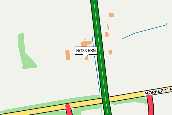
NG33 5BN is located in the Isaac Newton electoral ward, within the local authority district of South Kesteven and the English Parliamentary constituency of Grantham and Stamford. The Sub Integrated Care Board (ICB) Location is NHS Lincolnshire ICB - 71E and the police force is Lincolnshire. This postcode has been in use since March 2014.


GetTheData
Source: OS OpenMap – Local (Ordnance Survey)
Source: OS VectorMap District (Ordnance Survey)
Licence: Open Government Licence (requires attribution)
| Easting | 493782 |
| Northing | 319397 |
| Latitude | 52.764063 |
| Longitude | -0.611570 |
GetTheData
Source: Open Postcode Geo
Licence: Open Government Licence
| Country | England |
| Postcode District | NG33 |
➜ See where NG33 is on a map | |
GetTheData
Source: Land Registry Price Paid Data
Licence: Open Government Licence
Elevation or altitude of NG33 5BN as distance above sea level:
| Metres | Feet | |
|---|---|---|
| Elevation | 120m | 394ft |
Elevation is measured from the approximate centre of the postcode, to the nearest point on an OS contour line from OS Terrain 50, which has contour spacing of ten vertical metres.
➜ How high above sea level am I? Find the elevation of your current position using your device's GPS.
GetTheData
Source: Open Postcode Elevation
Licence: Open Government Licence
| Ward | Isaac Newton |
| Constituency | Grantham And Stamford |
GetTheData
Source: ONS Postcode Database
Licence: Open Government Licence
| Post Office (Water Lane) | South Witham | 1,152m |
| Demand Responsive Area | South Witham | 1,156m |
| Post Office (Water Lane) | South Witham | 1,159m |
| Cemetery (North Witham Road) | South Witham | 1,186m |
| Cemetery (North Witham Road) | South Witham | 1,188m |
GetTheData
Source: NaPTAN
Licence: Open Government Licence
GetTheData
Source: ONS Postcode Database
Licence: Open Government Licence


➜ Get more ratings from the Food Standards Agency
GetTheData
Source: Food Standards Agency
Licence: FSA terms & conditions
| Last Collection | |||
|---|---|---|---|
| Location | Mon-Fri | Sat | Distance |
| Colsterworth North End P O | 16:30 | 09:00 | 4,427m |
| Colsterworth North End | 16:30 | 07:30 | 4,861m |
| Corby Glen Birkholme | 14:45 | 07:15 | 5,203m |
GetTheData
Source: Dracos
Licence: Creative Commons Attribution-ShareAlike
The below table lists the International Territorial Level (ITL) codes (formerly Nomenclature of Territorial Units for Statistics (NUTS) codes) and Local Administrative Units (LAU) codes for NG33 5BN:
| ITL 1 Code | Name |
|---|---|
| TLF | East Midlands (England) |
| ITL 2 Code | Name |
| TLF3 | Lincolnshire |
| ITL 3 Code | Name |
| TLF30 | Lincolnshire CC |
| LAU 1 Code | Name |
| E07000141 | South Kesteven |
GetTheData
Source: ONS Postcode Directory
Licence: Open Government Licence
The below table lists the Census Output Area (OA), Lower Layer Super Output Area (LSOA), and Middle Layer Super Output Area (MSOA) for NG33 5BN:
| Code | Name | |
|---|---|---|
| OA | E00133789 | |
| LSOA | E01026339 | South Kesteven 009D |
| MSOA | E02005484 | South Kesteven 009 |
GetTheData
Source: ONS Postcode Directory
Licence: Open Government Licence
| NG33 5LN | Great North Road | 141m |
| NG33 5PZ | Occupation Road | 678m |
| NG33 5QW | Hillview Road | 1004m |
| NG33 5PL | Church Lane | 1028m |
| NG33 5PJ | Church Street | 1090m |
| NG33 5PN | North Witham Road | 1098m |
| NG33 5QA | Rutland Close | 1109m |
| NG33 5QB | High Street | 1124m |
| NG33 5PQ | Priory Court | 1144m |
| NG33 5PH | Water Lane | 1167m |
GetTheData
Source: Open Postcode Geo; Land Registry Price Paid Data
Licence: Open Government Licence