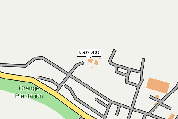
NG32 2DQ is located in the Peascliffe & Ridgeway electoral ward, within the local authority district of South Kesteven and the English Parliamentary constituency of Sleaford and North Hykeham. The Sub Integrated Care Board (ICB) Location is NHS Lincolnshire ICB - 71E and the police force is Lincolnshire. This postcode has been in use since July 2017.


GetTheData
Source: OS OpenMap – Local (Ordnance Survey)
Source: OS VectorMap District (Ordnance Survey)
Licence: Open Government Licence (requires attribution)
| Easting | 496602 |
| Northing | 340969 |
| Latitude | 52.957427 |
| Longitude | -0.563408 |
GetTheData
Source: Open Postcode Geo
Licence: Open Government Licence
| Country | England |
| Postcode District | NG32 |
➜ See where NG32 is on a map ➜ Where is Barkston Heath? | |
GetTheData
Source: Land Registry Price Paid Data
Licence: Open Government Licence
| Ward | Peascliffe & Ridgeway |
| Constituency | Sleaford And North Hykeham |
GetTheData
Source: ONS Postcode Database
Licence: Open Government Licence
| Ancaster Station | 3.9km |
GetTheData
Source: NaPTAN
Licence: Open Government Licence
GetTheData
Source: ONS Postcode Database
Licence: Open Government Licence

➜ Get more ratings from the Food Standards Agency
GetTheData
Source: Food Standards Agency
Licence: FSA terms & conditions
| Last Collection | |||
|---|---|---|---|
| Location | Mon-Fri | Sat | Distance |
| Ancaster South End | 16:00 | 07:00 | 2,943m |
| Ancaster Post Office | 15:30 | 09:00 | 3,525m |
| Syston | 16:30 | 07:30 | 3,661m |
GetTheData
Source: Dracos
Licence: Creative Commons Attribution-ShareAlike
The below table lists the International Territorial Level (ITL) codes (formerly Nomenclature of Territorial Units for Statistics (NUTS) codes) and Local Administrative Units (LAU) codes for NG32 2DQ:
| ITL 1 Code | Name |
|---|---|
| TLF | East Midlands (England) |
| ITL 2 Code | Name |
| TLF3 | Lincolnshire |
| ITL 3 Code | Name |
| TLF30 | Lincolnshire CC |
| LAU 1 Code | Name |
| E07000141 | South Kesteven |
GetTheData
Source: ONS Postcode Directory
Licence: Open Government Licence
The below table lists the Census Output Area (OA), Lower Layer Super Output Area (LSOA), and Middle Layer Super Output Area (MSOA) for NG32 2DQ:
| Code | Name | |
|---|---|---|
| OA | E00133646 | |
| LSOA | E01026313 | South Kesteven 001A |
| MSOA | E02005476 | South Kesteven 001 |
GetTheData
Source: ONS Postcode Directory
Licence: Open Government Licence
| NG32 2DA | 1076m | |
| NG32 3QD | Wilsford Heath | 1366m |
| NG32 2DB | 2317m | |
| NG32 3QA | 2533m | |
| NG32 3SN | 2567m | |
| NG32 3LN | Main Street | 2567m |
| NG32 2BU | Minnetts Hill | 2599m |
| NG32 3LT | Main Street | 2610m |
| NG32 3RT | Willoughby Road | 2764m |
| NG32 3LP | Main Street | 2781m |
GetTheData
Source: Open Postcode Geo; Land Registry Price Paid Data
Licence: Open Government Licence