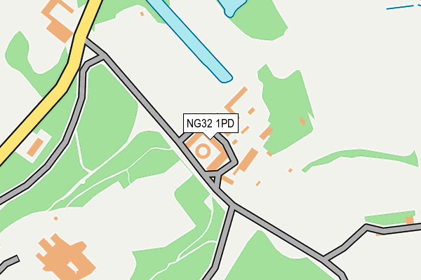
NG32 1PD is located in the Croxton Kerrial electoral ward, within the local authority district of Melton and the English Parliamentary constituency of Rutland and Melton. The Sub Integrated Care Board (ICB) Location is NHS Leicester, Leicestershire and Rutland ICB - 03W and the police force is Leicestershire. This postcode has been in use since January 1980.


GetTheData
Source: OS OpenMap – Local (Ordnance Survey)
Source: OS VectorMap District (Ordnance Survey)
Licence: Open Government Licence (requires attribution)
| Easting | 482215 |
| Northing | 333893 |
| Latitude | 52.896206 |
| Longitude | -0.779313 |
GetTheData
Source: Open Postcode Geo
Licence: Open Government Licence
| Country | England |
| Postcode District | NG32 |
➜ See where NG32 is on a map ➜ Where is Belvoir? | |
GetTheData
Source: Land Registry Price Paid Data
Licence: Open Government Licence
Elevation or altitude of NG32 1PD as distance above sea level:
| Metres | Feet | |
|---|---|---|
| Elevation | 100m | 328ft |
Elevation is measured from the approximate centre of the postcode, to the nearest point on an OS contour line from OS Terrain 50, which has contour spacing of ten vertical metres.
➜ How high above sea level am I? Find the elevation of your current position using your device's GPS.
GetTheData
Source: Open Postcode Elevation
Licence: Open Government Licence
| Ward | Croxton Kerrial |
| Constituency | Rutland And Melton |
GetTheData
Source: ONS Postcode Database
Licence: Open Government Licence
| Belvoir Castle (Cliff Road) | Belvoir | 533m |
| Cobleas (Village Street) | Woolsthorpe By Belvoir | 1,430m |
| Demand Responsive Area | Woolsthorpe By Belvoir | 1,505m |
| Worthington Lane (Village Street) | Woolsthorpe By Belvoir | 1,505m |
GetTheData
Source: NaPTAN
Licence: Open Government Licence
GetTheData
Source: ONS Postcode Database
Licence: Open Government Licence


➜ Get more ratings from the Food Standards Agency
GetTheData
Source: Food Standards Agency
Licence: FSA terms & conditions
| Last Collection | |||
|---|---|---|---|
| Location | Mon-Fri | Sat | Distance |
| Woolsthorpe Rectory | 16:30 | 10:15 | 1,455m |
| Woolsthorpe Post Office | 16:45 | 10:30 | 1,512m |
| Knipton Post Office | 16:15 | 10:00 | 2,660m |
GetTheData
Source: Dracos
Licence: Creative Commons Attribution-ShareAlike
The below table lists the International Territorial Level (ITL) codes (formerly Nomenclature of Territorial Units for Statistics (NUTS) codes) and Local Administrative Units (LAU) codes for NG32 1PD:
| ITL 1 Code | Name |
|---|---|
| TLF | East Midlands (England) |
| ITL 2 Code | Name |
| TLF2 | Leicestershire, Rutland and Northamptonshire |
| ITL 3 Code | Name |
| TLF22 | Leicestershire CC and Rutland |
| LAU 1 Code | Name |
| E07000133 | Melton |
GetTheData
Source: ONS Postcode Directory
Licence: Open Government Licence
The below table lists the Census Output Area (OA), Lower Layer Super Output Area (LSOA), and Middle Layer Super Output Area (MSOA) for NG32 1PD:
| Code | Name | |
|---|---|---|
| OA | E00131361 | |
| LSOA | E01025887 | Melton 001C |
| MSOA | E02005391 | Melton 001 |
GetTheData
Source: ONS Postcode Directory
Licence: Open Government Licence
| NG32 1NF | Rectory Lane | 1352m |
| NG32 1LX | Main Street | 1427m |
| NG32 1NQ | Belvoir Lane | 1435m |
| NG32 1LZ | Rosy Row | 1500m |
| NG32 1LT | Main Street | 1518m |
| NG32 1LY | Main Street | 1521m |
| NG32 1LU | Main Street | 1566m |
| NG32 1NH | Sedgebrook Road | 1706m |
| NG32 1NL | Hillside Road | 1735m |
| NG32 1NY | 2415m |
GetTheData
Source: Open Postcode Geo; Land Registry Price Paid Data
Licence: Open Government Licence