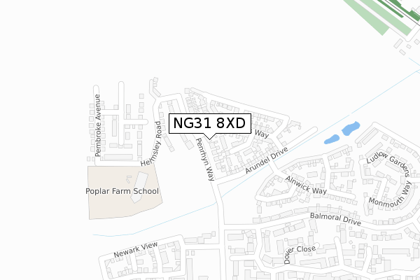
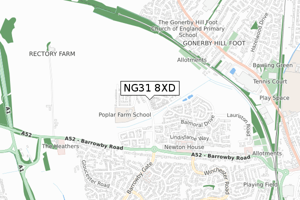
NG31 8XD is located in the Grantham Arnoldfield electoral ward, within the local authority district of South Kesteven and the English Parliamentary constituency of Grantham and Stamford. The Sub Integrated Care Board (ICB) Location is NHS Lincolnshire ICB - 71E and the police force is Lincolnshire. This postcode has been in use since May 2018.


GetTheData
Source: OS Open Zoomstack (Ordnance Survey)
Licence: Open Government Licence (requires attribution)
Attribution: Contains OS data © Crown copyright and database right 2024
Source: Open Postcode Geo
Licence: Open Government Licence (requires attribution)
Attribution: Contains OS data © Crown copyright and database right 2024; Contains Royal Mail data © Royal Mail copyright and database right 2024; Source: Office for National Statistics licensed under the Open Government Licence v.3.0
| Easting | 489934 |
| Northing | 336782 |
| Latitude | 52.920957 |
| Longitude | -0.663799 |
GetTheData
Source: Open Postcode Geo
Licence: Open Government Licence
| Country | England |
| Postcode District | NG31 |
➜ See where NG31 is on a map ➜ Where is Grantham? | |
GetTheData
Source: Land Registry Price Paid Data
Licence: Open Government Licence
| Ward | Grantham Arnoldfield |
| Constituency | Grantham And Stamford |
GetTheData
Source: ONS Postcode Database
Licence: Open Government Licence
| Muddle And Go Nowhere Ph (Barrowby Road) | Grantham | 442m |
| Muddle And Go Nowhere Ph (Barrowby Road) | Grantham | 472m |
| Newton House Nursing Home (Barrowby Road) | Grantham | 508m |
| Newton House Nursing Home (Barrowby Road) | Grantham | 532m |
| 2 Winchester Road (Winchester Road) | Grantham | 623m |
| Grantham Station | 2.2km |
GetTheData
Source: NaPTAN
Licence: Open Government Licence
| Percentage of properties with Next Generation Access | 100.0% |
| Percentage of properties with Superfast Broadband | 100.0% |
| Percentage of properties with Ultrafast Broadband | 100.0% |
| Percentage of properties with Full Fibre Broadband | 100.0% |
Superfast Broadband is between 30Mbps and 300Mbps
Ultrafast Broadband is > 300Mbps
| Percentage of properties unable to receive 2Mbps | 0.0% |
| Percentage of properties unable to receive 5Mbps | 0.0% |
| Percentage of properties unable to receive 10Mbps | 0.0% |
| Percentage of properties unable to receive 30Mbps | 0.0% |
GetTheData
Source: Ofcom
Licence: Ofcom Terms of Use (requires attribution)
GetTheData
Source: ONS Postcode Database
Licence: Open Government Licence


➜ Get more ratings from the Food Standards Agency
GetTheData
Source: Food Standards Agency
Licence: FSA terms & conditions
| Last Collection | |||
|---|---|---|---|
| Location | Mon-Fri | Sat | Distance |
| Barrowby Gate | 16:00 | 11:45 | 726m |
| Dysart Road Post Office | 17:00 | 12:00 | 1,259m |
| Asda | 16:30 | 11:30 | 1,381m |
GetTheData
Source: Dracos
Licence: Creative Commons Attribution-ShareAlike
The below table lists the International Territorial Level (ITL) codes (formerly Nomenclature of Territorial Units for Statistics (NUTS) codes) and Local Administrative Units (LAU) codes for NG31 8XD:
| ITL 1 Code | Name |
|---|---|
| TLF | East Midlands (England) |
| ITL 2 Code | Name |
| TLF3 | Lincolnshire |
| ITL 3 Code | Name |
| TLF30 | Lincolnshire CC |
| LAU 1 Code | Name |
| E07000141 | South Kesteven |
GetTheData
Source: ONS Postcode Directory
Licence: Open Government Licence
The below table lists the Census Output Area (OA), Lower Layer Super Output Area (LSOA), and Middle Layer Super Output Area (MSOA) for NG31 8XD:
| Code | Name | |
|---|---|---|
| OA | E00169420 | |
| LSOA | E01026320 | South Kesteven 004A |
| MSOA | E02005479 | South Kesteven 004 |
GetTheData
Source: ONS Postcode Directory
Licence: Open Government Licence
| NG31 8UL | Bamburgh Close | 214m |
| NG31 8UJ | Alnwick Way | 280m |
| NG31 8UN | Scarborough Close | 299m |
| NG31 8SS | Grimsthorpe Close | 300m |
| NG31 8UQ | Lewes Avenue | 313m |
| NG31 8UR | Newark View | 321m |
| NG31 8TF | Dover Close | 323m |
| NG31 8UP | Knaresborough Drive | 324m |
| NG31 8UT | St Mawes Way | 348m |
| NG31 8SY | Balmoral Drive | 371m |
GetTheData
Source: Open Postcode Geo; Land Registry Price Paid Data
Licence: Open Government Licence