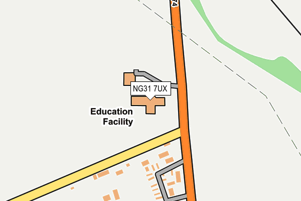
NG31 7UX is located in the Grantham Springfield electoral ward, within the local authority district of South Kesteven and the English Parliamentary constituency of Grantham and Stamford. The Sub Integrated Care Board (ICB) Location is NHS Lincolnshire ICB - 71E and the police force is Lincolnshire. This postcode has been in use since January 2004.


GetTheData
Source: OS OpenMap – Local (Ordnance Survey)
Source: OS VectorMap District (Ordnance Survey)
Licence: Open Government Licence (requires attribution)
| Easting | 491912 |
| Northing | 334075 |
| Latitude | 52.896273 |
| Longitude | -0.635158 |
GetTheData
Source: Open Postcode Geo
Licence: Open Government Licence
| Country | England |
| Postcode District | NG31 |
➜ See where NG31 is on a map ➜ Where is Grantham? | |
GetTheData
Source: Land Registry Price Paid Data
Licence: Open Government Licence
Elevation or altitude of NG31 7UX as distance above sea level:
| Metres | Feet | |
|---|---|---|
| Elevation | 100m | 328ft |
Elevation is measured from the approximate centre of the postcode, to the nearest point on an OS contour line from OS Terrain 50, which has contour spacing of ten vertical metres.
➜ How high above sea level am I? Find the elevation of your current position using your device's GPS.
GetTheData
Source: Open Postcode Elevation
Licence: Open Government Licence
| Ward | Grantham Springfield |
| Constituency | Grantham And Stamford |
GetTheData
Source: ONS Postcode Database
Licence: Open Government Licence
| Mobile Homes Park (B1174) | Grantham | 248m |
| Mobile Homes Park (B1174) | Grantham | 271m |
| 53 Walton Gardens (Walton Gardens) | Grantham | 623m |
| 10 Walton Gardens (Walton Gardens) | Grantham | 786m |
| Springfield Road (South Parade) | Grantham | 807m |
| Grantham Station | 1.2km |
GetTheData
Source: NaPTAN
Licence: Open Government Licence
GetTheData
Source: ONS Postcode Database
Licence: Open Government Licence


➜ Get more ratings from the Food Standards Agency
GetTheData
Source: Food Standards Agency
Licence: FSA terms & conditions
| Last Collection | |||
|---|---|---|---|
| Location | Mon-Fri | Sat | Distance |
| Tollemach Road | 16:00 | 11:00 | 519m |
| Houghton Road | 18:15 | 11:30 | 834m |
| Bridge End Road | 18:15 | 11:30 | 905m |
GetTheData
Source: Dracos
Licence: Creative Commons Attribution-ShareAlike
The below table lists the International Territorial Level (ITL) codes (formerly Nomenclature of Territorial Units for Statistics (NUTS) codes) and Local Administrative Units (LAU) codes for NG31 7UX:
| ITL 1 Code | Name |
|---|---|
| TLF | East Midlands (England) |
| ITL 2 Code | Name |
| TLF3 | Lincolnshire |
| ITL 3 Code | Name |
| TLF30 | Lincolnshire CC |
| LAU 1 Code | Name |
| E07000141 | South Kesteven |
GetTheData
Source: ONS Postcode Directory
Licence: Open Government Licence
The below table lists the Census Output Area (OA), Lower Layer Super Output Area (LSOA), and Middle Layer Super Output Area (MSOA) for NG31 7UX:
| Code | Name | |
|---|---|---|
| OA | E00133671 | |
| LSOA | E01026319 | South Kesteven 006C |
| MSOA | E02005481 | South Kesteven 006 |
GetTheData
Source: ONS Postcode Directory
Licence: Open Government Licence
| NG31 6HY | Albert Street | 551m |
| NG31 7BS | Stamford Street | 601m |
| NG31 6ES | Empire Court | 602m |
| NG31 6HU | Nottingham Terrace | 606m |
| NG31 7BP | Stamford Street | 615m |
| NG31 6JA | Fern Cottages | 626m |
| NG31 6HT | South Parade | 663m |
| NG31 7BN | Victoria Street | 672m |
| NG31 7BW | Victoria Street | 674m |
| NG31 6JG | Edward Street | 688m |
GetTheData
Source: Open Postcode Geo; Land Registry Price Paid Data
Licence: Open Government Licence