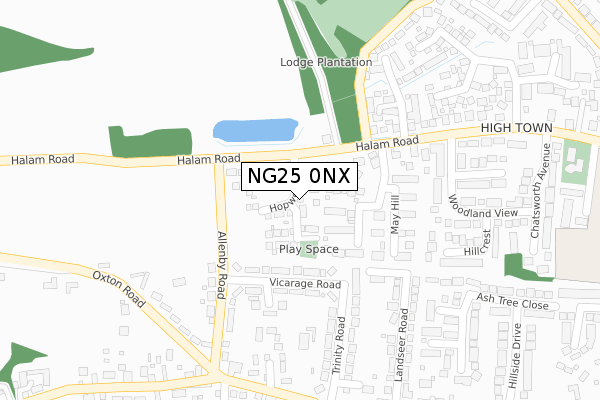
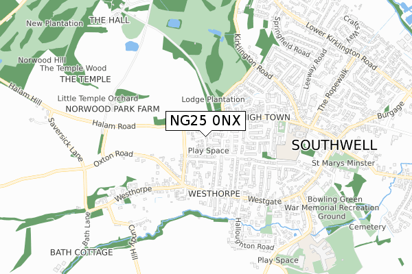
NG25 0NX is located in the Southwell electoral ward, within the local authority district of Newark and Sherwood and the English Parliamentary constituency of Newark. The Sub Integrated Care Board (ICB) Location is NHS Nottingham and Nottinghamshire ICB - 52R and the police force is Nottinghamshire. This postcode has been in use since September 2019.


GetTheData
Source: OS Open Zoomstack (Ordnance Survey)
Licence: Open Government Licence (requires attribution)
Attribution: Contains OS data © Crown copyright and database right 2025
Source: Open Postcode Geo
Licence: Open Government Licence (requires attribution)
Attribution: Contains OS data © Crown copyright and database right 2025; Contains Royal Mail data © Royal Mail copyright and database right 2025; Source: Office for National Statistics licensed under the Open Government Licence v.3.0
| Easting | 469248 |
| Northing | 353949 |
| Latitude | 53.078307 |
| Longitude | -0.967740 |
GetTheData
Source: Open Postcode Geo
Licence: Open Government Licence
| Country | England |
| Postcode District | NG25 |
➜ See where NG25 is on a map ➜ Where is Southwell? | |
GetTheData
Source: Land Registry Price Paid Data
Licence: Open Government Licence
| Ward | Southwell |
| Constituency | Newark |
GetTheData
Source: ONS Postcode Database
Licence: Open Government Licence
2024 28 AUG £750,000 |
2024 10 JUL £390,000 |
2023 4 OCT £415,000 |
2023 5 SEP £575,000 |
2023 1 AUG £540,000 |
2023 26 APR £455,000 |
2022 18 JAN £520,000 |
36, HOPEWELL RISE, SOUTHWELL, NG25 0NX 2021 19 OCT £345,000 |
34, HOPEWELL RISE, SOUTHWELL, NG25 0NX 2021 30 JUN £335,000 |
2021 30 JUN £540,000 |
GetTheData
Source: HM Land Registry Price Paid Data
Licence: Contains HM Land Registry data © Crown copyright and database right 2025. This data is licensed under the Open Government Licence v3.0.
| Vicarage Road (Allenby Road) | Southwell | 120m |
| Vicarage Road (Allenby Road) | Southwell | 127m |
| The Dumbles (Westgate) | Southwell | 288m |
| The Dumbles (Westgate) | Southwell | 308m |
| Woodland View (Halam Road) | Southwell | 369m |
| Fiskerton Station | 4.2km |
| Bleasby Station | 4.4km |
| Rolleston Station | 4.8km |
GetTheData
Source: NaPTAN
Licence: Open Government Licence
GetTheData
Source: ONS Postcode Database
Licence: Open Government Licence


➜ Get more ratings from the Food Standards Agency
GetTheData
Source: Food Standards Agency
Licence: FSA terms & conditions
| Last Collection | |||
|---|---|---|---|
| Location | Mon-Fri | Sat | Distance |
| Woodland Drive | 16:30 | 10:30 | 608m |
| Southwell Post Office | 17:15 | 11:30 | 794m |
| Burgage Gardens | 16:30 | 10:30 | 1,182m |
GetTheData
Source: Dracos
Licence: Creative Commons Attribution-ShareAlike
The below table lists the International Territorial Level (ITL) codes (formerly Nomenclature of Territorial Units for Statistics (NUTS) codes) and Local Administrative Units (LAU) codes for NG25 0NX:
| ITL 1 Code | Name |
|---|---|
| TLF | East Midlands (England) |
| ITL 2 Code | Name |
| TLF1 | Derbyshire and Nottinghamshire |
| ITL 3 Code | Name |
| TLF15 | North Nottinghamshire |
| LAU 1 Code | Name |
| E07000175 | Newark and Sherwood |
GetTheData
Source: ONS Postcode Directory
Licence: Open Government Licence
The below table lists the Census Output Area (OA), Lower Layer Super Output Area (LSOA), and Middle Layer Super Output Area (MSOA) for NG25 0NX:
| Code | Name | |
|---|---|---|
| OA | E00144450 | |
| LSOA | E01028348 | Newark and Sherwood 008D |
| MSOA | E02005900 | Newark and Sherwood 008 |
GetTheData
Source: ONS Postcode Directory
Licence: Open Government Licence
| NG25 0NN | Vicarage Road | 126m |
| NG25 0BB | Beaumont Avenue | 142m |
| NG25 0BD | The Riddings | 152m |
| NG25 0NL | Allenby Road | 169m |
| NG25 0NR | The Paddocks | 206m |
| NG25 0NW | Trinity Road | 218m |
| NG25 0BE | Mayhill | 229m |
| NG25 0NH | Oxton Road | 230m |
| NG25 0NP | Trinity Road | 232m |
| NG25 0NB | Westhorpe | 237m |
GetTheData
Source: Open Postcode Geo; Land Registry Price Paid Data
Licence: Open Government Licence