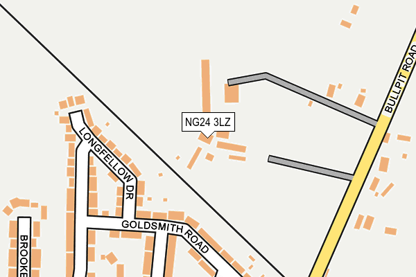
NG24 3LZ is located in the Balderton North & Coddington electoral ward, within the local authority district of Newark and Sherwood and the English Parliamentary constituency of Newark. The Sub Integrated Care Board (ICB) Location is NHS Nottingham and Nottinghamshire ICB - 52R and the police force is Nottinghamshire. This postcode has been in use since January 1980.


GetTheData
Source: OS OpenMap – Local (Ordnance Survey)
Source: OS VectorMap District (Ordnance Survey)
Licence: Open Government Licence (requires attribution)
| Easting | 482080 |
| Northing | 352469 |
| Latitude | 53.063192 |
| Longitude | -0.776610 |
GetTheData
Source: Open Postcode Geo
Licence: Open Government Licence
| Country | England |
| Postcode District | NG24 |
➜ See where NG24 is on a map ➜ Where is Balderton? | |
GetTheData
Source: Land Registry Price Paid Data
Licence: Open Government Licence
Elevation or altitude of NG24 3LZ as distance above sea level:
| Metres | Feet | |
|---|---|---|
| Elevation | 20m | 66ft |
Elevation is measured from the approximate centre of the postcode, to the nearest point on an OS contour line from OS Terrain 50, which has contour spacing of ten vertical metres.
➜ How high above sea level am I? Find the elevation of your current position using your device's GPS.
GetTheData
Source: Open Postcode Elevation
Licence: Open Government Licence
| Ward | Balderton North & Coddington |
| Constituency | Newark |
GetTheData
Source: ONS Postcode Database
Licence: Open Government Licence
| Wordsworth Drive | Balderton | 453m |
| Wordsworth Drive | Balderton | 461m |
| Tenzing Walk (Wolfit Avenue) | Balderton | 492m |
| Tenzing Walk (Wolfit Avenue) | Balderton | 508m |
| Bullpit Road | Balderton | 548m |
| Newark North Gate Station | 2.6km |
| Newark Castle Station | 3.1km |
GetTheData
Source: NaPTAN
Licence: Open Government Licence
GetTheData
Source: ONS Postcode Database
Licence: Open Government Licence


➜ Get more ratings from the Food Standards Agency
GetTheData
Source: Food Standards Agency
Licence: FSA terms & conditions
| Last Collection | |||
|---|---|---|---|
| Location | Mon-Fri | Sat | Distance |
| Macauley Drive | 16:00 | 11:00 | 335m |
| East End | 16:00 | 11:00 | 905m |
| Balderton Post Office | 16:45 | 11:15 | 928m |
GetTheData
Source: Dracos
Licence: Creative Commons Attribution-ShareAlike
The below table lists the International Territorial Level (ITL) codes (formerly Nomenclature of Territorial Units for Statistics (NUTS) codes) and Local Administrative Units (LAU) codes for NG24 3LZ:
| ITL 1 Code | Name |
|---|---|
| TLF | East Midlands (England) |
| ITL 2 Code | Name |
| TLF1 | Derbyshire and Nottinghamshire |
| ITL 3 Code | Name |
| TLF15 | North Nottinghamshire |
| LAU 1 Code | Name |
| E07000175 | Newark and Sherwood |
GetTheData
Source: ONS Postcode Directory
Licence: Open Government Licence
The below table lists the Census Output Area (OA), Lower Layer Super Output Area (LSOA), and Middle Layer Super Output Area (MSOA) for NG24 3LZ:
| Code | Name | |
|---|---|---|
| OA | E00144118 | |
| LSOA | E01028286 | Newark and Sherwood 011B |
| MSOA | E02005903 | Newark and Sherwood 011 |
GetTheData
Source: ONS Postcode Directory
Licence: Open Government Licence
| NG24 3QP | Longfellow Drive | 142m |
| NG24 3QR | Goldsmith Road | 183m |
| NG24 3QW | Macaulay Close | 241m |
| NG24 3NA | Bullpit Road | 258m |
| NG24 3NE | Barnby Road | 267m |
| NG24 3QU | Browning Road | 283m |
| NG24 3QS | Coleridge Road | 292m |
| NG24 3QT | Dryden Avenue | 304m |
| NG24 3QN | Brooke Close | 309m |
| NG24 3QJ | Macaulay Drive | 318m |
GetTheData
Source: Open Postcode Geo; Land Registry Price Paid Data
Licence: Open Government Licence