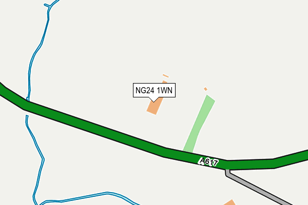
NG24 1WN is located in the Castle electoral ward, within the local authority district of Newark and Sherwood and the English Parliamentary constituency of Newark. The Sub Integrated Care Board (ICB) Location is NHS Nottingham and Nottinghamshire ICB - 52R and the police force is Nottinghamshire. This postcode has been in use since February 2004.


GetTheData
Source: OS OpenMap – Local (Ordnance Survey)
Source: OS VectorMap District (Ordnance Survey)
Licence: Open Government Licence (requires attribution)
| Easting | 478660 |
| Northing | 354661 |
| Latitude | 53.083385 |
| Longitude | -0.827101 |
GetTheData
Source: Open Postcode Geo
Licence: Open Government Licence
| Country | England |
| Postcode District | NG24 |
➜ See where NG24 is on a map | |
GetTheData
Source: Land Registry Price Paid Data
Licence: Open Government Licence
Elevation or altitude of NG24 1WN as distance above sea level:
| Metres | Feet | |
|---|---|---|
| Elevation | 10m | 33ft |
Elevation is measured from the approximate centre of the postcode, to the nearest point on an OS contour line from OS Terrain 50, which has contour spacing of ten vertical metres.
➜ How high above sea level am I? Find the elevation of your current position using your device's GPS.
GetTheData
Source: Open Postcode Elevation
Licence: Open Government Licence
| Ward | Castle |
| Constituency | Newark |
GetTheData
Source: ONS Postcode Database
Licence: Open Government Licence
| Rugby Ground (Kelham Road) | Newark | 139m |
| Rugby Ground (Kelham Road) | Newark | 146m |
| Newark Castle Railway Station (Great North Road) | Newark | 919m |
| Newark Castle Railway Station (Great North Road) | Newark | 943m |
| Smeatons Lakes (Great North Road) | Newark | 1,053m |
| Newark Castle Station | 1km |
| Newark North Gate Station | 1.8km |
| Rolleston Station | 5.3km |
GetTheData
Source: NaPTAN
Licence: Open Government Licence
GetTheData
Source: ONS Postcode Database
Licence: Open Government Licence


➜ Get more ratings from the Food Standards Agency
GetTheData
Source: Food Standards Agency
Licence: FSA terms & conditions
| Last Collection | |||
|---|---|---|---|
| Location | Mon-Fri | Sat | Distance |
| Castlegate Station | 18:30 | 11:30 | 989m |
| Castlegate | 18:30 | 11:30 | 1,214m |
| Castle Gate | 18:30 | 1,247m | |
GetTheData
Source: Dracos
Licence: Creative Commons Attribution-ShareAlike
| Risk of NG24 1WN flooding from rivers and sea | High |
| ➜ NG24 1WN flood map | |
GetTheData
Source: Open Flood Risk by Postcode
Licence: Open Government Licence
The below table lists the International Territorial Level (ITL) codes (formerly Nomenclature of Territorial Units for Statistics (NUTS) codes) and Local Administrative Units (LAU) codes for NG24 1WN:
| ITL 1 Code | Name |
|---|---|
| TLF | East Midlands (England) |
| ITL 2 Code | Name |
| TLF1 | Derbyshire and Nottinghamshire |
| ITL 3 Code | Name |
| TLF15 | North Nottinghamshire |
| LAU 1 Code | Name |
| E07000175 | Newark and Sherwood |
GetTheData
Source: ONS Postcode Directory
Licence: Open Government Licence
The below table lists the Census Output Area (OA), Lower Layer Super Output Area (LSOA), and Middle Layer Super Output Area (MSOA) for NG24 1WN:
| Code | Name | |
|---|---|---|
| OA | E00144234 | |
| LSOA | E01028311 | Newark and Sherwood 007G |
| MSOA | E02005899 | Newark and Sherwood 007 |
GetTheData
Source: ONS Postcode Directory
Licence: Open Government Licence
| NG24 1FH | Sandhills Close | 629m |
| NG24 1DF | Cullen Close | 630m |
| NG24 1DW | Kelham Lane | 651m |
| NG24 1DG | Sandhills Park | 683m |
| NG24 1BX | Kelham Road | 696m |
| NG24 1BZ | Tolney Lane | 757m |
| NG24 1BU | Kelham Road | 781m |
| NG24 1DA | Tolney Lane | 907m |
| NG24 1BT | Midland Terrace | 922m |
| NG24 1BL | Great North Road | 994m |
GetTheData
Source: Open Postcode Geo; Land Registry Price Paid Data
Licence: Open Government Licence