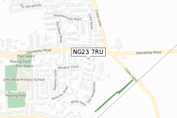
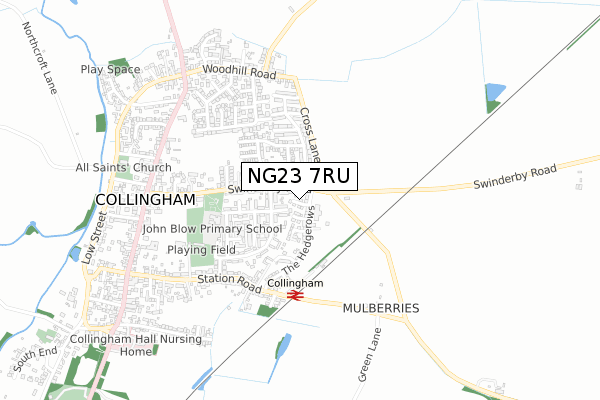
NG23 7RU is located in the Collingham electoral ward, within the local authority district of Newark and Sherwood and the English Parliamentary constituency of Newark. The Sub Integrated Care Board (ICB) Location is NHS Nottingham and Nottinghamshire ICB - 52R and the police force is Nottinghamshire. This postcode has been in use since December 2018.


GetTheData
Source: OS Open Zoomstack (Ordnance Survey)
Licence: Open Government Licence (requires attribution)
Attribution: Contains OS data © Crown copyright and database right 2025
Source: Open Postcode Geo
Licence: Open Government Licence (requires attribution)
Attribution: Contains OS data © Crown copyright and database right 2025; Contains Royal Mail data © Royal Mail copyright and database right 2025; Source: Office for National Statistics licensed under the Open Government Licence v.3.0
| Easting | 483710 |
| Northing | 361886 |
| Latitude | 53.147570 |
| Longitude | -0.749842 |
GetTheData
Source: Open Postcode Geo
Licence: Open Government Licence
| Country | England |
| Postcode District | NG23 |
➜ See where NG23 is on a map ➜ Where is Collingham? | |
GetTheData
Source: Land Registry Price Paid Data
Licence: Open Government Licence
| Ward | Collingham |
| Constituency | Newark |
GetTheData
Source: ONS Postcode Database
Licence: Open Government Licence
2022 25 MAR £320,000 |
1, PASTURE GROVE, COLLINGHAM, NEWARK, NG23 7RU 2019 10 APR £274,995 |
2018 20 DEC £272,995 |
GetTheData
Source: HM Land Registry Price Paid Data
Licence: Contains HM Land Registry data © Crown copyright and database right 2025. This data is licensed under the Open Government Licence v3.0.
| Braemer Road | Collingham | 116m |
| Braemer Road | Collingham | 126m |
| Barnfield Road (Swinderby Road) | Collingham | 159m |
| William Bailey House (Windsor Close) | Collingham | 222m |
| William Bailey House (Windsor Close) | Collingham | 223m |
| Collingham Station | 0.4km |
| Swinderby Station | 4km |
GetTheData
Source: NaPTAN
Licence: Open Government Licence
| Percentage of properties with Next Generation Access | 100.0% |
| Percentage of properties with Superfast Broadband | 100.0% |
| Percentage of properties with Ultrafast Broadband | 100.0% |
| Percentage of properties with Full Fibre Broadband | 100.0% |
Superfast Broadband is between 30Mbps and 300Mbps
Ultrafast Broadband is > 300Mbps
| Percentage of properties unable to receive 2Mbps | 0.0% |
| Percentage of properties unable to receive 5Mbps | 0.0% |
| Percentage of properties unable to receive 10Mbps | 0.0% |
| Percentage of properties unable to receive 30Mbps | 0.0% |
GetTheData
Source: Ofcom
Licence: Ofcom Terms of Use (requires attribution)
GetTheData
Source: ONS Postcode Database
Licence: Open Government Licence


➜ Get more ratings from the Food Standards Agency
GetTheData
Source: Food Standards Agency
Licence: FSA terms & conditions
| Last Collection | |||
|---|---|---|---|
| Location | Mon-Fri | Sat | Distance |
| Swinderby Road | 16:45 | 10:30 | 158m |
| Thornton Road | 16:45 | 10:30 | 467m |
| Collingham North End | 16:45 | 10:30 | 649m |
GetTheData
Source: Dracos
Licence: Creative Commons Attribution-ShareAlike
The below table lists the International Territorial Level (ITL) codes (formerly Nomenclature of Territorial Units for Statistics (NUTS) codes) and Local Administrative Units (LAU) codes for NG23 7RU:
| ITL 1 Code | Name |
|---|---|
| TLF | East Midlands (England) |
| ITL 2 Code | Name |
| TLF1 | Derbyshire and Nottinghamshire |
| ITL 3 Code | Name |
| TLF15 | North Nottinghamshire |
| LAU 1 Code | Name |
| E07000175 | Newark and Sherwood |
GetTheData
Source: ONS Postcode Directory
Licence: Open Government Licence
The below table lists the Census Output Area (OA), Lower Layer Super Output Area (LSOA), and Middle Layer Super Output Area (MSOA) for NG23 7RU:
| Code | Name | |
|---|---|---|
| OA | E00144272 | |
| LSOA | E01028316 | Newark and Sherwood 004B |
| MSOA | E02005896 | Newark and Sherwood 004 |
GetTheData
Source: ONS Postcode Directory
Licence: Open Government Licence
| NG23 7PB | Swinderby Road | 79m |
| NG23 7PP | Windsor Close | 80m |
| NG23 7SS | Pocklington Road | 123m |
| NG23 7NX | Swinderby Road | 145m |
| NG23 7SL | Fisher Close | 171m |
| NG23 7SR | Blackbourn Close | 187m |
| NG23 7ST | Crew Road | 203m |
| NG23 7SN | Barnfield Road | 207m |
| NG23 7PW | Braemer Road | 221m |
| NG23 7PN | Braemer Road | 228m |
GetTheData
Source: Open Postcode Geo; Land Registry Price Paid Data
Licence: Open Government Licence