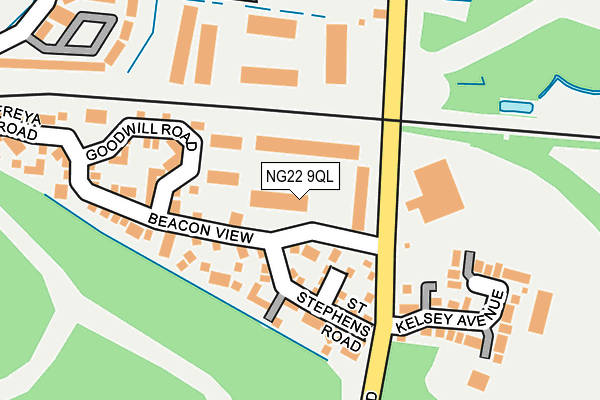
NG22 9QL is located in the Ollerton electoral ward, within the local authority district of Newark and Sherwood and the English Parliamentary constituency of Sherwood. The Sub Integrated Care Board (ICB) Location is NHS Nottingham and Nottinghamshire ICB - 52R and the police force is Nottinghamshire. This postcode has been in use since December 1995.


GetTheData
Source: OS OpenMap – Local (Ordnance Survey)
Source: OS VectorMap District (Ordnance Survey)
Licence: Open Government Licence (requires attribution)
| Easting | 466642 |
| Northing | 367198 |
| Latitude | 53.197695 |
| Longitude | -1.003889 |
GetTheData
Source: Open Postcode Geo
Licence: Open Government Licence
| Country | England |
| Postcode District | NG22 |
➜ See where NG22 is on a map ➜ Where is New Ollerton? | |
GetTheData
Source: Land Registry Price Paid Data
Licence: Open Government Licence
Elevation or altitude of NG22 9QL as distance above sea level:
| Metres | Feet | |
|---|---|---|
| Elevation | 50m | 164ft |
Elevation is measured from the approximate centre of the postcode, to the nearest point on an OS contour line from OS Terrain 50, which has contour spacing of ten vertical metres.
➜ How high above sea level am I? Find the elevation of your current position using your device's GPS.
GetTheData
Source: Open Postcode Elevation
Licence: Open Government Licence
| Ward | Ollerton |
| Constituency | Sherwood |
GetTheData
Source: ONS Postcode Database
Licence: Open Government Licence
| The Circle (Eddison Rise) | Ollerton | 322m |
| Poplar Street (Newark Road) | Ollerton | 367m |
| Pine Avenue (Whinney Lane) | Ollerton | 568m |
| Rufford Avenue | Ollerton | 661m |
| Briar Road | Ollerton | 792m |
GetTheData
Source: NaPTAN
Licence: Open Government Licence
| Median download speed | 80.0Mbps |
| Average download speed | 51.8Mbps |
| Maximum download speed | 80.00Mbps |
| Median upload speed | 20.0Mbps |
| Average upload speed | 12.2Mbps |
| Maximum upload speed | 20.00Mbps |
GetTheData
Source: Ofcom
Licence: Ofcom Terms of Use (requires attribution)
GetTheData
Source: ONS Postcode Database
Licence: Open Government Licence


➜ Get more ratings from the Food Standards Agency
GetTheData
Source: Food Standards Agency
Licence: FSA terms & conditions
| Last Collection | |||
|---|---|---|---|
| Location | Mon-Fri | Sat | Distance |
| New Ollerton Post Office | 16:45 | 11:30 | 751m |
| Wellow Road | 16:45 | 09:30 | 821m |
| Boughton | 16:00 | 10:00 | 911m |
GetTheData
Source: Dracos
Licence: Creative Commons Attribution-ShareAlike
The below table lists the International Territorial Level (ITL) codes (formerly Nomenclature of Territorial Units for Statistics (NUTS) codes) and Local Administrative Units (LAU) codes for NG22 9QL:
| ITL 1 Code | Name |
|---|---|
| TLF | East Midlands (England) |
| ITL 2 Code | Name |
| TLF1 | Derbyshire and Nottinghamshire |
| ITL 3 Code | Name |
| TLF15 | North Nottinghamshire |
| LAU 1 Code | Name |
| E07000175 | Newark and Sherwood |
GetTheData
Source: ONS Postcode Directory
Licence: Open Government Licence
The below table lists the Census Output Area (OA), Lower Layer Super Output Area (LSOA), and Middle Layer Super Output Area (MSOA) for NG22 9QL:
| Code | Name | |
|---|---|---|
| OA | E00173437 | |
| LSOA | E01028341 | Newark and Sherwood 001F |
| MSOA | E02005893 | Newark and Sherwood 001 |
GetTheData
Source: ONS Postcode Directory
Licence: Open Government Licence
| NG22 9WG | Merry Road | 77m |
| NG22 9WF | St Stephens Road | 121m |
| NG22 9WE | Beacon View | 126m |
| NG22 9WL | Goodwill Road | 128m |
| NG22 9UH | Newark Road | 140m |
| NG22 9TB | Kelsey Avenue | 195m |
| NG22 9WN | Freya Road | 295m |
| NG22 9GA | Culpepper Avenue | 306m |
| NG22 9GB | Lavender Close | 351m |
| NG22 9PY | Poplar Street | 417m |
GetTheData
Source: Open Postcode Geo; Land Registry Price Paid Data
Licence: Open Government Licence