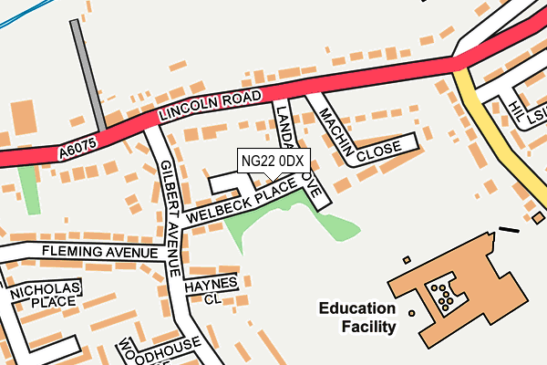
NG22 0DX is located in the Tuxford and Trent electoral ward, within the local authority district of Bassetlaw and the English Parliamentary constituency of Newark. The Sub Integrated Care Board (ICB) Location is NHS Nottingham and Nottinghamshire ICB - 02Q and the police force is Nottinghamshire. This postcode has been in use since April 2017.


GetTheData
Source: OS OpenMap – Local (Ordnance Survey)
Source: OS VectorMap District (Ordnance Survey)
Licence: Open Government Licence (requires attribution)
| Easting | 474374 |
| Northing | 371204 |
| Latitude | 53.232695 |
| Longitude | -0.887236 |
GetTheData
Source: Open Postcode Geo
Licence: Open Government Licence
| Country | England |
| Postcode District | NG22 |
➜ See where NG22 is on a map ➜ Where is Tuxford? | |
GetTheData
Source: Land Registry Price Paid Data
Licence: Open Government Licence
| Ward | Tuxford And Trent |
| Constituency | Newark |
GetTheData
Source: ONS Postcode Database
Licence: Open Government Licence
| Gilbert Avenue (Lincoln Road) | Tuxford | 83m |
| Gilbert Avenue (Lincoln Road) | Tuxford | 90m |
| Marnham Road (Lincoln Road) | Tuxford | 178m |
| Marnham Road (Lincoln Road) | Tuxford | 196m |
| Nicholas Place (Faraday Avenue) | Tuxford | 292m |
GetTheData
Source: NaPTAN
Licence: Open Government Licence
| Median download speed | 22.6Mbps |
| Average download speed | 39.5Mbps |
| Maximum download speed | 80.00Mbps |
| Median upload speed | 1.3Mbps |
| Average upload speed | 7.8Mbps |
| Maximum upload speed | 20.00Mbps |
GetTheData
Source: Ofcom
Licence: Ofcom Terms of Use (requires attribution)
GetTheData
Source: ONS Postcode Database
Licence: Open Government Licence


➜ Get more ratings from the Food Standards Agency
GetTheData
Source: Food Standards Agency
Licence: FSA terms & conditions
| Last Collection | |||
|---|---|---|---|
| Location | Mon-Fri | Sat | Distance |
| Darlton Road | 16:00 | 08:30 | 526m |
| Stone Road End | 16:45 | 11:30 | 2,371m |
| West Markham | 16:00 | 10:30 | 2,502m |
GetTheData
Source: Dracos
Licence: Creative Commons Attribution-ShareAlike
The below table lists the International Territorial Level (ITL) codes (formerly Nomenclature of Territorial Units for Statistics (NUTS) codes) and Local Administrative Units (LAU) codes for NG22 0DX:
| ITL 1 Code | Name |
|---|---|
| TLF | East Midlands (England) |
| ITL 2 Code | Name |
| TLF1 | Derbyshire and Nottinghamshire |
| ITL 3 Code | Name |
| TLF15 | North Nottinghamshire |
| LAU 1 Code | Name |
| E07000171 | Bassetlaw |
GetTheData
Source: ONS Postcode Directory
Licence: Open Government Licence
The below table lists the Census Output Area (OA), Lower Layer Super Output Area (LSOA), and Middle Layer Super Output Area (MSOA) for NG22 0DX:
| Code | Name | |
|---|---|---|
| OA | E00142871 | |
| LSOA | E01028037 | Bassetlaw 015D |
| MSOA | E02005849 | Bassetlaw 015 |
GetTheData
Source: ONS Postcode Directory
Licence: Open Government Licence
| NG22 0HS | Lincoln Road | 47m |
| NG22 0JF | Welbeck Place | 73m |
| NG22 0JG | Landa Grove | 73m |
| NG22 0JB | Gilbert Avenue | 103m |
| NG22 0JQ | Lincoln Road | 134m |
| NG22 0JA | Haynes Close | 149m |
| NG22 0JZ | Machin Close | 157m |
| NG22 0HZ | Fleming Avenue | 204m |
| NG22 0HX | Woodhouse Place | 217m |
| NG22 0JE | Capps Place | 226m |
GetTheData
Source: Open Postcode Geo; Land Registry Price Paid Data
Licence: Open Government Licence