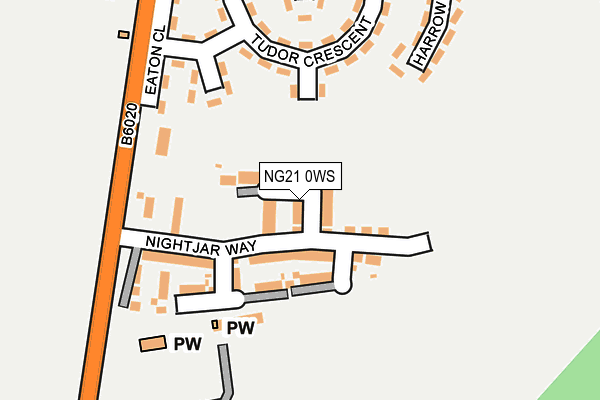
NG21 0WS is located in the Rainworth South & Blidworth electoral ward, within the local authority district of Newark and Sherwood and the English Parliamentary constituency of Sherwood. The Sub Integrated Care Board (ICB) Location is NHS Nottingham and Nottinghamshire ICB - 52R and the police force is Nottinghamshire. This postcode has been in use since June 2017.


GetTheData
Source: OS OpenMap – Local (Ordnance Survey)
Source: OS VectorMap District (Ordnance Survey)
Licence: Open Government Licence (requires attribution)
| Easting | 459133 |
| Northing | 357549 |
| Latitude | 53.111876 |
| Longitude | -1.118052 |
GetTheData
Source: Open Postcode Geo
Licence: Open Government Licence
| Country | England |
| Postcode District | NG21 |
➜ See where NG21 is on a map ➜ Where is Rainworth? | |
GetTheData
Source: Land Registry Price Paid Data
Licence: Open Government Licence
| Ward | Rainworth South & Blidworth |
| Constituency | Sherwood |
GetTheData
Source: ONS Postcode Database
Licence: Open Government Licence
2021 31 AUG £238,000 |
2021 14 JUL £210,500 |
4, GOLDCREST AVENUE, RAINWORTH, MANSFIELD, NG21 0WS 2017 20 DEC £182,000 |
2, GOLDCREST AVENUE, RAINWORTH, MANSFIELD, NG21 0WS 2017 27 OCT £182,000 |
3, GOLDCREST AVENUE, RAINWORTH, MANSFIELD, NG21 0WS 2017 16 OCT £182,000 |
1, GOLDCREST AVENUE, RAINWORTH, MANSFIELD, NG21 0WS 2017 30 JUN £182,000 |
30, GOLDCREST AVENUE, RAINWORTH, MANSFIELD, NG21 0WS 2017 30 JUN £182,000 |
2017 29 JUN £194,000 |
2017 28 JUN £180,000 |
5, GOLDCREST AVENUE, RAINWORTH, MANSFIELD, NG21 0WS 2017 16 JUN £192,000 |
GetTheData
Source: HM Land Registry Price Paid Data
Licence: Contains HM Land Registry data © Crown copyright and database right 2024. This data is licensed under the Open Government Licence v3.0.
| Joseph Whitaker School (Warsop Lane) | Rainworth | 216m |
| Joseph Whitaker School Bus Park (Warsop Lane) | Rainworth | 251m |
| Joseph Whitaker School (Warsop Lane) | Rainworth | 261m |
| St Georges Church (Warsop Lane) | Rainworth | 265m |
| Oxford Close (Preston Road) | Rainworth | 268m |
GetTheData
Source: NaPTAN
Licence: Open Government Licence
| Percentage of properties with Next Generation Access | 100.0% |
| Percentage of properties with Superfast Broadband | 100.0% |
| Percentage of properties with Ultrafast Broadband | 80.0% |
| Percentage of properties with Full Fibre Broadband | 0.0% |
Superfast Broadband is between 30Mbps and 300Mbps
Ultrafast Broadband is > 300Mbps
| Median download speed | 75.6Mbps |
| Average download speed | 93.2Mbps |
| Maximum download speed | 350.00Mbps |
| Median upload speed | 10.0Mbps |
| Average upload speed | 11.2Mbps |
| Maximum upload speed | 19.39Mbps |
| Percentage of properties unable to receive 2Mbps | 0.0% |
| Percentage of properties unable to receive 5Mbps | 0.0% |
| Percentage of properties unable to receive 10Mbps | 0.0% |
| Percentage of properties unable to receive 30Mbps | 0.0% |
GetTheData
Source: Ofcom
Licence: Ofcom Terms of Use (requires attribution)
GetTheData
Source: ONS Postcode Database
Licence: Open Government Licence


➜ Get more ratings from the Food Standards Agency
GetTheData
Source: Food Standards Agency
Licence: FSA terms & conditions
| Last Collection | |||
|---|---|---|---|
| Location | Mon-Fri | Sat | Distance |
| Preston Road | 16:45 | 08:30 | 263m |
| Cambridge Road | 16:45 | 08:30 | 565m |
| Water Road | 17:00 | 09:30 | 701m |
GetTheData
Source: Dracos
Licence: Creative Commons Attribution-ShareAlike
The below table lists the International Territorial Level (ITL) codes (formerly Nomenclature of Territorial Units for Statistics (NUTS) codes) and Local Administrative Units (LAU) codes for NG21 0WS:
| ITL 1 Code | Name |
|---|---|
| TLF | East Midlands (England) |
| ITL 2 Code | Name |
| TLF1 | Derbyshire and Nottinghamshire |
| ITL 3 Code | Name |
| TLF15 | North Nottinghamshire |
| LAU 1 Code | Name |
| E07000175 | Newark and Sherwood |
GetTheData
Source: ONS Postcode Directory
Licence: Open Government Licence
The below table lists the Census Output Area (OA), Lower Layer Super Output Area (LSOA), and Middle Layer Super Output Area (MSOA) for NG21 0WS:
| Code | Name | |
|---|---|---|
| OA | E00144425 | |
| LSOA | E01028343 | Newark and Sherwood 006F |
| MSOA | E02005898 | Newark and Sherwood 006 |
GetTheData
Source: ONS Postcode Directory
Licence: Open Government Licence
| NG21 0AP | Rochester Road | 112m |
| NG21 0AW | Tudor Crescent | 154m |
| NG21 0AR | Eaton Close | 166m |
| NG21 0AS | Harrow Close | 204m |
| NG21 0AQ | Preston Road | 230m |
| NG21 0AG | Warsop Lane | 310m |
| NG21 0BA | Preston Road | 323m |
| NG21 0AZ | Oxford Close | 355m |
| NG21 0AT | Rugby Road | 361m |
| NG21 0EY | Woodpecker Drive | 425m |
GetTheData
Source: Open Postcode Geo; Land Registry Price Paid Data
Licence: Open Government Licence