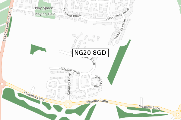
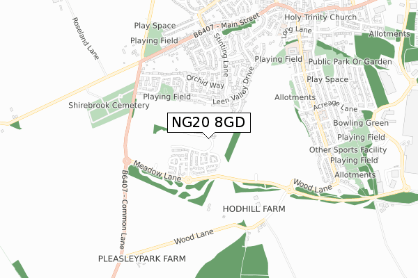
NG20 8GD is located in the Shirebrook South electoral ward, within the local authority district of Bolsover and the English Parliamentary constituency of Bolsover. The Sub Integrated Care Board (ICB) Location is NHS Derby and Derbyshire ICB - 15M and the police force is Derbyshire. This postcode has been in use since January 2020.


GetTheData
Source: OS Open Zoomstack (Ordnance Survey)
Licence: Open Government Licence (requires attribution)
Attribution: Contains OS data © Crown copyright and database right 2024
Source: Open Postcode Geo
Licence: Open Government Licence (requires attribution)
Attribution: Contains OS data © Crown copyright and database right 2024; Contains Royal Mail data © Royal Mail copyright and database right 2024; Source: Office for National Statistics licensed under the Open Government Licence v.3.0
| Easting | 451671 |
| Northing | 366811 |
| Latitude | 53.195897 |
| Longitude | -1.228026 |
GetTheData
Source: Open Postcode Geo
Licence: Open Government Licence
| Country | England |
| Postcode District | NG20 |
➜ See where NG20 is on a map ➜ Where is Shirebrook? | |
GetTheData
Source: Land Registry Price Paid Data
Licence: Open Government Licence
| Ward | Shirebrook South |
| Constituency | Bolsover |
GetTheData
Source: ONS Postcode Database
Licence: Open Government Licence
45, ASTER ROAD, SHIREBROOK, MANSFIELD, NG20 8GD 2023 28 JUL £210,000 |
43, ASTER ROAD, SHIREBROOK, MANSFIELD, NG20 8GD 2023 12 MAY £175,000 |
39, ASTER ROAD, SHIREBROOK, MANSFIELD, NG20 8GD 2023 28 APR £223,500 |
37, ASTER ROAD, SHIREBROOK, MANSFIELD, NG20 8GD 2023 31 MAR £218,500 |
65, ASTER ROAD, SHIREBROOK, MANSFIELD, NG20 8GD 2023 31 JAN £261,900 |
59, ASTER ROAD, SHIREBROOK, MANSFIELD, NG20 8GD 2023 30 JAN £261,900 |
67, ASTER ROAD, SHIREBROOK, MANSFIELD, NG20 8GD 2023 27 JAN £261,900 |
61, ASTER ROAD, SHIREBROOK, MANSFIELD, NG20 8GD 2022 16 DEC £220,995 |
63, ASTER ROAD, SHIREBROOK, MANSFIELD, NG20 8GD 2022 16 DEC £220,995 |
53, ASTER ROAD, SHIREBROOK, MANSFIELD, NG20 8GD 2022 28 NOV £217,995 |
GetTheData
Source: HM Land Registry Price Paid Data
Licence: Contains HM Land Registry data © Crown copyright and database right 2024. This data is licensed under the Open Government Licence v3.0.
| Bracken Road | Shirebrook | 201m |
| Orchid Way | Shirebrook | 311m |
| Newbarn Close (Leen Valley Drive) | Shirebrook | 357m |
| Cemetery (B6407) | Shirebrook | 385m |
| Cemetery (B6407) | Shirebrook | 409m |
| Shirebrook Station | 1.9km |
| Mansfield Woodhouse Station | 4km |
| Langwith - Whaley Thorns Station | 4.2km |
GetTheData
Source: NaPTAN
Licence: Open Government Licence
GetTheData
Source: ONS Postcode Database
Licence: Open Government Licence


➜ Get more ratings from the Food Standards Agency
GetTheData
Source: Food Standards Agency
Licence: FSA terms & conditions
| Last Collection | |||
|---|---|---|---|
| Location | Mon-Fri | Sat | Distance |
| Stinting Lane | 16:00 | 11:00 | 317m |
| Warren Terrace | 17:00 | 09:15 | 518m |
| Model Village Ex-post Office | 17:00 | 11:00 | 769m |
GetTheData
Source: Dracos
Licence: Creative Commons Attribution-ShareAlike
The below table lists the International Territorial Level (ITL) codes (formerly Nomenclature of Territorial Units for Statistics (NUTS) codes) and Local Administrative Units (LAU) codes for NG20 8GD:
| ITL 1 Code | Name |
|---|---|
| TLF | East Midlands (England) |
| ITL 2 Code | Name |
| TLF1 | Derbyshire and Nottinghamshire |
| ITL 3 Code | Name |
| TLF12 | East Derbyshire |
| LAU 1 Code | Name |
| E07000033 | Bolsover |
GetTheData
Source: ONS Postcode Directory
Licence: Open Government Licence
The below table lists the Census Output Area (OA), Lower Layer Super Output Area (LSOA), and Middle Layer Super Output Area (MSOA) for NG20 8GD:
| Code | Name | |
|---|---|---|
| OA | E00170735 | |
| LSOA | E01019512 | Bolsover 006D |
| MSOA | E02004050 | Bolsover 006 |
GetTheData
Source: ONS Postcode Directory
Licence: Open Government Licence
| NG20 8FD | Sunflower Close | 219m |
| NG20 8EZ | Primula Close | 251m |
| NG20 8FB | Bracken Road | 253m |
| NG20 8ET | Violet Close | 285m |
| NG20 8EX | Campion Close | 289m |
| NG20 8FE | Lavender Close | 294m |
| NG20 8ES | Orchid Way | 298m |
| NG20 8AT | Newbarn Close | 304m |
| NG20 8FH | Bracken Road | 342m |
| NG20 8FF | Lupin Close | 355m |
GetTheData
Source: Open Postcode Geo; Land Registry Price Paid Data
Licence: Open Government Licence