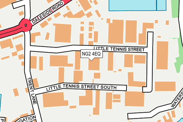
NG2 4EQ lies on Trent South Industrial Park in Nottingham. NG2 4EQ is located in the Dales electoral ward, within the unitary authority of Nottingham and the English Parliamentary constituency of Nottingham East. The Sub Integrated Care Board (ICB) Location is NHS Nottingham and Nottinghamshire ICB - 52R and the police force is Nottinghamshire. This postcode has been in use since June 1981.


GetTheData
Source: OS OpenMap – Local (Ordnance Survey)
Source: OS VectorMap District (Ordnance Survey)
Licence: Open Government Licence (requires attribution)
| Easting | 459219 |
| Northing | 339065 |
| Latitude | 52.945713 |
| Longitude | -1.120156 |
GetTheData
Source: Open Postcode Geo
Licence: Open Government Licence
| Street | Trent South Industrial Park |
| Town/City | Nottingham |
| Country | England |
| Postcode District | NG2 |
➜ See where NG2 is on a map ➜ Where is Nottingham? | |
GetTheData
Source: Land Registry Price Paid Data
Licence: Open Government Licence
Elevation or altitude of NG2 4EQ as distance above sea level:
| Metres | Feet | |
|---|---|---|
| Elevation | 30m | 98ft |
Elevation is measured from the approximate centre of the postcode, to the nearest point on an OS contour line from OS Terrain 50, which has contour spacing of ten vertical metres.
➜ How high above sea level am I? Find the elevation of your current position using your device's GPS.
GetTheData
Source: Open Postcode Elevation
Licence: Open Government Licence
| Ward | Dales |
| Constituency | Nottingham East |
GetTheData
Source: ONS Postcode Database
Licence: Open Government Licence
| Virgin Media (Daleside Road) | Sneinton | 210m |
| Virgin Media (Daleside Road) | Sneinton | 284m |
| Trent Lane (Daleside Road) | Meadow Lane Industrial Estate | 299m |
| Trent Lane (Daleside Road) | Meadow Lane Industrial Estate | 307m |
| Racecourse Road (Daleside Road) | Sneinton | 366m |
| Nottingham Station | 1.8km |
| Netherfield Station | 3.2km |
| Carlton Station | 3.5km |
GetTheData
Source: NaPTAN
Licence: Open Government Licence
| Median download speed | 76.8Mbps |
| Average download speed | 53.6Mbps |
| Maximum download speed | 80.00Mbps |
| Median upload speed | 20.0Mbps |
| Average upload speed | 13.5Mbps |
| Maximum upload speed | 20.00Mbps |
GetTheData
Source: Ofcom
Licence: Ofcom Terms of Use (requires attribution)
Estimated total energy consumption in NG2 4EQ by fuel type, 2015.
| Consumption (kWh) | 78,596 |
|---|---|
| Meter count | 11 |
| Mean (kWh/meter) | 7,145 |
| Median (kWh/meter) | 1 |
GetTheData
Source: Postcode level gas estimates: 2015 (experimental)
Source: Postcode level electricity estimates: 2015 (experimental)
Licence: Open Government Licence
GetTheData
Source: ONS Postcode Database
Licence: Open Government Licence


➜ Get more ratings from the Food Standards Agency
GetTheData
Source: Food Standards Agency
Licence: FSA terms & conditions
| Last Collection | |||
|---|---|---|---|
| Location | Mon-Fri | Sat | Distance |
| Trent Lane | 17:00 | 11:30 | 198m |
| Kentwood Road | 17:00 | 11:00 | 551m |
| Thoresby Avenue | 18:45 | 11:00 | 635m |
GetTheData
Source: Dracos
Licence: Creative Commons Attribution-ShareAlike
| Risk of NG2 4EQ flooding from rivers and sea | Low |
| ➜ NG2 4EQ flood map | |
GetTheData
Source: Open Flood Risk by Postcode
Licence: Open Government Licence
The below table lists the International Territorial Level (ITL) codes (formerly Nomenclature of Territorial Units for Statistics (NUTS) codes) and Local Administrative Units (LAU) codes for NG2 4EQ:
| ITL 1 Code | Name |
|---|---|
| TLF | East Midlands (England) |
| ITL 2 Code | Name |
| TLF1 | Derbyshire and Nottinghamshire |
| ITL 3 Code | Name |
| TLF14 | Nottingham |
| LAU 1 Code | Name |
| E06000018 | Nottingham |
GetTheData
Source: ONS Postcode Directory
Licence: Open Government Licence
The below table lists the Census Output Area (OA), Lower Layer Super Output Area (LSOA), and Middle Layer Super Output Area (MSOA) for NG2 4EQ:
| Code | Name | |
|---|---|---|
| OA | E00173466 | |
| LSOA | E01013920 | Nottingham 029C |
| MSOA | E02002896 | Nottingham 029 |
GetTheData
Source: ONS Postcode Directory
Licence: Open Government Licence
| NG2 4EL | Little Tennis Street | 62m |
| NG2 4EU | Little Tennis Street South | 68m |
| NG2 4EW | Tennis Court Industrial Estate | 87m |
| NG2 4DS | Trent Lane | 192m |
| NG2 4RE | Waterside Way | 242m |
| NG2 4RH | Waterside Way | 242m |
| NG2 4AS | Whittier Road | 421m |
| NG2 4DF | Trent Lane | 447m |
| NG2 4AR | Kingsley Road | 457m |
| NG2 4DD | Hutton Street | 465m |
GetTheData
Source: Open Postcode Geo; Land Registry Price Paid Data
Licence: Open Government Licence