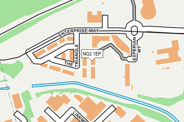
NG2 1EP is located in the Meadows electoral ward, within the unitary authority of Nottingham and the English Parliamentary constituency of Nottingham South. The Sub Integrated Care Board (ICB) Location is NHS Nottingham and Nottinghamshire ICB - 52R and the police force is Nottinghamshire. This postcode has been in use since March 2007.


GetTheData
Source: OS OpenMap – Local (Ordnance Survey)
Source: OS VectorMap District (Ordnance Survey)
Licence: Open Government Licence (requires attribution)
| Easting | 456315 |
| Northing | 338455 |
| Latitude | 52.940562 |
| Longitude | -1.163471 |
GetTheData
Source: Open Postcode Geo
Licence: Open Government Licence
| Country | England |
| Postcode District | NG2 |
➜ See where NG2 is on a map ➜ Where is Nottingham? | |
GetTheData
Source: Land Registry Price Paid Data
Licence: Open Government Licence
Elevation or altitude of NG2 1EP as distance above sea level:
| Metres | Feet | |
|---|---|---|
| Elevation | 30m | 98ft |
Elevation is measured from the approximate centre of the postcode, to the nearest point on an OS contour line from OS Terrain 50, which has contour spacing of ten vertical metres.
➜ How high above sea level am I? Find the elevation of your current position using your device's GPS.
GetTheData
Source: Open Postcode Elevation
Licence: Open Government Licence
| Ward | Meadows |
| Constituency | Nottingham South |
GetTheData
Source: ONS Postcode Database
Licence: Open Government Licence
| Ng2 Business Park (Queens Drive) | Meadows | 220m |
| Ng2 Business Park (Queens Drive) | Queens Drive | 245m |
| Ainsworth Drive (Meadows Way) | Meadows | 248m |
| Ainsworth Drive (Meadows Way) | Meadows | 258m |
| Risley Drive (Meadows Way) | Meadows | 259m |
| Ng2 Tram Stop (Enterprise Way) | Lenton Lane Industrial Estate | 186m |
| Meadows Way West Tram Stop (Meadows Way) | Meadows | 554m |
| Meadows Embankment Tram Stop (Queens Walk) | Meadows | 678m |
| Wilford Village Tram Stop (Main Road) | Wilford | 750m |
| Queens Walk Tram Stop (Queens Walk) | Meadows | 913m |
| Nottingham Station | 1.4km |
| Beeston Station | 3.7km |
| Attenborough Station | 6km |
GetTheData
Source: NaPTAN
Licence: Open Government Licence
GetTheData
Source: ONS Postcode Database
Licence: Open Government Licence


➜ Get more ratings from the Food Standards Agency
GetTheData
Source: Food Standards Agency
Licence: FSA terms & conditions
| Last Collection | |||
|---|---|---|---|
| Location | Mon-Fri | Sat | Distance |
| Cross Gate Drive | 18:30 | 11:30 | 315m |
| Crossgate Drive | 317m | ||
| Castle Marina Business Park | 18:30 | 470m | |
GetTheData
Source: Dracos
Licence: Creative Commons Attribution-ShareAlike
| Risk of NG2 1EP flooding from rivers and sea | Low |
| ➜ NG2 1EP flood map | |
GetTheData
Source: Open Flood Risk by Postcode
Licence: Open Government Licence
The below table lists the International Territorial Level (ITL) codes (formerly Nomenclature of Territorial Units for Statistics (NUTS) codes) and Local Administrative Units (LAU) codes for NG2 1EP:
| ITL 1 Code | Name |
|---|---|
| TLF | East Midlands (England) |
| ITL 2 Code | Name |
| TLF1 | Derbyshire and Nottinghamshire |
| ITL 3 Code | Name |
| TLF14 | Nottingham |
| LAU 1 Code | Name |
| E06000018 | Nottingham |
GetTheData
Source: ONS Postcode Directory
Licence: Open Government Licence
The below table lists the Census Output Area (OA), Lower Layer Super Output Area (LSOA), and Middle Layer Super Output Area (MSOA) for NG2 1EP:
| Code | Name | |
|---|---|---|
| OA | E00069977 | |
| LSOA | E01013870 | Nottingham 040A |
| MSOA | E02006905 | Nottingham 040 |
GetTheData
Source: ONS Postcode Directory
Licence: Open Government Licence
| NG2 1AE | The Triangle | 216m |
| NG2 1PA | Anmer Close | 265m |
| NG2 1PE | Castleton Close | 292m |
| NG2 1PW | Crammond Close | 306m |
| NG2 1PL | Royston Close | 311m |
| NG2 1PG | Hatley Close | 349m |
| NG2 1PQ | Hope Close | 371m |
| NG2 1QF | Saffron Gardens | 397m |
| NG2 1GF | Hawthorn Close | 401m |
| NG2 1PB | Bosworth Walk | 423m |
GetTheData
Source: Open Postcode Geo; Land Registry Price Paid Data
Licence: Open Government Licence