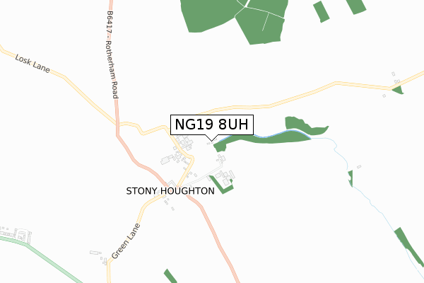
NG19 8UH is located in the Ault Hucknall electoral ward, within the local authority district of Bolsover and the English Parliamentary constituency of Bolsover. The Sub Integrated Care Board (ICB) Location is NHS Derby and Derbyshire ICB - 15M and the police force is Derbyshire. This postcode has been in use since July 2019.


GetTheData
Source: OS Open Zoomstack (Ordnance Survey)
Licence: Open Government Licence (requires attribution)
Attribution: Contains OS data © Crown copyright and database right 2025
Source: Open Postcode Geo
Licence: Open Government Licence (requires attribution)
Attribution: Contains OS data © Crown copyright and database right 2025; Contains Royal Mail data © Royal Mail copyright and database right 2025; Source: Office for National Statistics licensed under the Open Government Licence v.3.0
| Easting | 449552 |
| Northing | 366542 |
| Latitude | 53.193681 |
| Longitude | -1.259782 |
GetTheData
Source: Open Postcode Geo
Licence: Open Government Licence
| Country | England |
| Postcode District | NG19 |
➜ See where NG19 is on a map ➜ Where is Stony Houghton? | |
GetTheData
Source: Land Registry Price Paid Data
Licence: Open Government Licence
| Ward | Ault Hucknall |
| Constituency | Bolsover |
GetTheData
Source: ONS Postcode Database
Licence: Open Government Licence
| Rotherham Road | Stony Houghton | 323m |
| Rotherham Road | Stony Houghton | 383m |
| Recreation Road (Rotherham Road) | New Houghton | 995m |
| Recreation Road (Rotherham Road) | New Houghton | 1,023m |
| Church View (Recreation Road) | New Houghton | 1,092m |
| Shirebrook Station | 4km |
| Mansfield Woodhouse Station | 5.1km |
| Langwith - Whaley Thorns Station | 5.4km |
GetTheData
Source: NaPTAN
Licence: Open Government Licence
GetTheData
Source: ONS Postcode Database
Licence: Open Government Licence


➜ Get more ratings from the Food Standards Agency
GetTheData
Source: Food Standards Agency
Licence: FSA terms & conditions
| Last Collection | |||
|---|---|---|---|
| Location | Mon-Fri | Sat | Distance |
| Stoney Houghton | 16:30 | 10:00 | 251m |
| New Houghton Post Office | 16:45 | 10:45 | 1,512m |
| Glapwell Post Office | 16:00 | 10:30 | 1,673m |
GetTheData
Source: Dracos
Licence: Creative Commons Attribution-ShareAlike
The below table lists the International Territorial Level (ITL) codes (formerly Nomenclature of Territorial Units for Statistics (NUTS) codes) and Local Administrative Units (LAU) codes for NG19 8UH:
| ITL 1 Code | Name |
|---|---|
| TLF | East Midlands (England) |
| ITL 2 Code | Name |
| TLF1 | Derbyshire and Nottinghamshire |
| ITL 3 Code | Name |
| TLF12 | East Derbyshire |
| LAU 1 Code | Name |
| E07000033 | Bolsover |
GetTheData
Source: ONS Postcode Directory
Licence: Open Government Licence
The below table lists the Census Output Area (OA), Lower Layer Super Output Area (LSOA), and Middle Layer Super Output Area (MSOA) for NG19 8UH:
| Code | Name | |
|---|---|---|
| OA | E00098637 | |
| LSOA | E01019503 | Bolsover 007A |
| MSOA | E02004051 | Bolsover 007 |
GetTheData
Source: ONS Postcode Directory
Licence: Open Government Licence
| NG19 8TR | 423m | |
| NG19 8TS | Rockley Cottages | 427m |
| NG19 8TT | Pavilion Gardens | 982m |
| NG19 8TE | Rotherham Road | 1016m |
| NG19 8TJ | Crompton Street | 1103m |
| NG19 8TW | Church View | 1133m |
| NG19 8TL | Recreation Road | 1142m |
| NG19 8TD | Rotherham Road | 1170m |
| NG19 8TH | Verney Street | 1187m |
| NG19 8BY | Bek Close | 1200m |
GetTheData
Source: Open Postcode Geo; Land Registry Price Paid Data
Licence: Open Government Licence