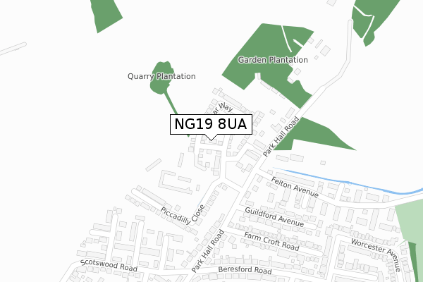
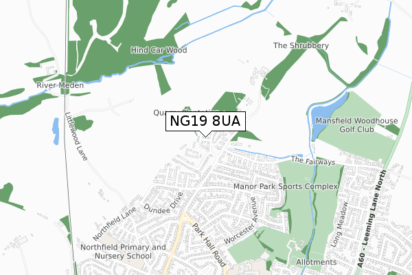
NG19 8UA is located in the Park Hall electoral ward, within the local authority district of Mansfield and the English Parliamentary constituency of Mansfield. The Sub Integrated Care Board (ICB) Location is NHS Nottingham and Nottinghamshire ICB - 52R and the police force is Nottinghamshire. This postcode has been in use since March 2018.


GetTheData
Source: OS Open Zoomstack (Ordnance Survey)
Licence: Open Government Licence (requires attribution)
Attribution: Contains OS data © Crown copyright and database right 2024
Source: Open Postcode Geo
Licence: Open Government Licence (requires attribution)
Attribution: Contains OS data © Crown copyright and database right 2024; Contains Royal Mail data © Royal Mail copyright and database right 2024; Source: Office for National Statistics licensed under the Open Government Licence v.3.0
| Easting | 454129 |
| Northing | 364989 |
| Latitude | 53.179277 |
| Longitude | -1.191545 |
GetTheData
Source: Open Postcode Geo
Licence: Open Government Licence
| Country | England |
| Postcode District | NG19 |
➜ See where NG19 is on a map ➜ Where is Mansfield Woodhouse? | |
GetTheData
Source: Land Registry Price Paid Data
Licence: Open Government Licence
| Ward | Park Hall |
| Constituency | Mansfield |
GetTheData
Source: ONS Postcode Database
Licence: Open Government Licence
2021 30 SEP £240,000 |
8, VINE WALK, MANSFIELD WOODHOUSE, MANSFIELD, NG19 8UA 2019 26 JUN £215,995 |
5, VINE WALK, MANSFIELD WOODHOUSE, MANSFIELD, NG19 8UA 2019 25 JUN £215,995 |
3, VINE WALK, MANSFIELD WOODHOUSE, MANSFIELD, NG19 8UA 2019 30 MAY £286,995 |
6, VINE WALK, MANSFIELD WOODHOUSE, MANSFIELD, NG19 8UA 2019 30 MAY £214,995 |
4, VINE WALK, MANSFIELD WOODHOUSE, MANSFIELD, NG19 8UA 2019 17 MAY £213,995 |
2, VINE WALK, MANSFIELD WOODHOUSE, MANSFIELD, NG19 8UA 2018 24 AUG £261,995 |
2018 22 FEB £207,995 |
➜ Mansfield Woodhouse house prices
GetTheData
Source: HM Land Registry Price Paid Data
Licence: Contains HM Land Registry data © Crown copyright and database right 2024. This data is licensed under the Open Government Licence v3.0.
| Beresford Road | Mansfield Woodhouse | 297m |
| Stranraer Close (Scotswood Road) | Mansfield Woodhouse | 319m |
| Baker Road (Beresford Road) | Mansfield Woodhouse | 406m |
| Beech Tree Avenue | Mansfield Woodhouse | 511m |
| Dundee Drive | Mansfield Woodhouse | 511m |
| Mansfield Woodhouse Station | 1.9km |
| Shirebrook Station | 2.9km |
| Mansfield Station | 4.2km |
GetTheData
Source: NaPTAN
Licence: Open Government Licence
| Percentage of properties with Next Generation Access | 100.0% |
| Percentage of properties with Superfast Broadband | 100.0% |
| Percentage of properties with Ultrafast Broadband | 100.0% |
| Percentage of properties with Full Fibre Broadband | 0.0% |
Superfast Broadband is between 30Mbps and 300Mbps
Ultrafast Broadband is > 300Mbps
| Percentage of properties unable to receive 2Mbps | 0.0% |
| Percentage of properties unable to receive 5Mbps | 0.0% |
| Percentage of properties unable to receive 10Mbps | 0.0% |
| Percentage of properties unable to receive 30Mbps | 0.0% |
GetTheData
Source: Ofcom
Licence: Ofcom Terms of Use (requires attribution)
GetTheData
Source: ONS Postcode Database
Licence: Open Government Licence


➜ Get more ratings from the Food Standards Agency
GetTheData
Source: Food Standards Agency
Licence: FSA terms & conditions
| Last Collection | |||
|---|---|---|---|
| Location | Mon-Fri | Sat | Distance |
| Park Hall Road | 17:30 | 11:00 | 417m |
| Mill Lane | 18:30 | 11:00 | 1,711m |
| Sookholme | 16:15 | 08:00 | 1,935m |
GetTheData
Source: Dracos
Licence: Creative Commons Attribution-ShareAlike
The below table lists the International Territorial Level (ITL) codes (formerly Nomenclature of Territorial Units for Statistics (NUTS) codes) and Local Administrative Units (LAU) codes for NG19 8UA:
| ITL 1 Code | Name |
|---|---|
| TLF | East Midlands (England) |
| ITL 2 Code | Name |
| TLF1 | Derbyshire and Nottinghamshire |
| ITL 3 Code | Name |
| TLF15 | North Nottinghamshire |
| LAU 1 Code | Name |
| E07000174 | Mansfield |
GetTheData
Source: ONS Postcode Directory
Licence: Open Government Licence
The below table lists the Census Output Area (OA), Lower Layer Super Output Area (LSOA), and Middle Layer Super Output Area (MSOA) for NG19 8UA:
| Code | Name | |
|---|---|---|
| OA | E00144084 | |
| LSOA | E01028277 | Mansfield 003D |
| MSOA | E02005882 | Mansfield 003 |
GetTheData
Source: ONS Postcode Directory
Licence: Open Government Licence
| NG19 8QX | Park Hall Road | 130m |
| NG19 8UD | Exford Court | 221m |
| NG19 8UE | Purbeck Close | 244m |
| NG19 8QU | Farm Croft Road | 269m |
| NG19 8PP | Stranraer Close | 276m |
| NG19 8RB | Guildford Avenue | 276m |
| NG19 8UB | Felton Avenue | 282m |
| NG19 8QS | Park Hall Road | 285m |
| NG19 8PL | Eastleigh Drive | 296m |
| NG19 8QT | Farm Croft Road | 306m |
GetTheData
Source: Open Postcode Geo; Land Registry Price Paid Data
Licence: Open Government Licence