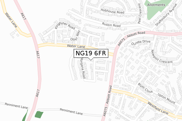
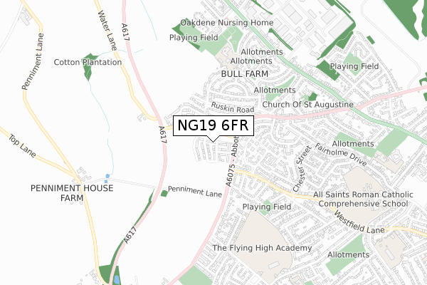
NG19 6FR is located in the Pleasley electoral ward, within the local authority district of Mansfield and the English Parliamentary constituency of Mansfield. The Sub Integrated Care Board (ICB) Location is NHS Nottingham and Nottinghamshire ICB - 52R and the police force is Nottinghamshire. This postcode has been in use since June 2019.


GetTheData
Source: OS Open Zoomstack (Ordnance Survey)
Licence: Open Government Licence (requires attribution)
Attribution: Contains OS data © Crown copyright and database right 2024
Source: Open Postcode Geo
Licence: Open Government Licence (requires attribution)
Attribution: Contains OS data © Crown copyright and database right 2024; Contains Royal Mail data © Royal Mail copyright and database right 2024; Source: Office for National Statistics licensed under the Open Government Licence v.3.0
| Easting | 451627 |
| Northing | 362285 |
| Latitude | 53.155222 |
| Longitude | -1.229413 |
GetTheData
Source: Open Postcode Geo
Licence: Open Government Licence
| Country | England |
| Postcode District | NG19 |
➜ See where NG19 is on a map ➜ Where is Mansfield? | |
GetTheData
Source: Land Registry Price Paid Data
Licence: Open Government Licence
| Ward | Pleasley |
| Constituency | Mansfield |
GetTheData
Source: ONS Postcode Database
Licence: Open Government Licence
2, KNIGHTS ROAD, MANSFIELD, NG19 6FR 2022 24 JUN £204,995 |
30, KNIGHTS ROAD, MANSFIELD, NG19 6FR 2020 28 FEB £225,995 |
28, KNIGHTS ROAD, MANSFIELD, NG19 6FR 2020 28 FEB £225,995 |
26, KNIGHTS ROAD, MANSFIELD, NG19 6FR 2020 28 FEB £219,995 |
32, KNIGHTS ROAD, MANSFIELD, NG19 6FR 2020 28 FEB £235,995 |
24, KNIGHTS ROAD, MANSFIELD, NG19 6FR 2020 28 FEB £229,995 |
22, KNIGHTS ROAD, MANSFIELD, NG19 6FR 2020 5 FEB £196,995 |
20, KNIGHTS ROAD, MANSFIELD, NG19 6FR 2019 19 DEC £221,000 |
10, KNIGHTS ROAD, MANSFIELD, NG19 6FR 2019 28 OCT £220,000 |
8, KNIGHTS ROAD, MANSFIELD, NG19 6FR 2019 25 OCT £195,000 |
GetTheData
Source: HM Land Registry Price Paid Data
Licence: Contains HM Land Registry data © Crown copyright and database right 2024. This data is licensed under the Open Government Licence v3.0.
| Water Lane (Abbott Road) | Mansfield | 129m |
| Water Lane (Abbott Road) | Mansfield | 144m |
| Peel Crescent | Bull Farm | 283m |
| Collingham Road (Westfield Lane) | Mansfield | 303m |
| Ruskin Road | Bull Farm | 329m |
| Mansfield Woodhouse Station | 2.1km |
| Mansfield Station | 2.5km |
| Sutton Parkway Station | 4.7km |
GetTheData
Source: NaPTAN
Licence: Open Government Licence
| Percentage of properties with Next Generation Access | 100.0% |
| Percentage of properties with Superfast Broadband | 100.0% |
| Percentage of properties with Ultrafast Broadband | 0.0% |
| Percentage of properties with Full Fibre Broadband | 0.0% |
Superfast Broadband is between 30Mbps and 300Mbps
Ultrafast Broadband is > 300Mbps
| Percentage of properties unable to receive 2Mbps | 0.0% |
| Percentage of properties unable to receive 5Mbps | 0.0% |
| Percentage of properties unable to receive 10Mbps | 0.0% |
| Percentage of properties unable to receive 30Mbps | 0.0% |
GetTheData
Source: Ofcom
Licence: Ofcom Terms of Use (requires attribution)
GetTheData
Source: ONS Postcode Database
Licence: Open Government Licence


➜ Get more ratings from the Food Standards Agency
GetTheData
Source: Food Standards Agency
Licence: FSA terms & conditions
| Last Collection | |||
|---|---|---|---|
| Location | Mon-Fri | Sat | Distance |
| Beck Lane | 17:30 | 11:00 | 1,308m |
| West Bank Avenue | 19:00 | 11:00 | 2,058m |
| Moor Lane | 17:30 | 11:00 | 2,074m |
GetTheData
Source: Dracos
Licence: Creative Commons Attribution-ShareAlike
The below table lists the International Territorial Level (ITL) codes (formerly Nomenclature of Territorial Units for Statistics (NUTS) codes) and Local Administrative Units (LAU) codes for NG19 6FR:
| ITL 1 Code | Name |
|---|---|
| TLF | East Midlands (England) |
| ITL 2 Code | Name |
| TLF1 | Derbyshire and Nottinghamshire |
| ITL 3 Code | Name |
| TLF15 | North Nottinghamshire |
| LAU 1 Code | Name |
| E07000174 | Mansfield |
GetTheData
Source: ONS Postcode Directory
Licence: Open Government Licence
The below table lists the Census Output Area (OA), Lower Layer Super Output Area (LSOA), and Middle Layer Super Output Area (MSOA) for NG19 6FR:
| Code | Name | |
|---|---|---|
| OA | E00144015 | |
| LSOA | E01028267 | Mansfield 006E |
| MSOA | E02005885 | Mansfield 006 |
GetTheData
Source: ONS Postcode Directory
Licence: Open Government Licence
| NG19 6DH | Otter Way | 152m |
| NG19 6EG | Kingfisher Road | 155m |
| NG19 6NX | Saundby Avenue | 185m |
| NG19 7LZ | Ruskin Road | 193m |
| NG19 6NS | Drayton Avenue | 238m |
| NG19 7NA | Ruskin Road | 248m |
| NG19 7LX | Ruskin Road | 249m |
| NG19 6DF | Abbott Road | 253m |
| NG19 6HN | Abbott Road | 272m |
| NG19 6NT | Dalestorth Avenue | 281m |
GetTheData
Source: Open Postcode Geo; Land Registry Price Paid Data
Licence: Open Government Licence