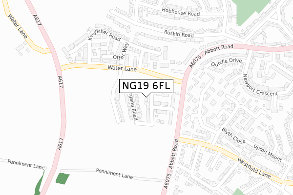
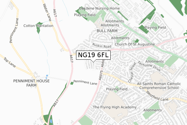
NG19 6FL is located in the Pleasley electoral ward, within the local authority district of Mansfield and the English Parliamentary constituency of Mansfield. The Sub Integrated Care Board (ICB) Location is NHS Nottingham and Nottinghamshire ICB - 52R and the police force is Nottinghamshire. This postcode has been in use since April 2020.


GetTheData
Source: OS Open Zoomstack (Ordnance Survey)
Licence: Open Government Licence (requires attribution)
Attribution: Contains OS data © Crown copyright and database right 2025
Source: Open Postcode Geo
Licence: Open Government Licence (requires attribution)
Attribution: Contains OS data © Crown copyright and database right 2025; Contains Royal Mail data © Royal Mail copyright and database right 2025; Source: Office for National Statistics licensed under the Open Government Licence v.3.0
| Easting | 451666 |
| Northing | 362217 |
| Latitude | 53.154607 |
| Longitude | -1.228841 |
GetTheData
Source: Open Postcode Geo
Licence: Open Government Licence
| Country | England |
| Postcode District | NG19 |
➜ See where NG19 is on a map ➜ Where is Mansfield? | |
GetTheData
Source: Land Registry Price Paid Data
Licence: Open Government Licence
| Ward | Pleasley |
| Constituency | Mansfield |
GetTheData
Source: ONS Postcode Database
Licence: Open Government Licence
2024 18 OCT £268,000 |
2023 30 OCT £190,000 |
30, EXCALIBUR WALK, MANSFIELD, NG19 6FL 2020 25 SEP £199,995 |
18, EXCALIBUR WALK, MANSFIELD, NG19 6FL 2020 21 AUG £225,995 |
25, EXCALIBUR WALK, MANSFIELD, NG19 6FL 2020 7 AUG £232,995 |
4, EXCALIBUR WALK, MANSFIELD, NG19 6FL 2020 31 JUL £218,995 |
6, EXCALIBUR WALK, MANSFIELD, NG19 6FL 2020 31 JUL £181,995 |
23, EXCALIBUR WALK, MANSFIELD, NG19 6FL 2020 31 JUL £218,995 |
26, EXCALIBUR WALK, MANSFIELD, NG19 6FL 2020 31 JUL £218,995 |
28, EXCALIBUR WALK, MANSFIELD, NG19 6FL 2020 31 JUL £199,995 |
GetTheData
Source: HM Land Registry Price Paid Data
Licence: Contains HM Land Registry data © Crown copyright and database right 2025. This data is licensed under the Open Government Licence v3.0.
| Water Lane (Abbott Road) | Mansfield | 91m |
| Water Lane (Abbott Road) | Mansfield | 94m |
| Collingham Road (Westfield Lane) | Mansfield | 231m |
| Collingham Road (Westfield Lane) | Mansfield | 273m |
| Ruskin Road | Bull Farm | 346m |
| Mansfield Woodhouse Station | 2.1km |
| Mansfield Station | 2.5km |
| Sutton Parkway Station | 4.6km |
GetTheData
Source: NaPTAN
Licence: Open Government Licence
GetTheData
Source: ONS Postcode Database
Licence: Open Government Licence


➜ Get more ratings from the Food Standards Agency
GetTheData
Source: Food Standards Agency
Licence: FSA terms & conditions
| Last Collection | |||
|---|---|---|---|
| Location | Mon-Fri | Sat | Distance |
| Beck Lane | 17:30 | 11:00 | 1,278m |
| Moor Lane | 17:30 | 11:00 | 1,996m |
| West Bank Avenue | 19:00 | 11:00 | 2,012m |
GetTheData
Source: Dracos
Licence: Creative Commons Attribution-ShareAlike
The below table lists the International Territorial Level (ITL) codes (formerly Nomenclature of Territorial Units for Statistics (NUTS) codes) and Local Administrative Units (LAU) codes for NG19 6FL:
| ITL 1 Code | Name |
|---|---|
| TLF | East Midlands (England) |
| ITL 2 Code | Name |
| TLF1 | Derbyshire and Nottinghamshire |
| ITL 3 Code | Name |
| TLF15 | North Nottinghamshire |
| LAU 1 Code | Name |
| E07000174 | Mansfield |
GetTheData
Source: ONS Postcode Directory
Licence: Open Government Licence
The below table lists the Census Output Area (OA), Lower Layer Super Output Area (LSOA), and Middle Layer Super Output Area (MSOA) for NG19 6FL:
| Code | Name | |
|---|---|---|
| OA | E00144015 | |
| LSOA | E01028267 | Mansfield 006E |
| MSOA | E02005885 | Mansfield 006 |
GetTheData
Source: ONS Postcode Directory
Licence: Open Government Licence
| NG19 6NX | Saundby Avenue | 147m |
| NG19 6HN | Abbott Road | 194m |
| NG19 6NS | Drayton Avenue | 198m |
| NG19 6DH | Otter Way | 230m |
| NG19 6EG | Kingfisher Road | 233m |
| NG19 7LZ | Ruskin Road | 246m |
| NG19 6HQ | Pratt Close | 253m |
| NG19 6NT | Dalestorth Avenue | 254m |
| NG19 6DF | Abbott Road | 274m |
| NG19 6DA | Buxton Road | 281m |
GetTheData
Source: Open Postcode Geo; Land Registry Price Paid Data
Licence: Open Government Licence