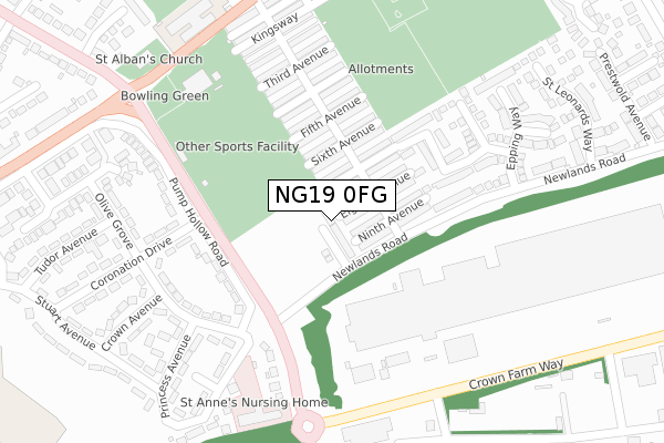
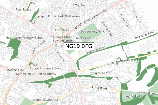
NG19 0FG is located in the Kingsway Forest Town electoral ward, within the local authority district of Mansfield and the English Parliamentary constituency of Mansfield. The Sub Integrated Care Board (ICB) Location is NHS Nottingham and Nottinghamshire ICB - 52R and the police force is Nottinghamshire. This postcode has been in use since October 2019.


GetTheData
Source: OS Open Zoomstack (Ordnance Survey)
Licence: Open Government Licence (requires attribution)
Attribution: Contains OS data © Crown copyright and database right 2025
Source: Open Postcode Geo
Licence: Open Government Licence (requires attribution)
Attribution: Contains OS data © Crown copyright and database right 2025; Contains Royal Mail data © Royal Mail copyright and database right 2025; Source: Office for National Statistics licensed under the Open Government Licence v.3.0
| Easting | 456282 |
| Northing | 361760 |
| Latitude | 53.150033 |
| Longitude | -1.159901 |
GetTheData
Source: Open Postcode Geo
Licence: Open Government Licence
| Country | England |
| Postcode District | NG19 |
➜ See where NG19 is on a map ➜ Where is Forest Town? | |
GetTheData
Source: Land Registry Price Paid Data
Licence: Open Government Licence
| Ward | Kingsway Forest Town |
| Constituency | Mansfield |
GetTheData
Source: ONS Postcode Database
Licence: Open Government Licence
22, POTTERS CORNER, FOREST TOWN, MANSFIELD, NG19 0FG 2025 14 JAN £287,500 |
2024 28 JUN £285,000 |
2023 17 FEB £304,000 |
2022 18 AUG £290,000 |
55, POTTERS CORNER, FOREST TOWN, MANSFIELD, NG19 0FG 2022 21 JUN £320,000 |
42, POTTERS CORNER, FOREST TOWN, MANSFIELD, NG19 0FG 2021 12 NOV £261,900 |
38, POTTERS CORNER, FOREST TOWN, MANSFIELD, NG19 0FG 2021 29 OCT £259,995 |
40, POTTERS CORNER, FOREST TOWN, MANSFIELD, NG19 0FG 2021 29 OCT £268,995 |
36, POTTERS CORNER, FOREST TOWN, MANSFIELD, NG19 0FG 2021 29 OCT £243,995 |
34, POTTERS CORNER, FOREST TOWN, MANSFIELD, NG19 0FG 2021 30 SEP £254,995 |
GetTheData
Source: HM Land Registry Price Paid Data
Licence: Contains HM Land Registry data © Crown copyright and database right 2025. This data is licensed under the Open Government Licence v3.0.
| Coronation Drive | Sherwood Hall | 162m |
| Coronation Drive | Sherwood Hall | 181m |
| Princess Avenue | Sherwood Hall | 235m |
| Princess Avenue | Sherwood Hall | 241m |
| Community Centre (Stuart Avenue) | Sherwood Hall | 310m |
| Mansfield Station | 2.7km |
| Mansfield Woodhouse Station | 3.2km |
GetTheData
Source: NaPTAN
Licence: Open Government Licence
| Percentage of properties with Next Generation Access | 100.0% |
| Percentage of properties with Superfast Broadband | 100.0% |
| Percentage of properties with Ultrafast Broadband | 0.0% |
| Percentage of properties with Full Fibre Broadband | 0.0% |
Superfast Broadband is between 30Mbps and 300Mbps
Ultrafast Broadband is > 300Mbps
| Percentage of properties unable to receive 2Mbps | 0.0% |
| Percentage of properties unable to receive 5Mbps | 0.0% |
| Percentage of properties unable to receive 10Mbps | 0.0% |
| Percentage of properties unable to receive 30Mbps | 0.0% |
GetTheData
Source: Ofcom
Licence: Ofcom Terms of Use (requires attribution)
GetTheData
Source: ONS Postcode Database
Licence: Open Government Licence


➜ Get more ratings from the Food Standards Agency
GetTheData
Source: Food Standards Agency
Licence: FSA terms & conditions
| Last Collection | |||
|---|---|---|---|
| Location | Mon-Fri | Sat | Distance |
| Bramble Lane | 17:00 | 11:00 | 1,529m |
| Ratcliffe Gate | 17:30 | 11:00 | 1,597m |
| Berry Hill Road | 17:00 | 11:00 | 1,769m |
GetTheData
Source: Dracos
Licence: Creative Commons Attribution-ShareAlike
The below table lists the International Territorial Level (ITL) codes (formerly Nomenclature of Territorial Units for Statistics (NUTS) codes) and Local Administrative Units (LAU) codes for NG19 0FG:
| ITL 1 Code | Name |
|---|---|
| TLF | East Midlands (England) |
| ITL 2 Code | Name |
| TLF1 | Derbyshire and Nottinghamshire |
| ITL 3 Code | Name |
| TLF15 | North Nottinghamshire |
| LAU 1 Code | Name |
| E07000174 | Mansfield |
GetTheData
Source: ONS Postcode Directory
Licence: Open Government Licence
The below table lists the Census Output Area (OA), Lower Layer Super Output Area (LSOA), and Middle Layer Super Output Area (MSOA) for NG19 0FG:
| Code | Name | |
|---|---|---|
| OA | E00143881 | |
| LSOA | E01028239 | Mansfield 007C |
| MSOA | E02005886 | Mansfield 007 |
GetTheData
Source: ONS Postcode Directory
Licence: Open Government Licence
| NG19 0BW | Eighth Avenue | 134m |
| NG19 0BN | Seventh Avenue | 135m |
| NG19 0BP | Ninth Avenue | 156m |
| NG19 0BL | Sixth Avenue | 165m |
| NG19 0AR | Olive Grove | 182m |
| NG19 0AX | Pump Hollow Road | 183m |
| NG19 0AT | Violet Hill | 200m |
| NG19 0BJ | Fifth Avenue | 204m |
| NG19 0BH | Fourth Avenue | 219m |
| NG19 0GA | Grizedale Rise | 240m |
GetTheData
Source: Open Postcode Geo; Land Registry Price Paid Data
Licence: Open Government Licence