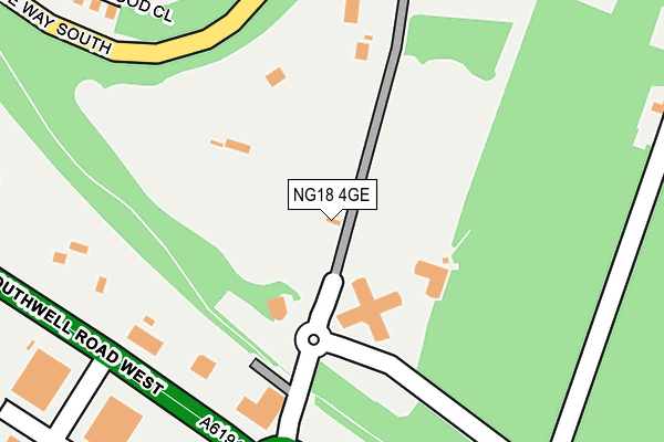
NG18 4GE is located in the Southwell electoral ward, within the local authority district of Mansfield and the English Parliamentary constituency of Mansfield. The Sub Integrated Care Board (ICB) Location is NHS Nottingham and Nottinghamshire ICB - 52R and the police force is Nottinghamshire. This postcode has been in use since October 2005.


GetTheData
Source: OS OpenMap – Local (Ordnance Survey)
Source: OS VectorMap District (Ordnance Survey)
Licence: Open Government Licence (requires attribution)
| Easting | 457062 |
| Northing | 359474 |
| Latitude | 53.129385 |
| Longitude | -1.148648 |
GetTheData
Source: Open Postcode Geo
Licence: Open Government Licence
| Country | England |
| Postcode District | NG18 |
➜ See where NG18 is on a map ➜ Where is Mansfield? | |
GetTheData
Source: Land Registry Price Paid Data
Licence: Open Government Licence
Elevation or altitude of NG18 4GE as distance above sea level:
| Metres | Feet | |
|---|---|---|
| Elevation | 140m | 459ft |
Elevation is measured from the approximate centre of the postcode, to the nearest point on an OS contour line from OS Terrain 50, which has contour spacing of ten vertical metres.
➜ How high above sea level am I? Find the elevation of your current position using your device's GPS.
GetTheData
Source: Open Postcode Elevation
Licence: Open Government Licence
| Ward | Southwell |
| Constituency | Mansfield |
GetTheData
Source: ONS Postcode Database
Licence: Open Government Licence
| Anglia Way (Southwell Road West) | Mansfield | 221m |
| Bellamy Road (Southwell Road West) | Mansfield | 331m |
| Sandown Road (Jubilee Way South) | Oak Tree | 349m |
| Sandown Road (Jubilee Way South) | Oak Tree | 349m |
| Teal Avenue (Jubilee Way South) | Oak Tree | 370m |
| Mansfield Station | 3.6km |
| Mansfield Woodhouse Station | 5.2km |
GetTheData
Source: NaPTAN
Licence: Open Government Licence
GetTheData
Source: ONS Postcode Database
Licence: Open Government Licence

➜ Get more ratings from the Food Standards Agency
GetTheData
Source: Food Standards Agency
Licence: FSA terms & conditions
| Last Collection | |||
|---|---|---|---|
| Location | Mon-Fri | Sat | Distance |
| Berry Hill Road | 17:00 | 11:00 | 767m |
| Ratcliffe Gate | 17:30 | 11:00 | 833m |
| Bramble Lane | 17:00 | 11:00 | 1,001m |
GetTheData
Source: Dracos
Licence: Creative Commons Attribution-ShareAlike
The below table lists the International Territorial Level (ITL) codes (formerly Nomenclature of Territorial Units for Statistics (NUTS) codes) and Local Administrative Units (LAU) codes for NG18 4GE:
| ITL 1 Code | Name |
|---|---|
| TLF | East Midlands (England) |
| ITL 2 Code | Name |
| TLF1 | Derbyshire and Nottinghamshire |
| ITL 3 Code | Name |
| TLF15 | North Nottinghamshire |
| LAU 1 Code | Name |
| E07000174 | Mansfield |
GetTheData
Source: ONS Postcode Directory
Licence: Open Government Licence
The below table lists the Census Output Area (OA), Lower Layer Super Output Area (LSOA), and Middle Layer Super Output Area (MSOA) for NG18 4GE:
| Code | Name | |
|---|---|---|
| OA | E00143960 | |
| LSOA | E01028256 | Mansfield 012B |
| MSOA | E02005891 | Mansfield 012 |
GetTheData
Source: ONS Postcode Directory
Licence: Open Government Licence
| NG18 4LP | Anglia Way Industrial Estate | 349m |
| NG18 4TB | Sherwood Oaks Close | 397m |
| NG18 3SQ | Shirland Drive | 494m |
| NG18 3HQ | Oakwood Road | 513m |
| NG18 3SB | Thurley Walk | 617m |
| NG18 4ND | Greasley Court | 649m |
| NG18 3RU | Saxby Drive | 660m |
| NG18 4LN | Bellamy Road | 679m |
| NG18 3RT | Jubilee Way South | 685m |
| NG18 4NB | Flintham Court | 686m |
GetTheData
Source: Open Postcode Geo; Land Registry Price Paid Data
Licence: Open Government Licence