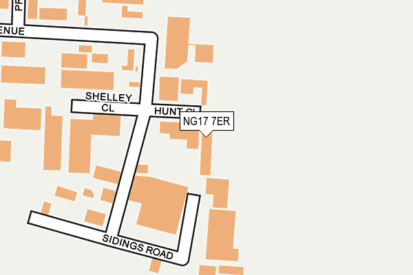
NG17 7ER is located in the Abbey Hill electoral ward, within the local authority district of Ashfield and the English Parliamentary constituency of Ashfield. The Sub Integrated Care Board (ICB) Location is NHS Nottingham and Nottinghamshire ICB - 52R and the police force is Nottinghamshire. This postcode has been in use since December 1999.


GetTheData
Source: OS OpenMap – Local (Ordnance Survey)
Source: OS VectorMap District (Ordnance Survey)
Licence: Open Government Licence (requires attribution)
| Easting | 451223 |
| Northing | 357201 |
| Latitude | 53.109565 |
| Longitude | -1.236264 |
GetTheData
Source: Open Postcode Geo
Licence: Open Government Licence
| Country | England |
| Postcode District | NG17 |
➜ See where NG17 is on a map ➜ Where is Kirkby-in-Ashfield? | |
GetTheData
Source: Land Registry Price Paid Data
Licence: Open Government Licence
Elevation or altitude of NG17 7ER as distance above sea level:
| Metres | Feet | |
|---|---|---|
| Elevation | 170m | 558ft |
Elevation is measured from the approximate centre of the postcode, to the nearest point on an OS contour line from OS Terrain 50, which has contour spacing of ten vertical metres.
➜ How high above sea level am I? Find the elevation of your current position using your device's GPS.
GetTheData
Source: Open Postcode Elevation
Licence: Open Government Licence
| Ward | Abbey Hill |
| Constituency | Ashfield |
GetTheData
Source: ONS Postcode Database
Licence: Open Government Licence
| Lowmoor Business Park (Lowmoor Road) | Kirkby In Ashfield | 560m |
| Marlborough Road (Alexandra Street) | Coxmoor Estate | 570m |
| Lowmoor Business Park (Lowmoor Road) | Kirkby In Ashfield | 571m |
| Marlborough Road (Alexandra Street) | Coxmoor Estate | 572m |
| David Street (Lowmoor Road) | Kirkby In Ashfield | 593m |
| Sutton Parkway Station | 0.8km |
| Kirkby in Ashfield Station | 1.5km |
| Mansfield Station | 4.4km |
GetTheData
Source: NaPTAN
Licence: Open Government Licence
GetTheData
Source: ONS Postcode Database
Licence: Open Government Licence


➜ Get more ratings from the Food Standards Agency
GetTheData
Source: Food Standards Agency
Licence: FSA terms & conditions
| Last Collection | |||
|---|---|---|---|
| Location | Mon-Fri | Sat | Distance |
| Byron Avenue | 18:30 | 12:00 | 323m |
| Byron Avenue | 18:30 | 454m | |
| Alexandra Street | 17:00 | 12:00 | 734m |
GetTheData
Source: Dracos
Licence: Creative Commons Attribution-ShareAlike
The below table lists the International Territorial Level (ITL) codes (formerly Nomenclature of Territorial Units for Statistics (NUTS) codes) and Local Administrative Units (LAU) codes for NG17 7ER:
| ITL 1 Code | Name |
|---|---|
| TLF | East Midlands (England) |
| ITL 2 Code | Name |
| TLF1 | Derbyshire and Nottinghamshire |
| ITL 3 Code | Name |
| TLF15 | North Nottinghamshire |
| LAU 1 Code | Name |
| E07000170 | Ashfield |
GetTheData
Source: ONS Postcode Directory
Licence: Open Government Licence
The below table lists the Census Output Area (OA), Lower Layer Super Output Area (LSOA), and Middle Layer Super Output Area (MSOA) for NG17 7ER:
| Code | Name | |
|---|---|---|
| OA | E00142422 | |
| LSOA | E01027951 | Ashfield 007B |
| MSOA | E02005825 | Ashfield 007 |
GetTheData
Source: ONS Postcode Directory
Licence: Open Government Licence
| NG17 7JZ | Sidings Road | 178m |
| NG17 7LE | Unity Road | 328m |
| NG17 7LA | Byron Avenue | 336m |
| NG17 7RE | Acorn View | 396m |
| NG17 7PX | Beacon Drive | 403m |
| NG17 7QE | Pinewood Close | 453m |
| NG17 7JW | David Street | 472m |
| NG17 7BL | Blossom Court | 489m |
| NG17 7JX | David Street | 491m |
| NG17 7JQ | Edward Street | 493m |
GetTheData
Source: Open Postcode Geo; Land Registry Price Paid Data
Licence: Open Government Licence