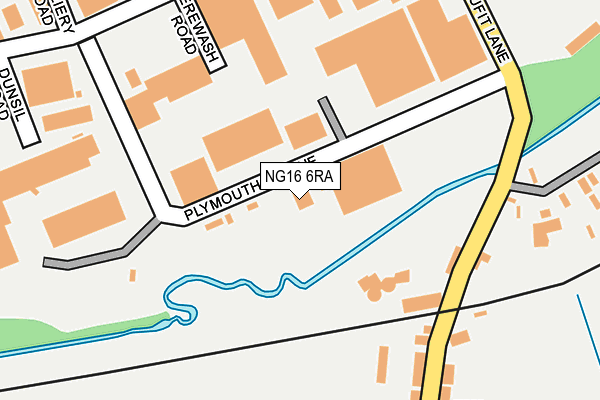
NG16 6RA is located in the Pinxton electoral ward, within the local authority district of Bolsover and the English Parliamentary constituency of Bolsover. The Sub Integrated Care Board (ICB) Location is NHS Derby and Derbyshire ICB - 15M and the police force is Derbyshire. This postcode has been in use since June 1998.


GetTheData
Source: OS OpenMap – Local (Ordnance Survey)
Source: OS VectorMap District (Ordnance Survey)
Licence: Open Government Licence (requires attribution)
| Easting | 446183 |
| Northing | 354726 |
| Latitude | 53.087778 |
| Longitude | -1.311902 |
GetTheData
Source: Open Postcode Geo
Licence: Open Government Licence
| Country | England |
| Postcode District | NG16 |
➜ See where NG16 is on a map ➜ Where is Pinxton? | |
GetTheData
Source: Land Registry Price Paid Data
Licence: Open Government Licence
Elevation or altitude of NG16 6RA as distance above sea level:
| Metres | Feet | |
|---|---|---|
| Elevation | 90m | 295ft |
Elevation is measured from the approximate centre of the postcode, to the nearest point on an OS contour line from OS Terrain 50, which has contour spacing of ten vertical metres.
➜ How high above sea level am I? Find the elevation of your current position using your device's GPS.
GetTheData
Source: Open Postcode Elevation
Licence: Open Government Licence
| Ward | Pinxton |
| Constituency | Bolsover |
GetTheData
Source: ONS Postcode Database
Licence: Open Government Licence
| Greensquare Road (Station Road) | Pinxton | 250m |
| Greensquare Road (Station Road) | Pinxton | 277m |
| Station Road | Selston Commonside | 307m |
| Wharf Road | Pinxton | 319m |
| Wharf Road | Pinxton | 319m |
| Alfreton Station | 4.1km |
| Kirkby in Ashfield Station | 4.2km |
| Sutton Parkway Station | 5.3km |
GetTheData
Source: NaPTAN
Licence: Open Government Licence
| Percentage of properties with Next Generation Access | 100.0% |
| Percentage of properties with Superfast Broadband | 100.0% |
| Percentage of properties with Ultrafast Broadband | 0.0% |
| Percentage of properties with Full Fibre Broadband | 0.0% |
Superfast Broadband is between 30Mbps and 300Mbps
Ultrafast Broadband is > 300Mbps
| Percentage of properties unable to receive 2Mbps | 0.0% |
| Percentage of properties unable to receive 5Mbps | 0.0% |
| Percentage of properties unable to receive 10Mbps | 0.0% |
| Percentage of properties unable to receive 30Mbps | 0.0% |
GetTheData
Source: Ofcom
Licence: Ofcom Terms of Use (requires attribution)
GetTheData
Source: ONS Postcode Database
Licence: Open Government Licence


➜ Get more ratings from the Food Standards Agency
GetTheData
Source: Food Standards Agency
Licence: FSA terms & conditions
| Last Collection | |||
|---|---|---|---|
| Location | Mon-Fri | Sat | Distance |
| The Chine | 16:00 | 09:30 | 1,645m |
| Pinxton Lane End | 16:45 | 08:00 | 1,939m |
| Lea Vale | 16:30 | 08:30 | 2,116m |
GetTheData
Source: Dracos
Licence: Creative Commons Attribution-ShareAlike
| Risk of NG16 6RA flooding from rivers and sea | Medium |
| ➜ NG16 6RA flood map | |
GetTheData
Source: Open Flood Risk by Postcode
Licence: Open Government Licence
The below table lists the International Territorial Level (ITL) codes (formerly Nomenclature of Territorial Units for Statistics (NUTS) codes) and Local Administrative Units (LAU) codes for NG16 6RA:
| ITL 1 Code | Name |
|---|---|
| TLF | East Midlands (England) |
| ITL 2 Code | Name |
| TLF1 | Derbyshire and Nottinghamshire |
| ITL 3 Code | Name |
| TLF12 | East Derbyshire |
| LAU 1 Code | Name |
| E07000033 | Bolsover |
GetTheData
Source: ONS Postcode Directory
Licence: Open Government Licence
The below table lists the Census Output Area (OA), Lower Layer Super Output Area (LSOA), and Middle Layer Super Output Area (MSOA) for NG16 6RA:
| Code | Name | |
|---|---|---|
| OA | E00098627 | |
| LSOA | E01019499 | Bolsover 010A |
| MSOA | E02004054 | Bolsover 010 |
GetTheData
Source: ONS Postcode Directory
Licence: Open Government Licence
| NG16 6NT | Brookhill Industrial Estate | 191m |
| NG16 6FG | Victoria Terrace | 264m |
| NG16 6FF | Station Road | 359m |
| NG16 6HA | Wharf Road | 361m |
| NG16 6LQ | Wharf Road | 371m |
| NG16 6GJ | Guildhall Drive | 392m |
| NG16 6LR | Victoria Road | 426m |
| NG16 6LH | Wharf Road | 429m |
| NG16 6FH | Station Road | 438m |
| NG16 6LP | North Street | 450m |
GetTheData
Source: Open Postcode Geo; Land Registry Price Paid Data
Licence: Open Government Licence