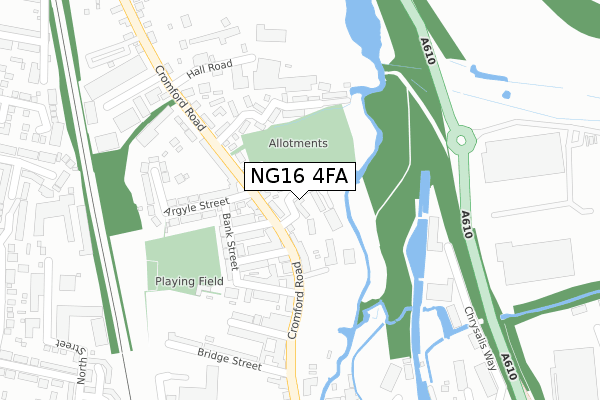
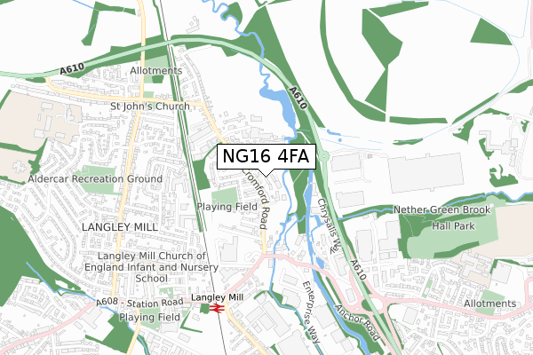
NG16 4FA is located in the Codnor, Langley Mill & Aldercar electoral ward, within the local authority district of Amber Valley and the English Parliamentary constituency of Amber Valley. The Sub Integrated Care Board (ICB) Location is NHS Derby and Derbyshire ICB - 15M and the police force is Derbyshire. This postcode has been in use since November 2017.


GetTheData
Source: OS Open Zoomstack (Ordnance Survey)
Licence: Open Government Licence (requires attribution)
Attribution: Contains OS data © Crown copyright and database right 2025
Source: Open Postcode Geo
Licence: Open Government Licence (requires attribution)
Attribution: Contains OS data © Crown copyright and database right 2025; Contains Royal Mail data © Royal Mail copyright and database right 2025; Source: Office for National Statistics licensed under the Open Government Licence v.3.0
| Easting | 445206 |
| Northing | 347556 |
| Latitude | 53.023414 |
| Longitude | -1.327492 |
GetTheData
Source: Open Postcode Geo
Licence: Open Government Licence
| Country | England |
| Postcode District | NG16 |
➜ See where NG16 is on a map ➜ Where is Heanor? | |
GetTheData
Source: Land Registry Price Paid Data
Licence: Open Government Licence
| Ward | Codnor, Langley Mill & Aldercar |
| Constituency | Amber Valley |
GetTheData
Source: ONS Postcode Database
Licence: Open Government Licence
| Gladstone Street (Cromford Road) | Langley Mill | 62m |
| Gladstone Street (Cromford Road) | Langley Mill | 105m |
| Bridge Street (Cromford Road) | Langley Mill | 285m |
| Bridge Street (Cromford Road) | Langley Mill | 308m |
| Business Park (Derby Road) | Langley Mill | 377m |
| Langley Mill Station | 0.6km |
| Ilkeston Station | 5.3km |
GetTheData
Source: NaPTAN
Licence: Open Government Licence
| Percentage of properties with Next Generation Access | 100.0% |
| Percentage of properties with Superfast Broadband | 100.0% |
| Percentage of properties with Ultrafast Broadband | 0.0% |
| Percentage of properties with Full Fibre Broadband | 0.0% |
Superfast Broadband is between 30Mbps and 300Mbps
Ultrafast Broadband is > 300Mbps
| Median download speed | 40.0Mbps |
| Average download speed | 37.6Mbps |
| Maximum download speed | 80.00Mbps |
| Median upload speed | 10.0Mbps |
| Average upload speed | 8.8Mbps |
| Maximum upload speed | 20.00Mbps |
| Percentage of properties unable to receive 2Mbps | 0.0% |
| Percentage of properties unable to receive 5Mbps | 0.0% |
| Percentage of properties unable to receive 10Mbps | 0.0% |
| Percentage of properties unable to receive 30Mbps | 0.0% |
GetTheData
Source: Ofcom
Licence: Ofcom Terms of Use (requires attribution)
GetTheData
Source: ONS Postcode Database
Licence: Open Government Licence

➜ Get more ratings from the Food Standards Agency
GetTheData
Source: Food Standards Agency
Licence: FSA terms & conditions
| Last Collection | |||
|---|---|---|---|
| Location | Mon-Fri | Sat | Distance |
| Cromford Road | 17:30 | 11:30 | 361m |
| Langley Mill Post Office | 17:00 | 11:45 | 369m |
| North Street | 17:30 | 11:30 | 535m |
GetTheData
Source: Dracos
Licence: Creative Commons Attribution-ShareAlike
| Risk of NG16 4FA flooding from rivers and sea | High |
| ➜ NG16 4FA flood map | |
GetTheData
Source: Open Flood Risk by Postcode
Licence: Open Government Licence
The below table lists the International Territorial Level (ITL) codes (formerly Nomenclature of Territorial Units for Statistics (NUTS) codes) and Local Administrative Units (LAU) codes for NG16 4FA:
| ITL 1 Code | Name |
|---|---|
| TLF | East Midlands (England) |
| ITL 2 Code | Name |
| TLF1 | Derbyshire and Nottinghamshire |
| ITL 3 Code | Name |
| TLF13 | South and West Derbyshire |
| LAU 1 Code | Name |
| E07000032 | Amber Valley |
GetTheData
Source: ONS Postcode Directory
Licence: Open Government Licence
The below table lists the Census Output Area (OA), Lower Layer Super Output Area (LSOA), and Middle Layer Super Output Area (MSOA) for NG16 4FA:
| Code | Name | |
|---|---|---|
| OA | E00098380 | |
| LSOA | E01019453 | Amber Valley 017D |
| MSOA | E02006827 | Amber Valley 017 |
GetTheData
Source: ONS Postcode Directory
Licence: Open Government Licence
| NG16 4EW | Cromford Road | 70m |
| NG16 4EP | Cromford Road | 74m |
| NG16 4ER | Cromford Road | 76m |
| NG16 4EQ | Campbell Street | 98m |
| NG16 4EN | Gladstone Street | 120m |
| NG16 4EL | Cromford Road | 130m |
| NG16 4ES | Bank Street | 146m |
| NG16 4JD | Cherry Tree Way | 154m |
| NG16 4JA | Minkley Drive | 157m |
| NG16 4EJ | Queen Street | 170m |
GetTheData
Source: Open Postcode Geo; Land Registry Price Paid Data
Licence: Open Government Licence