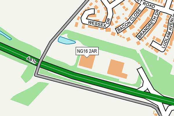
NG16 2AR is located in the Greasley electoral ward, within the local authority district of Broxtowe and the English Parliamentary constituency of Broxtowe. The Sub Integrated Care Board (ICB) Location is NHS Nottingham and Nottinghamshire ICB - 52R and the police force is Nottinghamshire. This postcode has been in use since June 1997.


GetTheData
Source: OS OpenMap – Local (Ordnance Survey)
Source: OS VectorMap District (Ordnance Survey)
Licence: Open Government Licence (requires attribution)
| Easting | 447306 |
| Northing | 345384 |
| Latitude | 53.003710 |
| Longitude | -1.296504 |
GetTheData
Source: Open Postcode Geo
Licence: Open Government Licence
| Country | England |
| Postcode District | NG16 |
➜ See where NG16 is on a map ➜ Where is Eastwood? | |
GetTheData
Source: Land Registry Price Paid Data
Licence: Open Government Licence
Elevation or altitude of NG16 2AR as distance above sea level:
| Metres | Feet | |
|---|---|---|
| Elevation | 70m | 230ft |
Elevation is measured from the approximate centre of the postcode, to the nearest point on an OS contour line from OS Terrain 50, which has contour spacing of ten vertical metres.
➜ How high above sea level am I? Find the elevation of your current position using your device's GPS.
GetTheData
Source: Open Postcode Elevation
Licence: Open Government Licence
| Ward | Greasley |
| Constituency | Broxtowe |
GetTheData
Source: ONS Postcode Database
Licence: Open Government Licence
| Bacon Close (Smithurst Road) | Newthorpe Common | 241m |
| Bacon Close (Smithurst Road) | Newthorpe Common | 249m |
| Brassington Close (Smithurst Road) | Newthorpe Common | 296m |
| Brassington Close (Smithurst Road) | Newthorpe Common | 314m |
| Sussex Close (Smithurst Road) | Newthorpe Common | 337m |
| Ilkeston Station | 2.7km |
| Langley Mill Station | 2.8km |
GetTheData
Source: NaPTAN
Licence: Open Government Licence
GetTheData
Source: ONS Postcode Database
Licence: Open Government Licence


➜ Get more ratings from the Food Standards Agency
GetTheData
Source: Food Standards Agency
Licence: FSA terms & conditions
| Last Collection | |||
|---|---|---|---|
| Location | Mon-Fri | Sat | Distance |
| Smithurst Road | 16:30 | 12:15 | 538m |
| Newthorpe Common | 16:30 | 12:15 | 596m |
| Common Lane | 16:00 | 12:00 | 904m |
GetTheData
Source: Dracos
Licence: Creative Commons Attribution-ShareAlike
The below table lists the International Territorial Level (ITL) codes (formerly Nomenclature of Territorial Units for Statistics (NUTS) codes) and Local Administrative Units (LAU) codes for NG16 2AR:
| ITL 1 Code | Name |
|---|---|
| TLF | East Midlands (England) |
| ITL 2 Code | Name |
| TLF1 | Derbyshire and Nottinghamshire |
| ITL 3 Code | Name |
| TLF16 | South Nottinghamshire |
| LAU 1 Code | Name |
| E07000172 | Broxtowe |
GetTheData
Source: ONS Postcode Directory
Licence: Open Government Licence
The below table lists the Census Output Area (OA), Lower Layer Super Output Area (LSOA), and Middle Layer Super Output Area (MSOA) for NG16 2AR:
| Code | Name | |
|---|---|---|
| OA | E00143261 | |
| LSOA | E01028117 | Broxtowe 003D |
| MSOA | E02005852 | Broxtowe 003 |
GetTheData
Source: ONS Postcode Directory
Licence: Open Government Licence
| NG16 2UW | Bacon Close | 159m |
| NG16 2YP | Wessex Drive | 172m |
| NG16 2UN | Brandreth Drive | 185m |
| NG16 2YN | Wessex Drive | 204m |
| NG16 2UL | Ludlam Avenue | 204m |
| NG16 2UJ | Turner Drive | 253m |
| NG16 2XH | Wessex Drive | 254m |
| NG16 2YL | Godber Close | 259m |
| NG16 2UP | Smithurst Road | 294m |
| NG16 2UH | Brassington Close | 302m |
GetTheData
Source: Open Postcode Geo; Land Registry Price Paid Data
Licence: Open Government Licence