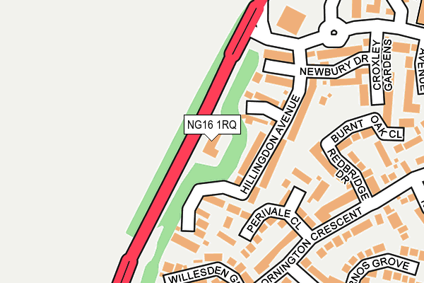
NG16 1RQ is located in the Nuthall East & Strelley electoral ward, within the local authority district of Broxtowe and the English Parliamentary constituency of Broxtowe. The Sub Integrated Care Board (ICB) Location is NHS Nottingham and Nottinghamshire ICB - 52R and the police force is Nottinghamshire. This postcode has been in use since January 1993.


GetTheData
Source: OS OpenMap – Local (Ordnance Survey)
Source: OS VectorMap District (Ordnance Survey)
Licence: Open Government Licence (requires attribution)
| Easting | 451653 |
| Northing | 343305 |
| Latitude | 52.984623 |
| Longitude | -1.232064 |
GetTheData
Source: Open Postcode Geo
Licence: Open Government Licence
| Country | England |
| Postcode District | NG16 |
➜ See where NG16 is on a map ➜ Where is Nuthall? | |
GetTheData
Source: Land Registry Price Paid Data
Licence: Open Government Licence
Elevation or altitude of NG16 1RQ as distance above sea level:
| Metres | Feet | |
|---|---|---|
| Elevation | 100m | 328ft |
Elevation is measured from the approximate centre of the postcode, to the nearest point on an OS contour line from OS Terrain 50, which has contour spacing of ten vertical metres.
➜ How high above sea level am I? Find the elevation of your current position using your device's GPS.
GetTheData
Source: Open Postcode Elevation
Licence: Open Government Licence
| Ward | Nuthall East & Strelley |
| Constituency | Broxtowe |
GetTheData
Source: ONS Postcode Database
Licence: Open Government Licence
| Willesden Green (Mornington Crescent) | Assarts Farm | 215m |
| Willesden Green (Mornington Crescent) | Assarts Farm | 216m |
| Northolt Drive (Mornington Crescent) | Assarts Farm | 262m |
| Northolt Drive (Mornington Crescent) | Assarts Farm | 271m |
| Canterbury Close (Mornington Crescent) | Assarts Farm | 305m |
| Bulwell Station | 2.9km |
| Ilkeston Station | 4.3km |
GetTheData
Source: NaPTAN
Licence: Open Government Licence
GetTheData
Source: ONS Postcode Database
Licence: Open Government Licence


➜ Get more ratings from the Food Standards Agency
GetTheData
Source: Food Standards Agency
Licence: FSA terms & conditions
| Last Collection | |||
|---|---|---|---|
| Location | Mon-Fri | Sat | Distance |
| Mornington Crescent | 17:30 | 11:00 | 280m |
| Wimbledon Drive | 17:30 | 11:00 | 383m |
| Cranwell Road | 17:00 | 11:30 | 559m |
GetTheData
Source: Dracos
Licence: Creative Commons Attribution-ShareAlike
The below table lists the International Territorial Level (ITL) codes (formerly Nomenclature of Territorial Units for Statistics (NUTS) codes) and Local Administrative Units (LAU) codes for NG16 1RQ:
| ITL 1 Code | Name |
|---|---|
| TLF | East Midlands (England) |
| ITL 2 Code | Name |
| TLF1 | Derbyshire and Nottinghamshire |
| ITL 3 Code | Name |
| TLF16 | South Nottinghamshire |
| LAU 1 Code | Name |
| E07000172 | Broxtowe |
GetTheData
Source: ONS Postcode Directory
Licence: Open Government Licence
The below table lists the Census Output Area (OA), Lower Layer Super Output Area (LSOA), and Middle Layer Super Output Area (MSOA) for NG16 1RQ:
| Code | Name | |
|---|---|---|
| OA | E00143290 | |
| LSOA | E01028119 | Broxtowe 016C |
| MSOA | E02006906 | Broxtowe 016 |
GetTheData
Source: ONS Postcode Directory
Licence: Open Government Licence
| NG16 1RA | Hillingdon Avenue | 57m |
| NG16 1RS | Oakwood Gardens | 101m |
| NG16 1QZ | Holborn Close | 130m |
| NG16 1QG | Perivale Close | 131m |
| NG16 1QF | Willesden Green | 181m |
| NG16 1QP | Redbridge Drive | 189m |
| NG16 1RB | Newbury Drive | 213m |
| NG16 1QR | Burnt Oak Close | 241m |
| NG16 1QQ | Mornington Crescent | 252m |
| NG16 1RR | Croxley Gardens | 271m |
GetTheData
Source: Open Postcode Geo; Land Registry Price Paid Data
Licence: Open Government Licence