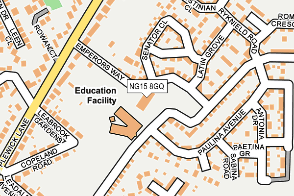
NG15 8GQ is located in the Hucknall North electoral ward, within the local authority district of Ashfield and the English Parliamentary constituency of Sherwood. The Sub Integrated Care Board (ICB) Location is NHS Nottingham and Nottinghamshire ICB - 52R and the police force is Nottinghamshire. This postcode has been in use since May 2017.


GetTheData
Source: OS OpenMap – Local (Ordnance Survey)
Source: OS VectorMap District (Ordnance Survey)
Licence: Open Government Licence (requires attribution)
| Easting | 454317 |
| Northing | 349724 |
| Latitude | 53.042055 |
| Longitude | -1.191308 |
GetTheData
Source: Open Postcode Geo
Licence: Open Government Licence
| Country | England |
| Postcode District | NG15 |
➜ See where NG15 is on a map ➜ Where is Hucknall? | |
GetTheData
Source: Land Registry Price Paid Data
Licence: Open Government Licence
| Ward | Hucknall North |
| Constituency | Sherwood |
GetTheData
Source: ONS Postcode Database
Licence: Open Government Licence
| Leabrook Gardens (Papplewick Lane) | Vaughan Estate | 192m |
| Leabrook Gardens (Papplewick Lane) | Vaughan Estate | 199m |
| Papplewick Lane | Vaughan Estate | 270m |
| Papplewick Lane | Vaughan Estate | 294m |
| Copeland Road (Papplewick Lane) | Vaughan Estate | 326m |
| Hucknall Tram Stop (Station Road) | Hucknall | 515m |
| Butler's Hill Tram Stop (Butlers Hill) | Butlers Hill | 1,487m |
| Hucknall Station | 0.5km |
| Newstead Station | 3.7km |
| Bulwell Station | 4.7km |
GetTheData
Source: NaPTAN
Licence: Open Government Licence
GetTheData
Source: ONS Postcode Database
Licence: Open Government Licence


➜ Get more ratings from the Food Standards Agency
GetTheData
Source: Food Standards Agency
Licence: FSA terms & conditions
| Last Collection | |||
|---|---|---|---|
| Location | Mon-Fri | Sat | Distance |
| Wigwam Lane | 17:30 | 12:15 | 536m |
| Station Terrace | 17:30 | 12:15 | 569m |
| Hayden Lane Post Office | 17:00 | 12:15 | 650m |
GetTheData
Source: Dracos
Licence: Creative Commons Attribution-ShareAlike
The below table lists the International Territorial Level (ITL) codes (formerly Nomenclature of Territorial Units for Statistics (NUTS) codes) and Local Administrative Units (LAU) codes for NG15 8GQ:
| ITL 1 Code | Name |
|---|---|
| TLF | East Midlands (England) |
| ITL 2 Code | Name |
| TLF1 | Derbyshire and Nottinghamshire |
| ITL 3 Code | Name |
| TLF15 | North Nottinghamshire |
| LAU 1 Code | Name |
| E07000170 | Ashfield |
GetTheData
Source: ONS Postcode Directory
Licence: Open Government Licence
The below table lists the Census Output Area (OA), Lower Layer Super Output Area (LSOA), and Middle Layer Super Output Area (MSOA) for NG15 8GQ:
| Code | Name | |
|---|---|---|
| OA | E00142309 | |
| LSOA | E01027931 | Ashfield 013B |
| MSOA | E02005831 | Ashfield 013 |
GetTheData
Source: ONS Postcode Directory
Licence: Open Government Licence
| NG15 8GG | Emperors Way | 62m |
| NG15 8GJ | Tiberius Gardens | 107m |
| NG15 8GH | Senator Close | 121m |
| NG15 8HZ | Kenbrook Road | 127m |
| NG15 8GP | Latin Grove | 154m |
| NG15 7TG | Hugessen Avenue | 155m |
| NG15 8ED | Leabrook Gardens | 176m |
| NG15 8EF | Papplewick Lane | 181m |
| NG15 7TH | Edmond Grove | 223m |
| NG15 8GR | Justinian Close | 227m |
GetTheData
Source: Open Postcode Geo; Land Registry Price Paid Data
Licence: Open Government Licence