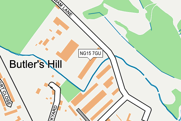
NG15 7GU lies on Wigwam Lane in Hucknall, Nottingham. NG15 7GU is located in the Hucknall North electoral ward, within the local authority district of Ashfield and the English Parliamentary constituency of Sherwood. The Sub Integrated Care Board (ICB) Location is NHS Nottingham and Nottinghamshire ICB - 52R and the police force is Nottinghamshire. This postcode has been in use since June 2009.


GetTheData
Source: OS OpenMap – Local (Ordnance Survey)
Source: OS VectorMap District (Ordnance Survey)
Licence: Open Government Licence (requires attribution)
| Easting | 454572 |
| Northing | 348776 |
| Latitude | 53.033490 |
| Longitude | -1.187669 |
GetTheData
Source: Open Postcode Geo
Licence: Open Government Licence
| Street | Wigwam Lane |
| Locality | Hucknall |
| Town/City | Nottingham |
| Country | England |
| Postcode District | NG15 |
➜ See where NG15 is on a map ➜ Where is Hucknall? | |
GetTheData
Source: Land Registry Price Paid Data
Licence: Open Government Licence
Elevation or altitude of NG15 7GU as distance above sea level:
| Metres | Feet | |
|---|---|---|
| Elevation | 60m | 197ft |
Elevation is measured from the approximate centre of the postcode, to the nearest point on an OS contour line from OS Terrain 50, which has contour spacing of ten vertical metres.
➜ How high above sea level am I? Find the elevation of your current position using your device's GPS.
GetTheData
Source: Open Postcode Elevation
Licence: Open Government Licence
| Ward | Hucknall North |
| Constituency | Sherwood |
GetTheData
Source: ONS Postcode Database
Licence: Open Government Licence
| Aldi (Ashgate Road) | Hucknall | 534m |
| Aldi (Ashgate Road) | Hucknall | 543m |
| Tesco (Ashgate Road) | Hucknall | 621m |
| Tesco (Ashgate Road) | Hucknall | 630m |
| Ashgate Road (Portland Road) | Hucknall | 638m |
| Butler's Hill Tram Stop (Butlers Hill) | Butlers Hill | 526m |
| Hucknall Tram Stop (Station Road) | Hucknall | 762m |
| Hucknall Station | 0.8km |
| Bulwell Station | 3.8km |
| Newstead Station | 4.7km |
GetTheData
Source: NaPTAN
Licence: Open Government Licence
GetTheData
Source: ONS Postcode Database
Licence: Open Government Licence


➜ Get more ratings from the Food Standards Agency
GetTheData
Source: Food Standards Agency
Licence: FSA terms & conditions
| Last Collection | |||
|---|---|---|---|
| Location | Mon-Fri | Sat | Distance |
| Wigwam Lane | 17:30 | 12:15 | 578m |
| Station Terrace | 17:30 | 12:15 | 938m |
| Broomhill Road | 16:00 | 12:45 | 1,074m |
GetTheData
Source: Dracos
Licence: Creative Commons Attribution-ShareAlike
The below table lists the International Territorial Level (ITL) codes (formerly Nomenclature of Territorial Units for Statistics (NUTS) codes) and Local Administrative Units (LAU) codes for NG15 7GU:
| ITL 1 Code | Name |
|---|---|
| TLF | East Midlands (England) |
| ITL 2 Code | Name |
| TLF1 | Derbyshire and Nottinghamshire |
| ITL 3 Code | Name |
| TLF15 | North Nottinghamshire |
| LAU 1 Code | Name |
| E07000170 | Ashfield |
GetTheData
Source: ONS Postcode Directory
Licence: Open Government Licence
The below table lists the Census Output Area (OA), Lower Layer Super Output Area (LSOA), and Middle Layer Super Output Area (MSOA) for NG15 7GU:
| Code | Name | |
|---|---|---|
| OA | E00142311 | |
| LSOA | E01027931 | Ashfield 013B |
| MSOA | E02005831 | Ashfield 013 |
GetTheData
Source: ONS Postcode Directory
Licence: Open Government Licence
| NG15 7SZ | Wigwam Lane | 117m |
| NG15 7PG | Brickyard | 224m |
| NG15 7RH | Covert Close | 320m |
| NG15 7PX | Roseberry Gardens | 327m |
| NG15 7RS | The Copse | 356m |
| NG15 7PH | Lakeland Avenue | 373m |
| NG15 7PJ | Clumber Street | 378m |
| NG15 7PF | Brickyard Drive | 385m |
| NG15 7PP | Green Close | 407m |
| NG15 7PE | Brickyard Drive | 409m |
GetTheData
Source: Open Postcode Geo; Land Registry Price Paid Data
Licence: Open Government Licence