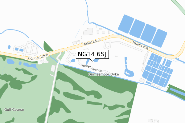
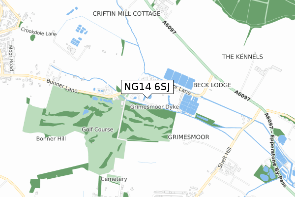
NG14 6SJ is located in the Calverton electoral ward, within the local authority district of Gedling and the English Parliamentary constituency of Sherwood. The Sub Integrated Care Board (ICB) Location is NHS Nottingham and Nottinghamshire ICB - 52R and the police force is Nottinghamshire. This postcode has been in use since January 2019.


GetTheData
Source: OS Open Zoomstack (Ordnance Survey)
Licence: Open Government Licence (requires attribution)
Attribution: Contains OS data © Crown copyright and database right 2025
Source: Open Postcode Geo
Licence: Open Government Licence (requires attribution)
Attribution: Contains OS data © Crown copyright and database right 2025; Contains Royal Mail data © Royal Mail copyright and database right 2025; Source: Office for National Statistics licensed under the Open Government Licence v.3.0
| Easting | 463385 |
| Northing | 348870 |
| Latitude | 53.033384 |
| Longitude | -1.056246 |
GetTheData
Source: Open Postcode Geo
Licence: Open Government Licence
| Country | England |
| Postcode District | NG14 |
➜ See where NG14 is on a map ➜ Where is Calverton? | |
GetTheData
Source: Land Registry Price Paid Data
Licence: Open Government Licence
| Ward | Calverton |
| Constituency | Sherwood |
GetTheData
Source: ONS Postcode Database
Licence: Open Government Licence
| Caravan Park (Moor Lane) | Calverton | 116m |
| Caravan Park (Moor Lane) | Calverton | 125m |
| Golf Club (Moor Lane) | Calverton | 153m |
| Golf Club (Moor Lane) | Calverton | 159m |
| Sunningdale Drive | Woodborough | 823m |
| Lowdham Station | 4.9km |
GetTheData
Source: NaPTAN
Licence: Open Government Licence
| Percentage of properties with Next Generation Access | 100.0% |
| Percentage of properties with Superfast Broadband | 100.0% |
| Percentage of properties with Ultrafast Broadband | 0.0% |
| Percentage of properties with Full Fibre Broadband | 0.0% |
Superfast Broadband is between 30Mbps and 300Mbps
Ultrafast Broadband is > 300Mbps
| Percentage of properties unable to receive 2Mbps | 0.0% |
| Percentage of properties unable to receive 5Mbps | 0.0% |
| Percentage of properties unable to receive 10Mbps | 0.0% |
| Percentage of properties unable to receive 30Mbps | 0.0% |
GetTheData
Source: Ofcom
Licence: Ofcom Terms of Use (requires attribution)
GetTheData
Source: ONS Postcode Database
Licence: Open Government Licence


➜ Get more ratings from the Food Standards Agency
GetTheData
Source: Food Standards Agency
Licence: FSA terms & conditions
| Last Collection | |||
|---|---|---|---|
| Location | Mon-Fri | Sat | Distance |
| Moor Farm Caravan Park | 17:00 | 11:00 | 132m |
| Shelt Hill | 17:00 | 12:00 | 965m |
| Woodborough Post Office | 17:00 | 12:00 | 1,122m |
GetTheData
Source: Dracos
Licence: Creative Commons Attribution-ShareAlike
The below table lists the International Territorial Level (ITL) codes (formerly Nomenclature of Territorial Units for Statistics (NUTS) codes) and Local Administrative Units (LAU) codes for NG14 6SJ:
| ITL 1 Code | Name |
|---|---|
| TLF | East Midlands (England) |
| ITL 2 Code | Name |
| TLF1 | Derbyshire and Nottinghamshire |
| ITL 3 Code | Name |
| TLF16 | South Nottinghamshire |
| LAU 1 Code | Name |
| E07000173 | Gedling |
GetTheData
Source: ONS Postcode Directory
Licence: Open Government Licence
The below table lists the Census Output Area (OA), Lower Layer Super Output Area (LSOA), and Middle Layer Super Output Area (MSOA) for NG14 6SJ:
| Code | Name | |
|---|---|---|
| OA | E00143751 | |
| LSOA | E01028213 | Gedling 002F |
| MSOA | E02005866 | Gedling 002 |
GetTheData
Source: ONS Postcode Directory
Licence: Open Government Licence
| NG14 6FZ | Moor Lane | 114m |
| NG14 6RT | Moor Lane | 552m |
| NG14 6AT | Oxton Road | 775m |
| NG14 6DG | Shelt Hill | 818m |
| NG14 6FX | Bonner Lane | 827m |
| NG14 6EQ | Sunningdale Drive | 849m |
| NG14 6ER | Dover Beck Drive | 904m |
| NG14 6DW | Private Road | 906m |
| NG14 6DR | Ash Grove | 919m |
| NG14 6DS | Roe Hill | 944m |
GetTheData
Source: Open Postcode Geo; Land Registry Price Paid Data
Licence: Open Government Licence