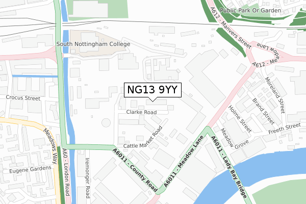
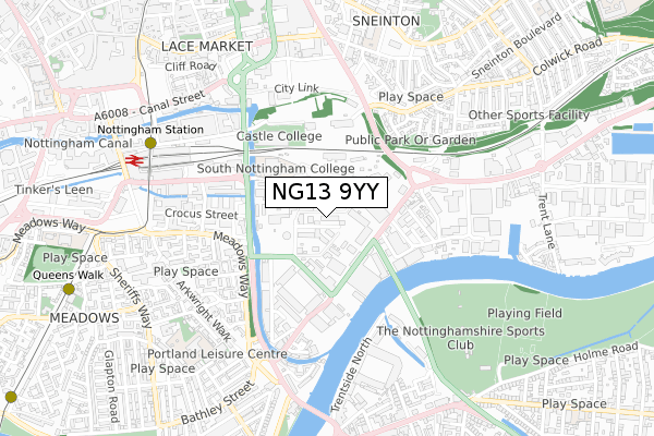
NG13 9YY is located in the Meadows electoral ward, within the unitary authority of Nottingham and the English Parliamentary constituency of Nottingham South. The Sub Integrated Care Board (ICB) Location is NHS Nottingham and Nottinghamshire ICB - 52R and the police force is Nottinghamshire. This postcode has been in use since March 2019.


GetTheData
Source: OS Open Zoomstack (Ordnance Survey)
Licence: Open Government Licence (requires attribution)
Attribution: Contains OS data © Crown copyright and database right 2024
Source: Open Postcode Geo
Licence: Open Government Licence (requires attribution)
Attribution: Contains OS data © Crown copyright and database right 2024; Contains Royal Mail data © Royal Mail copyright and database right 2024; Source: Office for National Statistics licensed under the Open Government Licence v.3.0
| Easting | 458182 |
| Northing | 338984 |
| Latitude | 52.945118 |
| Longitude | -1.135598 |
GetTheData
Source: Open Postcode Geo
Licence: Open Government Licence
| Country | England |
| Postcode District | NG13 |
➜ See where NG13 is on a map ➜ Where is Nottingham? | |
GetTheData
Source: Land Registry Price Paid Data
Licence: Open Government Licence
| Ward | Meadows |
| Constituency | Nottingham South |
GetTheData
Source: ONS Postcode Database
Licence: Open Government Licence
| Waterway Street (London Road) | Meadows | 314m |
| Eugene Gardens (Meadows Way) | Meadows | 355m |
| Eugene Gardens (Meadows Way) | Meadows | 399m |
| London Road Temporary (London Road) | Nottingham | 416m |
| London Road Temporary (London Road) | Nottingham | 419m |
| Nottingham Station Tram Stop (N/A) | Nottingham | 703m |
| Queens Walk Tram Stop (Queens Walk) | Meadows | 1,028m |
| Lace Market Tram Stop (Fletcher Gate) | Nottingham | 1,106m |
| Old Market Square Tram Stop (South Parade) | Nottingham | 1,347m |
| Meadows Embankment Tram Stop (Queens Walk) | Meadows | 1,388m |
| Nottingham Station | 0.8km |
| Netherfield Station | 4.2km |
| Carlton Station | 4.4km |
GetTheData
Source: NaPTAN
Licence: Open Government Licence
GetTheData
Source: ONS Postcode Database
Licence: Open Government Licence


➜ Get more ratings from the Food Standards Agency
GetTheData
Source: Food Standards Agency
Licence: FSA terms & conditions
| Last Collection | |||
|---|---|---|---|
| Location | Mon-Fri | Sat | Distance |
| Cattle Market | 18:45 | 11:30 | 209m |
| Meadow Lane | 18:45 | 11:30 | 288m |
| Eugene Gardens | 18:30 | 12:30 | 394m |
GetTheData
Source: Dracos
Licence: Creative Commons Attribution-ShareAlike
| Risk of NG13 9YY flooding from rivers and sea | Low |
| ➜ NG13 9YY flood map | |
GetTheData
Source: Open Flood Risk by Postcode
Licence: Open Government Licence
The below table lists the International Territorial Level (ITL) codes (formerly Nomenclature of Territorial Units for Statistics (NUTS) codes) and Local Administrative Units (LAU) codes for NG13 9YY:
| ITL 1 Code | Name |
|---|---|
| TLF | East Midlands (England) |
| ITL 2 Code | Name |
| TLF1 | Derbyshire and Nottinghamshire |
| ITL 3 Code | Name |
| TLF14 | Nottingham |
| LAU 1 Code | Name |
| E06000018 | Nottingham |
GetTheData
Source: ONS Postcode Directory
Licence: Open Government Licence
The below table lists the Census Output Area (OA), Lower Layer Super Output Area (LSOA), and Middle Layer Super Output Area (MSOA) for NG13 9YY:
| Code | Name | |
|---|---|---|
| OA | E00173532 | |
| LSOA | E01033402 | Nottingham 039C |
| MSOA | E02006904 | Nottingham 039 |
GetTheData
Source: ONS Postcode Directory
Licence: Open Government Licence
| NG2 3JJ | Clarke Road | 67m |
| NG2 3GL | Meadow Lane | 292m |
| NG2 3BE | Queens Road | 346m |
| NG2 3BX | Queens Road | 403m |
| NG2 3BU | Queens Road | 406m |
| NG2 4GR | Marham Close | 447m |
| NG2 3LG | Ryehill Close | 448m |
| NG2 3LF | Eugene Gardens | 455m |
| NG2 3LD | Uppingham Gardens | 465m |
| NG2 3AN | Queens Road | 469m |
GetTheData
Source: Open Postcode Geo; Land Registry Price Paid Data
Licence: Open Government Licence