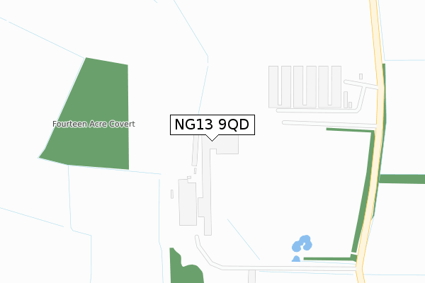
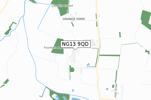
NG13 9QD is located in the Farndon & Fernwood electoral ward, within the local authority district of Newark and Sherwood and the English Parliamentary constituency of Newark. The Sub Integrated Care Board (ICB) Location is NHS Nottingham and Nottinghamshire ICB - 52R and the police force is Nottinghamshire. This postcode has been in use since December 2018.


GetTheData
Source: OS Open Zoomstack (Ordnance Survey)
Licence: Open Government Licence (requires attribution)
Attribution: Contains OS data © Crown copyright and database right 2025
Source: Open Postcode Geo
Licence: Open Government Licence (requires attribution)
Attribution: Contains OS data © Crown copyright and database right 2025; Contains Royal Mail data © Royal Mail copyright and database right 2025; Source: Office for National Statistics licensed under the Open Government Licence v.3.0
| Easting | 479926 |
| Northing | 344517 |
| Latitude | 52.992054 |
| Longitude | -0.810710 |
GetTheData
Source: Open Postcode Geo
Licence: Open Government Licence
| Country | England |
| Postcode District | NG13 |
➜ See where NG13 is on a map | |
GetTheData
Source: Land Registry Price Paid Data
Licence: Open Government Licence
| Ward | Farndon & Fernwood |
| Constituency | Newark |
GetTheData
Source: ONS Postcode Database
Licence: Open Government Licence
| Riverside Cottage (Alverton Road) | Staunton In The Vale | 917m |
| Riverside Cottage (Alverton Road) | Staunton In The Vale | 931m |
| High Street | Staunton In The Vale | 1,056m |
| High Street (Main Street) | Staunton In The Vale | 1,062m |
| Elton & Orston Station | 5.4km |
GetTheData
Source: NaPTAN
Licence: Open Government Licence
| Percentage of properties with Next Generation Access | 100.0% |
| Percentage of properties with Superfast Broadband | 100.0% |
| Percentage of properties with Ultrafast Broadband | 0.0% |
| Percentage of properties with Full Fibre Broadband | 0.0% |
Superfast Broadband is between 30Mbps and 300Mbps
Ultrafast Broadband is > 300Mbps
| Percentage of properties unable to receive 2Mbps | 0.0% |
| Percentage of properties unable to receive 5Mbps | 0.0% |
| Percentage of properties unable to receive 10Mbps | 0.0% |
| Percentage of properties unable to receive 30Mbps | 0.0% |
GetTheData
Source: Ofcom
Licence: Ofcom Terms of Use (requires attribution)
GetTheData
Source: ONS Postcode Database
Licence: Open Government Licence
| Last Collection | |||
|---|---|---|---|
| Location | Mon-Fri | Sat | Distance |
| Cotham Station | 16:00 | 07:30 | 1,669m |
| Shelton | 16:00 | 10:00 | 1,756m |
| Cotham | 16:00 | 07:30 | 2,989m |
GetTheData
Source: Dracos
Licence: Creative Commons Attribution-ShareAlike
| Risk of NG13 9QD flooding from rivers and sea | Medium |
| ➜ NG13 9QD flood map | |
GetTheData
Source: Open Flood Risk by Postcode
Licence: Open Government Licence
The below table lists the International Territorial Level (ITL) codes (formerly Nomenclature of Territorial Units for Statistics (NUTS) codes) and Local Administrative Units (LAU) codes for NG13 9QD:
| ITL 1 Code | Name |
|---|---|
| TLF | East Midlands (England) |
| ITL 2 Code | Name |
| TLF1 | Derbyshire and Nottinghamshire |
| ITL 3 Code | Name |
| TLF15 | North Nottinghamshire |
| LAU 1 Code | Name |
| E07000175 | Newark and Sherwood |
GetTheData
Source: ONS Postcode Directory
Licence: Open Government Licence
The below table lists the Census Output Area (OA), Lower Layer Super Output Area (LSOA), and Middle Layer Super Output Area (MSOA) for NG13 9QD:
| Code | Name | |
|---|---|---|
| OA | E00144320 | |
| LSOA | E01028325 | Newark and Sherwood 012B |
| MSOA | E02005904 | Newark and Sherwood 012 |
GetTheData
Source: ONS Postcode Directory
Licence: Open Government Licence
| NG13 9PE | 1099m | |
| NG23 5JY | Station Road | 1666m |
| NG23 5JX | Valley Lane | 1721m |
| NG13 9PD | 1726m | |
| NG23 5JH | St Anns Way | 1755m |
| NG23 5JQ | 1863m | |
| NG23 5JG | Main Street | 2247m |
| NG13 9PA | 2281m | |
| NG13 9PJ | Brandhills View | 2328m |
| NG23 5JZ | Grange Lane | 2372m |
GetTheData
Source: Open Postcode Geo; Land Registry Price Paid Data
Licence: Open Government Licence